Ski Areas > Northern Alps > Belledonne
The Belledonne range stretches 50km north to south and is just 25km across at its widest point. Although the highest point. the Grand Pic de Belledonne (2977 meters) is a shade shy of the 3000 meter mark the range forms a barrier between Vallée de l'Eau d'Olle and the Gresivaudan. The lowest passes (cols) are around 2000 meters, leading travellers to pass either by the deep Maurienne valley to the North or the Romanche to the south.

Belledonne mountains as seen from the Pic St Michel (Vercors)
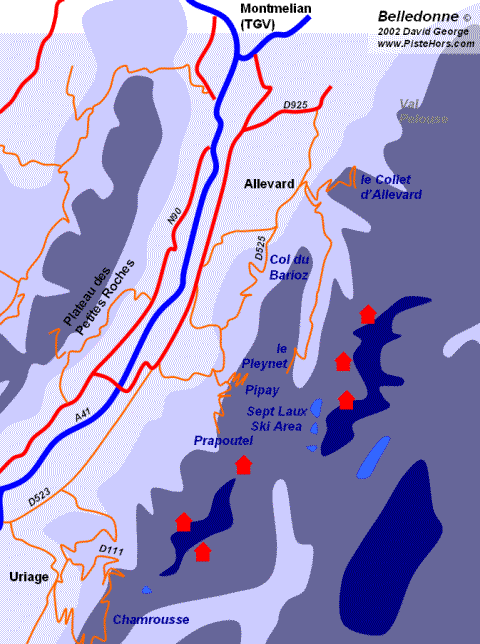
At the southern end of the Belledonne is the large University town of Grenoble which played host to the 1968 Winter Olympics and beyond that the flat Vercors plateau. To the north the Gresivaudan valley forks, left to Chambéry, right to Albertville and the large Savoie ski resorts of the Tarentaise. The Belledonne massif is home to the Olympic resorts of Chamrousse, the Collet d'Allevard and the Sept Laux. While these resorts are aimed at family skiers and the Grenoblois they are also known to freeriders with many hidden, and not so hidden spots.
There are at least three possible origins to the name Belledonne:
Amongst other information this site has panorama pictures of the Belledonne and Chartreuse ranges.
List of refuges in the Belledonne Massif
An excellent user maintained list of refuges in the Belledonne
<< Beaufortain | Northern Alps | Bornes >>
