
Following a couple of serious early-season avalanche accidents in the French Alps, forecasters from Météo-France's Bourg-Saint-Maurice office headed into the mountains on Thursday, 12 November 2026, to investigate the developing snowpack. Their destination was the Cime de Caron, a 3,195-metre summit above Val Thorens, where recent snowfall has provided some of the first opportunities for ski touring this winter.
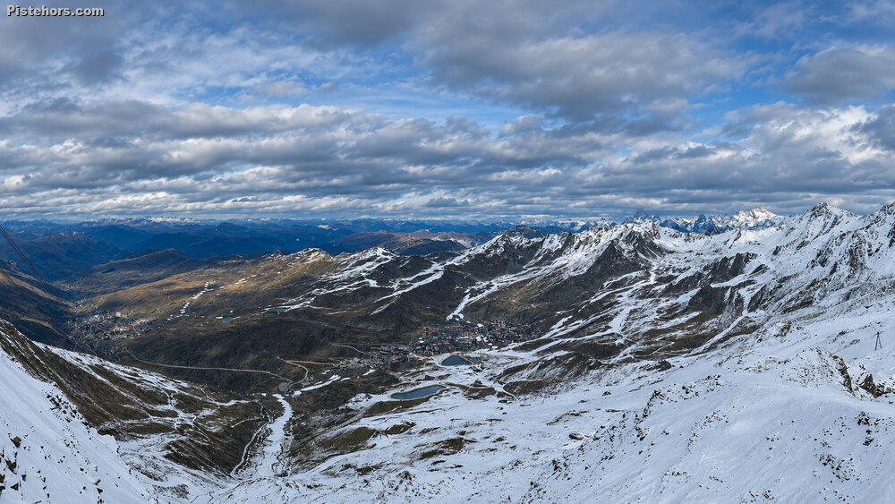 Val Thorens from the Cime de Carron
Although snow cover remains relatively thin, the forecasters discovered a potentially dangerous structure in the snowpack, with a buried layer of fragile, faceted crystals that collapsed readily during stability testing. The findings are particularly significant following Sunday's avalanche in the Dent d'Ambin sector of the Haute-Maurienne and another accident near the Étendard at the end of October.
Above approximately 2,800 metres, the snowpack has already developed a distinctly wintry structure, despite the relatively limited accumulation.
Météo-France identified three principal layers:
The critical weakness lies in the depth-hoar layer at the bottom of the snowpack. Depth hoar forms when strong temperature gradients within the snow cause crystals to grow into large, poorly bonded structures. Unlike the rounded grains found in a well-consolidated snowpack, these crystals have very little cohesion and can collapse under additional loading.
During their fieldwork, the forecasters carried out a stability test that produced a particularly concerning result: the weak layer failed as soon as the snow block was cut. This demonstrates just how reactive the basal snow crystals remain. Météo-France also identified this same type of persistent weak layer as the mechanism behind the recent avalanche accidents near the Dent d'Ambin and Étendard.
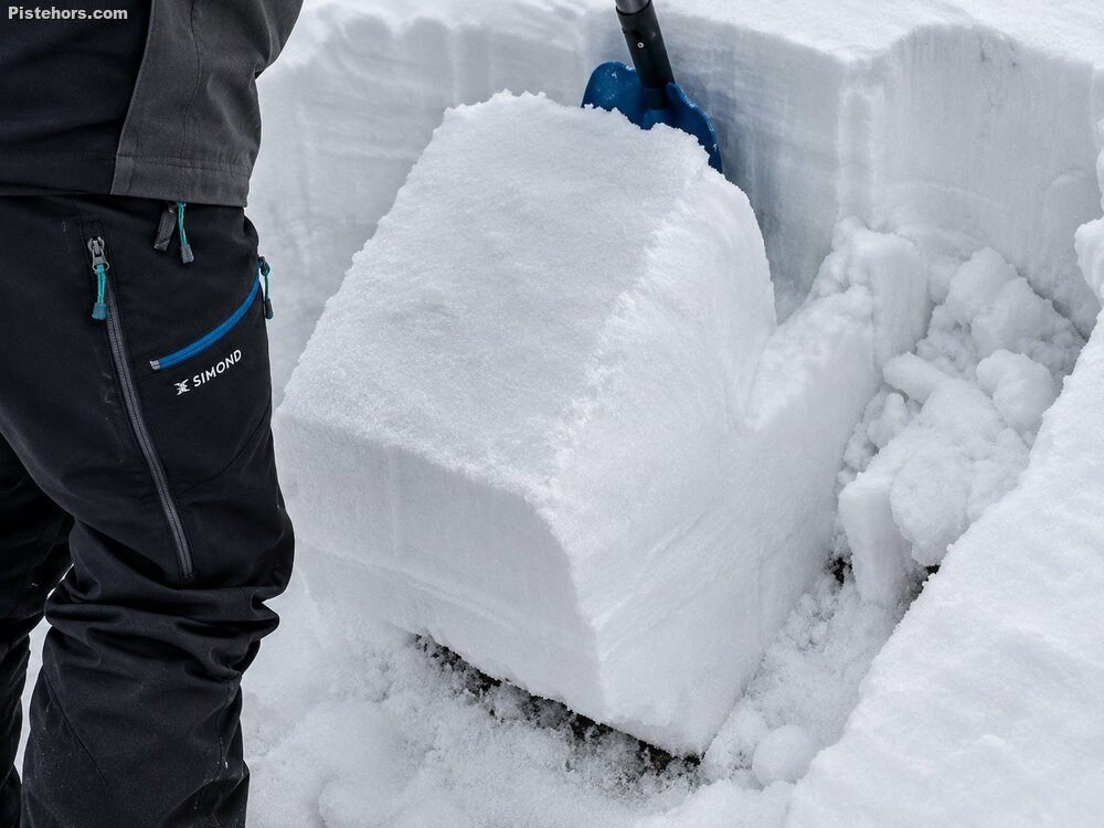 Stability Test (source: Météo-France)
One of the most striking observations was the contrast between the visible avalanche activity and the results of the stability test. During a visit to the Cime de Caron the previous weekend, shortly after 20–30 cm of fresh snow had fallen, the forecaster had observed several small powder avalanches in rocky terrain. By Thursday, however, there was little visible evidence of recent avalanche activity. However the snowpack remained highly reactive when tested.
This is an important distinction. The absence of recent avalanche activity does not necessarily indicate that a slope has stabilised, particularly when a persistent weak layer is buried beneath a cohesive slab. Such weaknesses can survive for weeks, and sometimes considerably longer, depending on snowpack evolution and weather conditions. A relatively small additional load, such as a skier crossing a vulnerable part of the slope, may be sufficient to initiate a fracture. If that fracture propagates through the weak layer, it can release a slab avalanche.
Conditions were very different at lower elevations. The Météo-France team encountered overcast skies, light rain and relatively mild temperatures, with the rain-snow limit rising from around 2,600 metres during the ascent to approximately 2,800 metres on the return. Above the rain-snow limit, precipitation fell as light, relatively wet snow. A sustained southerly wind was blowing along the ridges at around 3,000 metres, producing some snow transport, although conditions were not exceptionally stormy.
The team reported the following snow conditions:
On south-facing slopes, natural snow cover was largely absent below approximately 2,800 metres. The forecasters noted that the snow below 2,800 metres had already been affected by liquid water. On the descent, the fresh snow had become sticky below that altitude. The resulting skiing conditions were described as mediocre, although the dense, wet snow at lower elevations was not entirely unpleasant.
The findings highlight a recurring problem at the beginning of the Alpine winter. A shallow snowpack can favour the development of persistent weak layers, particularly during clear, cold periods when large temperature differences exist between the relatively warm ground and the snow surface. These conditions encourage the formation of faceted crystals and depth hoar. When subsequent storms deposit new snow, a cohesive slab can develop above the fragile foundation.
The problem is compounded by the irregular distribution of early-season snow. Wind-exposed ridges may be almost bare, while hollows and sheltered slopes accumulate considerably deeper deposits. This creates substantial variations in snowpack thickness and stability over relatively short distances (spatial variability). A slope may therefore appear to offer excellent skiing, with fresh powder over a firm base with existing ski tracks, while concealing a highly unstable structure underneath.
In addition, early-season avalanches carry particular consequences because the snowpack is often too shallow to cover rocks, boulders and other terrain obstacles. Even a relatively small avalanche can cause serious injuries if it carries a skier into exposed rocks.
The visit to the Cime de Caron was part of Météo-France's regular field monitoring programme, which supports the production of its avalanche risk bulletins, known in France as BERA (Bulletins d'Estimation du Risque d'Avalanche). The forecasters explained that although the snow cover remains limited, ski touring has already been possible at higher elevations for some time, with occasionally excellent conditions, particularly during the previous weekend. Thursday's outing was less rewarding from a skiing perspective, but provided an opportunity to carry out the first snow profiles and stability tests of the season.
The principal concern emerging from the Cime de Caron survey is not simply the amount of snow currently on the ground, but its structure. At lower elevations, rain and mild temperatures are transforming the snowpack. Higher up, however, a persistent weak layer has developed buried beneath an increasingly substantial accumulation of snow. As further storms arrive, additional loading could make these weaknesses increasingly consequential, particularly on high-altitude slopes where the fragile basal layer survives.
Further Information