Mon, 1 April 2013
Vertical Climbed: 1,560 meters (5,118 feet)
Rating: 4.2
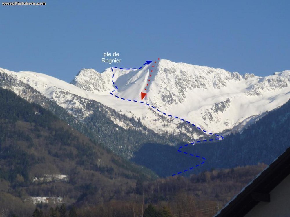
From Mollard Ciseaux climb the road towards Prodin. At the hairpin at 1080 meters continue to the Trois Sources. At 1250m (le Remou) leave the forest road to follow a path to the Chalets du Gargotton (1463m) then the sources du Gargotton (1628m). Climb to the SW slope towards the refuge des Plattieres then turn eastwards to the Pointe de Rognier which you can climb directly via the Grand Canal and not via the summer trail. From the Rognier traverse SW to pt 2325m, the entrance to the couloir is on the shoulder just before the summit. Descend towards the refuge des Plattieres via a wide couloir. The entrance to the couloir is frequently icy.
The section below the Chalets du Gargotton is not the most skiable. At 1319m you may find it easier to ski the right bank of the river.
Comments on route: Couloir: 40° over 200m.
Access: A41 Chambery - Grenoble -> Pontcharra exit -> D925b -> la Rochette -> D207 Vallee des Hurtieres -> Presle -> route de Prodin to the limit of snow clearing, usually 780m in the winter. Pont de Bois Picolet 1250m from mid April.
Equipment: Crampons for the climb to the Rognier
Country: France Area: Belledonne Trailhead: Florence
Description: The entrance to the couloir is 10 meters below the summit on the ridge that leads to the Pas du Gargotton. The couloir turns lower down. Take the left leg. Can lack snow just before the exit in late spring.
Rating: 4.3/E3
Orientation: South-West
Vertical: 1560
