Wed, 20 March 2013
Vertical Climbed: 835 meters (2,740 feet)
Rating: 2.3
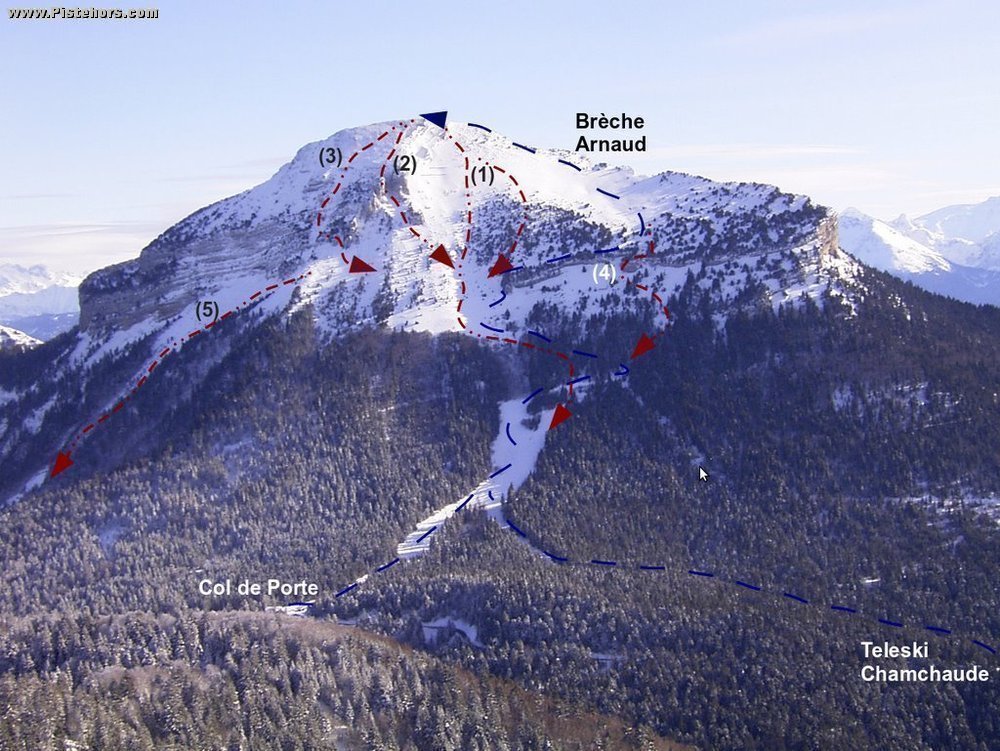
Climb
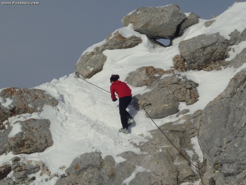
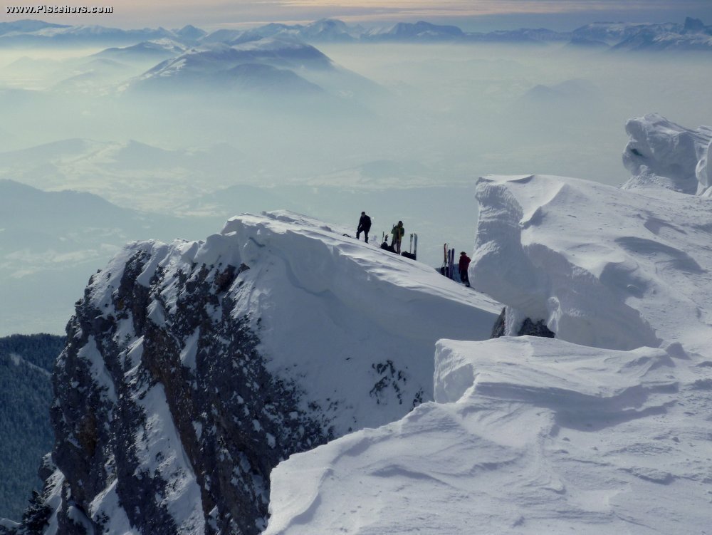
From the Teleski du Chamchaude parking at 1250 meters about 1km before the col de Porte follow the ski run. After about 1km you join the main run from the Col de Porte on your left. Continue to the top of the pistes. You reach a horizontal trail. Take this to the south for 100 meters. Then left onto a forest track to the North. This exits onto the main slope near the Chalet de Bachassons (1640m). Zig-zag up the bottom of this slope to just below a large mushroom shaped rock (la Folatière, perhaps named after the eponymous neolithic burial mound). Traverse south just above cliff bands onto the summit prairie. Follow this to the south to first the breche Arnaud (attention cornice, do not approach to closely) then three rock steps that lead to the summit. Unless you are skiing directly off the summit it is normal to leave skis at the last step where you will see a cable.
Descent
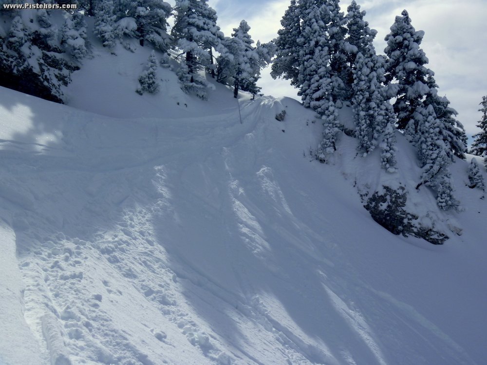
If the snow conditions are not sure you can descend the route you climbed or any of the more direct lines including directly by the Folatière (right hand side).
Best time: late November -> start of April
Comments on route: When the ski resort is operating be careful of whinched ratracks grooming the runs. Take the track that goes up to the left of the ski lift from the Col de Porte. The route is heavily skied but there is still a risk of avalanche and falls as many rescue interventions witness
Access: Grenoble > la Tronche > le Sappey > Col de Porte, park 1 km before the col by the Chamchaude Draglift
Equipment: Ski crampons
Country: France Area: Chartreuse Trailhead: Col De Porte
Description: When you reach the level of the Folatière traverse to the NE under a large outcrop midslope then aim for a gap between two butresses, you cannot see the exit from the bottom. Climb to reach the summit plateau which you follow to the summit.
If you climbed by the normal route from the summit cross look downslope to the Col de Porte, There is a rock outcrop just visible at the edge of the summit plateau. Aim for this but take care about thin snow cover near the summit and rocks lower down.
Rating: 3.2/E2
Orientation: North-West
Vertical: 756
Description: From the ridge ski down to the southmost extent of the summer trail on the summit plateau, direction SW. The Pass is shown as a little U in the cliff line directly south of the Cabane de Bachasson at 1760m. In a normal snow year you either downclimb the pass or do a small jump. From the pass ski directly west to arrive at the top of the Chamechaude drag lift.
Rating: 3.1/E2
Orientation: West