Minimum altitude: 219 meters
Distance: 36.8 km
Slope Aspect: West
Vertical Climbed: 839 meters (2,753 feet)
Vertical Descended: 826 meters
Rating: 3
I started a little later than planned, after a morning walk and the usual bit of faffing around in Crolles. After the recent heatwave, the night had at least been relatively cool, so the temperature felt more manageable than it had on some of the previous rides.
The plan was to head up towards Hurtières, but with a small gravel variation: the Chemin de Bois Callet. After leaving Crolles, I joined the Belle Via and followed the valley northwards. It is a useful way to start a ride, flat and easy to settle into, especially when the legs are not feeling particularly sharp.
I have been feeling a bit tired recently, probably from the accumulated effect of the heat, so this was never going to be a ride for forcing the pace. The early part of the climb confirmed that. I was moving, but not exactly floating. The road towards Hurtières climbs steadily from the valley, and with the fatigue in the legs it felt harder than the numbers probably suggested.
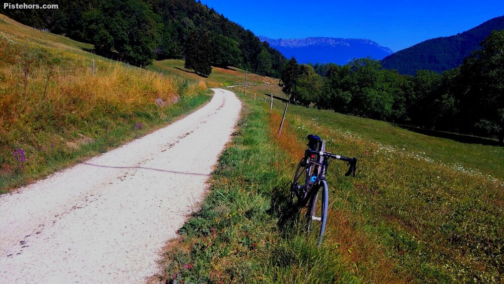
The aim, though, was not just the climb itself. I wanted to take the Chemin de Bois Callet, a gravel track that cuts across the hillside. The surface is relatively good, and although I was on 28 mm tyres today, I have ridden it before on 25s without any real problem. It is not rough gravel in the adventurous sense, more a useful and enjoyable unpaved link that adds a bit of variety to what would otherwise be a standard road loop.
From the end of the track, I continued on proper roads towards the Col des Ayes. By then most of the climbing had already been done, so the final section to the col was not too hard. In fact, it was only after Hurtières that I began to feel as if I was climbing properly. That may have been because the gradients eased off, or simply because the legs finally started to wake up. Either way, the second half of the climb felt much better than the first and I managed a 30 minutes VAM of 785 m/h. Next target is to get above 800 again.
The top of the ride came after a compact but worthwhile effort: under 40 km in total, but with 830 m of climbing, which is never quite as easy as the distance suggests. It was a good reminder that these small Grésivaudan loops can still carry a proper amount of vertical.
For the descent, I took the direct route down to Brignoud via the Route de la Planta. It is the obvious way down, but the surface is pretty bumpy, so it is not exactly a relaxing descent. The maximum speed was still 65 km/h, which sounds fast enough on paper, although on that road it always feels like the bike and the tarmac are having a minor argument.
Once back in the valley, the return was straightforward. I even picked up a PR on the Bella Via Rive Droite and a few good segment times, which suggests the ride was not quite as sluggish as it felt at the start.
In the end, this was a compact mixed-surface loop: a flat valley approach, a shaded climb towards Hurtières, a good gravel traverse on the Chemin de Bois Callet, then the Col des Ayes and a fast but bumpy descent to Brignoud. Not a big ride in distance, but with enough climbing and variation to make it feel like a proper morning out.
24C in the valley and bizarrely 25C on the col