Toggle navigation
Home
(current)
Articles
(current)
Trip Reports
(current)
Search
Guest User
Sign-in
Register
Search Results
Filter
Activity Type
Alpine Skiing (82)
Cross Skating (14)
Hiking (20)
Mountain Biking (72)
Nordic Skiing (290)
Off Piste Skiing (23)
Road Cycling (261)
Roller Skiing (125)
Running (21)
Ski Touring (288)
Orientation
East (201)
North (102)
North-East (75)
North-West (114)
South (83)
South-East (65)
South-West (92)
Various (193)
West (181)
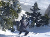
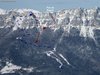
Lances de Malissard, climb by the West Couloir, Descent Bellefont
Fantastic day on the Mallisards. Bottom of couloir lacked snow but we were climbing. All the south west slopes were crusty and light cloud stopped the sun melting this.
2013-03-18 14:26:32
Lances de Malissard, West Couloir
ClimbFollow the forest trail that leads to the Col de la Saulce. At 1170 meters do not take the path that continues to the right but continue North.
2013-03-18 14:02:18
Pas de la Rousse
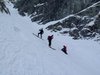
The Pas de la Rousse, East Couloir is almost the last line of the east Chartreuse that I've not skied. It is supposed to be the steepest line in the range.
2013-03-18 10:11:37
Pas de la Rousse, East Couloir
Climb to the Col de l'AlpeFrom the village of les Prés take the forest road direction in the direction of Pre Orcel.
2013-03-18 09:41:50
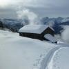
Foehn Call
I wasn't free on the Monday so Chris and I decided on a short trip on Tuesday "faut de mieux".
2013-03-15 23:53:59
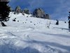
Ferrouillet, brêche Nord, North-West couloir
ClimbFrom Prabert climb the road to the Pont de la Betta turn at around 1300 meters. Descend a short distance to the Pont de la Betta then take a steep forest trail to the left (SE).
2013-03-15 21:55:21
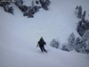
Aulp du Seuil, Couloir en Virgule
Quick trip to show Mike the Comma (Virgule) couloir and the spendid Cirque de l'Aulp du Seuil which are just above his house.
2013-03-15 19:35:10
Aulp du Seuil, Couloir en Virgule
Climb to the summit of the ski runs (watch out for downhill skiers). At the top take the small path the climbs above the ski life to the north-west.
2013-03-15 19:06:32
Mont Brequin by the Col de la Vallee Etroit; Maurienne; France
Access: Highway A43-> Saint Jean de Maurienne -> Saint Michel de Maurienne -> Beaune -> Col routier de Beau Plan according to the snow coverDescriptionClimb ENE to the chalets Ste Mar
2012-12-21 12:26:11
Col des Ayes -> Col de Lauteret
The col des Ayes from Tencin is 10km covering 704 vertical meters.
2012-11-23 15:22:24
Previous
110
111
112
113
114
115
116
117
118
119
Next