Ski Areas > Northern Alps > Belledonne > le Fond de France > Le Rocher Blanc
I'd set off on Saturday morning to meet Geraldine in Grenoble before taking a final decision as to whether to leave for two days ski touring, alone, in the Belledonne mountains. My destination, the Combe Madame. Not the most difficult environment for ski touring but alone on the mountain, in fog, navigating by way of compass and altimeter with sheer drops on either side makes the experience all the more exciting!

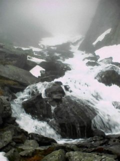
Cascades after the refuge
The journey down from Paris was in rain and as I turned the car towards the mountains low cloud hung ominously in the valleys. The weather forecast had promised an improvement for Sunday with good weather on Monday. My plan was to try the Rocher Blanc and maybe snatch another route early on Monday morning before picking up Geraldine and heading back to Paris.

The Combe Madame
I pulled into the car park at la Martinette (1100 meters) at 6 pm. I changed into my ski gear, checked the equipment I'd packed, food for two days, first aid kit, snow shovel, petrol stove. I decided to leave my ski crampons as I doubted that the snow would be sufficiently frozen to make them of use. The weight saving would be appreciated. I phoned down to Grenoble, at least I had a good signal so was not entirely cut off. As I started up the long path the Auberge's two large St Bernard's came out to greet me, as did the rain. I climbed fairly rapidly to the first chalet (1429 meters), this tumbled down shepherd's hut can be used as a point of refuge or bivouac. As I exited the forest the rain grew harder. Unlike the previous year the avalanches that cross the path had all melted and I finally got to the refuge after nearly 2 hours tortuous climbing.

Col de l'Amiante
The refuge was open and had five mattresses in the upper bedroom, damp wood and a stove. The cupboard was also full of candles and pasta left by previous occupants. I set about cooking myself dinner then getting a night's sleep.

Brèche de l'Argentiere
I awoke at 6am, it was still raining lightly outside. I fetched water from the spring below the refuge and made breakfast. Coffee, chocolate cake and bread. The sky showed signs of clearing and then it would rain again. Around 9 am it got lighter and I could see the snow on the slopes across the valley. I got myself ready and as the rain finally stopped at 10 am I set out. The first snow was only 150 meters away from the refuge at around 1800 metes altitude. Not too bad for late May although the route has been skied as late as July. I put on my skis and shuffled up the nevé. After a number of conversions in the waterfall I had to take my skis off and climb a few meters before finding snow again.

Col de Tepey and Puy Gris
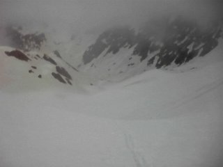
As this point the clouds cleared to reveal the valley I was climbing, I tried to memorize some features before all was enveloped in the warm and humid mist. Unlike last year I had my altimeter with me and I was hoping that this, combined with a compass, would enable me to easily navigate up the glacier to the summit. The first problem was that the cloud cover of the previous night had stopped the snow from refreezing. It stuck to the bottom of the skis in large clods, making me feel like a diver in lead boots. Secondly I didn't know the route so had no familiar markers to navigate by and the previous days light snowfall had all but covered any tracks left from other skiers.

Aiguille Michel
At around 2200 meters I figured that I should be heading southwards, and this is what the river seemed to do. I crossed from the right bank of the valley but the river seemed to head off much more sharply than I could divine from the map. I gingerly traversed across a steep slope, ahead I could hear the occasional 'clack' like a ski binding being snapped shut. I inched forward and was surprised by another 'clack' and a football sized rock whizzing past in front of me. I was in the process of making a U-turn down the left bank and was coming up to a couloir and stone shoot.

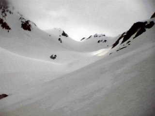
The Col de la Combe Madame appears out of the mist
I backed up to the middle of the valley and followed a steep arête. Sometimes the wind got up a bit and lifted the cloud enough to see the route up the valley. I realised from my compass bearing that this must be the right direction. On the other side of the valley small avalanches and rocks exploded off the Crête de Marmottane and down the Breche de l'Argentière. This is a set of three steep but short couloirs that allow skiers to cross from the Glacier de l'Argentière onto the Glacier de la Combe Madame. Obviously a route to be tackled early in the day.

Looking back down the Combe
I was now at around 2450 meters and noticed a rock band to my right, I was obviously on the right bank of the glacier but could hardly see the snow in front, there were some faint snow shoe tracks and the sun was sometimes visible above me. I came up to the Col de Buyant which leads down to the Chalets de Rieu Claret, a favourite departure point for ski tourists due to its high altitude.
I took a bearing with my compass and carefully traversed back across the glacier. The summit of the Rocher Blanc is in the form of a pyramid with steep, although by no means unskiable, sides. However given the visibility I didn't want to find myself pitching off into the unknown.

The Rocher Blanc lives up to its name
By a series of conversions I finally edged up to the final arête to the summit (2928 meters) and settled down to admire the view. The sun was hot and I was just on the limit of the clouds. The summit cairn was still snow covered, it normally stands at least 1 meter proud. In front of me a gentle sloped lead off to the Col de l'Amiante (Asbestos Pass). This can be skied down to the refuge of the Sept Laux or to Rieu Claret.
In front of me I caught glimpses of the Grand Pic de Belledonne, at 2977 meters the highest point in the range. I'd skied the Croix de Belledonne (2926 meters) the year before and it too occasionally poked its head out from the clouds.
To the left of me were the Aiguilles d'Arves, the Pic de Etendard and the Grands Rousses. The Pic Blanc cable car station was clearly visible. I rested a good half an hour at the top then noticed that the cloud was getting thicker. I put on my skis and edged back down the summit ridge and onto the wider slopes of the glacier. I could just make out my tracks for some 20 meters. I really didn't want to lose them so slowly skied down the wet snow in a series of slow parallel turns. This was not really pleasure skiing but an exercise in losing height without losing myself.
I traversed across the left bank of the Combe Madame and onto the steep ridge I'd followed early. Here the visibility opened up to some 100 meters and I was able to ski down this ridge in a series of tight, linked, parallel turns. I kept straight ahead between some cliffs and rocks. A giant snowball formed off the wake of my skis and started off down the slope with me following. This time I was able to follow a better line in the waterfall and only had to take my skis off for a short 5 meter section although a snow bridge over the river exploded in spectacular fashion as I skied across it.

The cascades called for some acrobatics!
On the final tongues of snow before the refuge I came across a couple who were planning to do the Rocher Blanc on snow shoes the next day. They told me there were two other people in the refuge and one was attempting to get the stove working. Good, I'd be able to dry off my wet clothes.
I must have looked quite a state, it had taken me from 10 am to 4 pm to get to the summit, a rate of only 200 meters per hour. I was tired and thirsty and my limbs were aching from the effort. I staggered into the refuge, dried myself with a towel, put on some dry clothes and lay down on the bed.
Three years later I came back. It had snowed overnight and I'd managed not to hear my alarm clock only making it to the carpark at 8am. A bit late for May but the weather was chilly. About an hours climb brought me to the refuge where a young lady was spotting Chamois with her binoculars. We chatted about the flora and fauna of the Belledonne and the return of the wolf to the mountains. I arrived at the summit at 11h30. Judging by the tracks there had been quite a bit of activity during the morning but largely on the steeper Amiant side. I skied down to the snow line at 1650 meters in 10cm of fresh powder on a firm base, the continuous snow went to 1500 meters on the left bank of the stream but the river was too wild to cross at this point. I made it back to the car at 2pm, just 6 hours after setting out.
Some photos are from this outing which had much better weather and snow conditions.
In August 2006 flooding swept away part of the forest track and there is now a diversion which needs to be climbed.
GPS: N 45.2416°, E 06.1077°, Altitude: 2928 meters
Orientation: North-East then North-West
Toponeige Rating: Danger: 1, Climb: R, Ski: 2.3
Climbing: 1830 meters, 6000 ft.
Dates skied: 19 May 2002, 7 May 2005
<< Rocher Blanc, north-west Couloir | le Fond de France | Col de Mouchillon north face >>