To enhance the safety of backcountry skiers and snowshoers, nearly 700 new routes have been added to France’s national geographic portal, Géoportail, bringing the total to around 4,000. The updated maps, developed by the Institut national de l'information géographique et forestière (IGN) in partnership with Petzl and Skitourenguru.ch, aim to guide outdoor enthusiasts toward safer terrain by taking into account avalanche risk data.
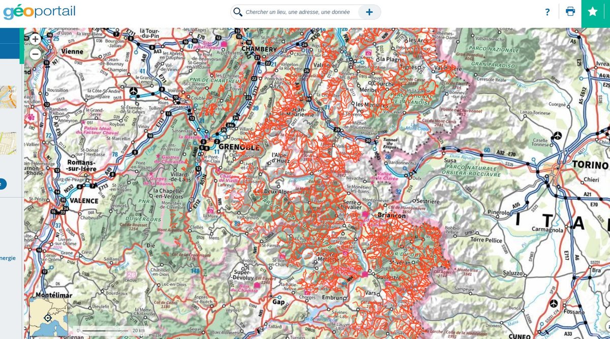
Geoportail with winter tracks
These new routes, highlighted in orange on the platform, are designed to avoid avalanche-prone areas whenever possible. Users can simply search for "randonnées hivernales" (winter hikes) on Géoportail home page. Zooming in reveals detailed trails overlaid on topographic maps. Dangerous zones, such as avalanche prone slopes or where there is a risk of falling are shown with a dotted line. “As a cartographer and companion for exploration, IGN wants to provide the public with tools to better understand mountain conditions and improve safety,” explained Stéphanie Barrière, IGN’s head of institutional relations for tourism and sports.
This initiative comes at a critical time, as the 2024–2025 winter season has already claimed the lives of 12 backcountry skiers in avalanches in the Northern Alps. The most recent tragedy occurred on February 5, when a 59-year-old mountain guide was caught in an avalanche while skiing off-piste in the Mont Blanc Massif. The French Alpine Club (FFCAM) reminds enthusiasts that these new digital tools do not replace thorough trip preparation, which should include avalanche risk bulletins (BERA), weather reports, and proper equipment such as a shovel, probe, and avalanche transceiver.
A Long-Awaited Update or a False Sense of Security?
While many see the updated maps as a valuable resource, some backcountry enthusiasts argue they do little to improve actual safety. The routes largely compile existing ski touring itineraries already found on IGN maps, now transferred to the Géoportail platform in digital form. "This has nothing to do with safety—it’s simply an update and a digital transfer of existing routes," claimed skier Yannick C.
Others warn that relying too heavily on mapped routes could create a false sense of security. “Following a track doesn’t mean you’re safe,” notes Herve H. “The foundation of ski touring is having the right equipment and carefully assessing conditions on the day of your trip. The mapped route is just one factor.”
Some worry that these efforts could lead to an over-sanitization of the sport. “Trip planning is part of the experience and the pleasure of ski touring,” says Julien J. “Knowing, accepting, and understanding risk is essential.” Similarly, Julien C.stresses that no map can replace in-depth preparation. “Skiers must analyze snow conditions, wind patterns, and weather over the preceding days or even weeks. Even highly experienced professionals get caught in avalanches—amateurs must be even more cautious.”
Despite these concerns, the digital mapping project is expected to expand in the coming years, with additional routes planned for the Southern Alps and the Pyrenees. Whether these tools will truly enhance safety—or simply encourage more people into avalanche-prone terrain—remains an open debate.