Fri, 3 February 2023
Minimum altitude: 1,203 meters
Distance: 44 km
Slope Aspect: Various
Vertical Climbed: 823 meters (2,700 feet)
Vertical Descended: 823 meters
Description:
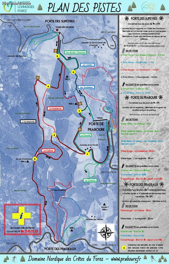
The Crêtes du Forez ski area is located on a high plateau in the eastern end of the Massif Central mountains about 40 minutes drive from St Etienne. Despite the "nordic" feel to the area The ski season generally lasts from the first snows in December to early March.
Access: via St Etienne, 120km from Lyon center (1h40)
Trip Report:
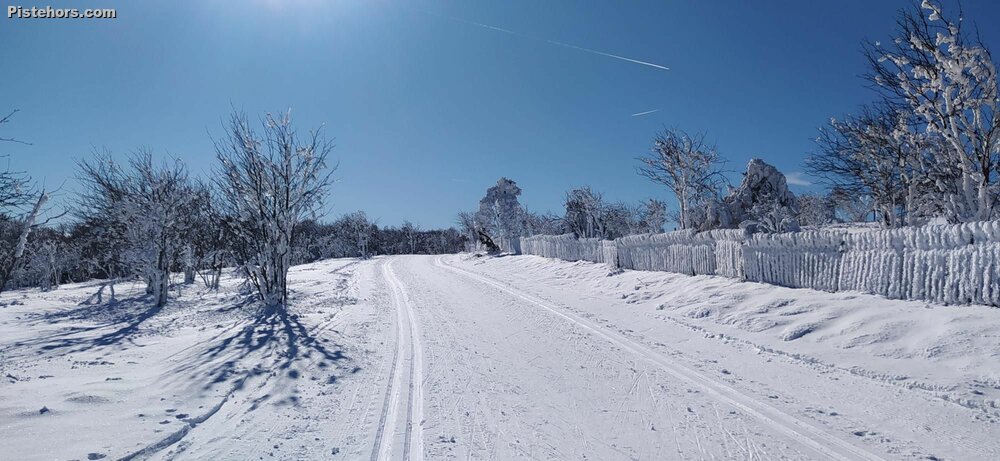
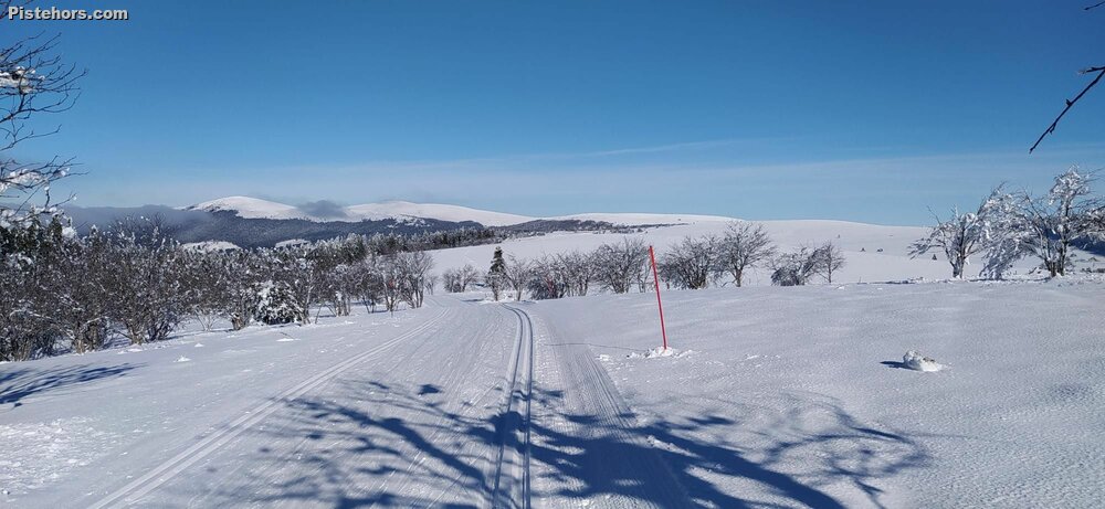
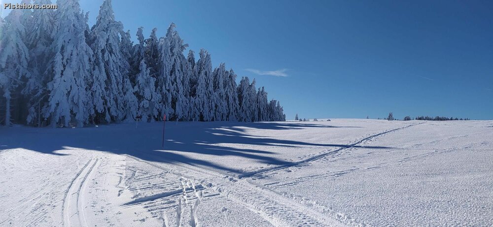
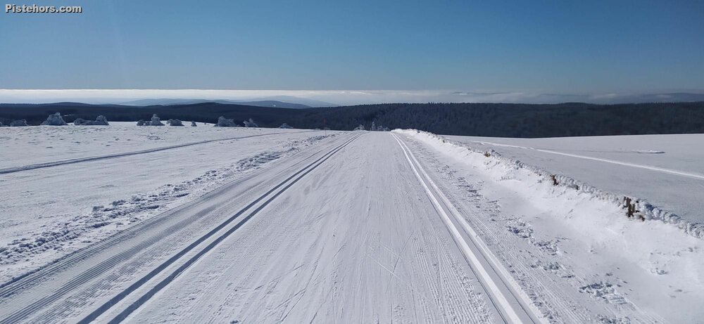
I hesitated about skiing the Crêtes du Forez as it is a long drive in terms of time. I'm not sure why, the autoroute is fairly good and toll free! but it seems to be the part after St Etienne that takes the time. Cross country from Lyon it is just 100km but takes forever. After an early start I arrived around 9h45 having taken a wrong turn, something of a tradition this year. I started at Prabouré where there is a small Alpine ski area. The services have been centralized around this access point for the 2023 season but there isn't much there, tickets and ski hire. The climb over to the southern access point on a col at Pradeaux, a small hamlet, was pleasing. Never too steep it was possible to practice a range of styles on a well groomed trail. At Pradeaux there is nothing - it only opens at the weekends and then just to sell tickets. Climbing back to the Northern access at the col de Supeyres was intially harder than I expected but the snow was in the shade and was sliding well. Once back on the plateau you follow the left hand side (looking north) on a rolling trail: l'Auvergnate before plunging into a frozen forest which was a real fridge. The organisation that manages the trails say they have changed the layout for this season to give better views to skiers and I must say I've never taken so many photos. It is sumptuous. You really get the feeling of being in Norway - but with southern sunshine.
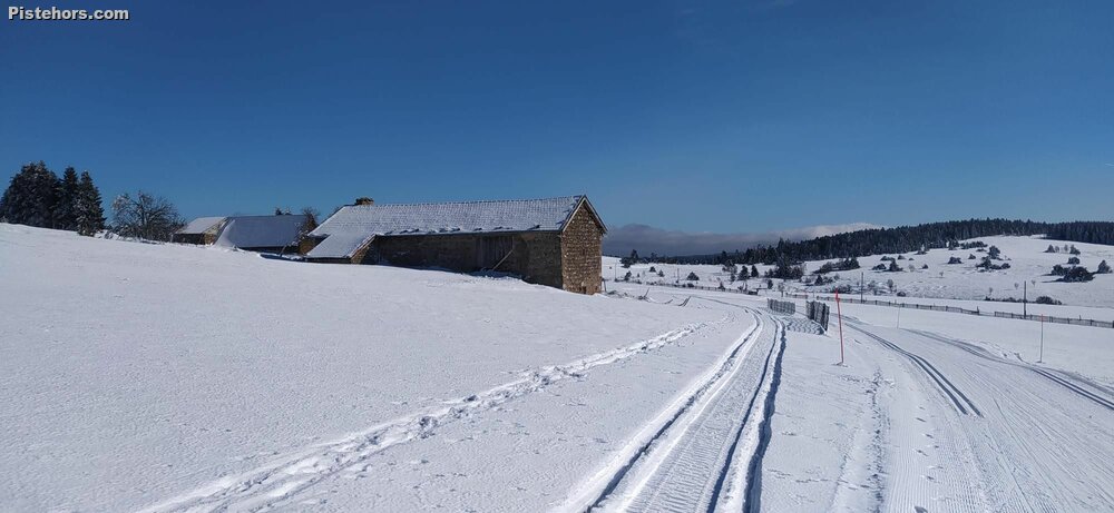
At the Col des Supeyres (1365m) there is a gite where it is possible to eat and buy lift passes: Chalet des Gentianes : 04 73 82 00 95 / https://www.lechaletdesgentianes.com/ I was now 20km into my tour and turned south to the Jasseries de la Fayolle on a Green/Black trail. This high traverse is about 5km and has a few steeper sections (despite the green grading) ending in the little summer village of Fayolle. A Jasserie are high grazing and a farm where traditioinally Fourme cheese is made. The term is assocaiated with the Monts du Forez and is the equivalent of an Alpe. The farm is called a "loge" or "cabane".
It was a bit after 12 and after the Auvergnate I thought I'd finish with the Forezienne trail. This looped back over to the frozen forest and here I double back against the (non-existent) traffic to the Suc de Montchaud. A suc is an extinct volcano, you can't see it very well here but in the Ardeche they look like Sugar Loaves due to their geology, hence the name. It was 1pm, I figured I could finish the Forezienne skiing the frozen forest, which was not starting to thaw then back to the Fayolle but via the woods. I'd not had breakfast (normal for me) and by 35km I was starting to get a bit tired. If I were doing a race I would eat every 10km at least. I was running on empty.
On the trail back to Praboure I just concentrated on skiing well with the minimum of effort, even the ski down was hard work as the snow was transforming in the warmth and sun. Finally 44km and 825m of climbing.
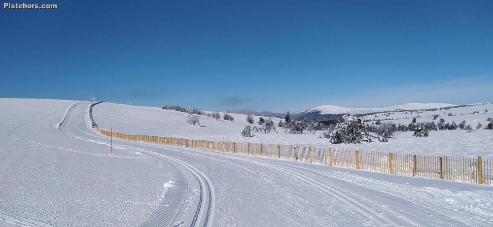
The ski area is absolutely beautiful on a sunny, warm day but the snow fencing and very close spaced marker posts show it is not a place to be when the weather closes in. The rime ice on the fences and trees a testament to the harsh conditions on the high central plains.
Good at 10am, sticky after 1pm in the sun. About 10-20cm of hard frozen snow on the trails. Ski while you can.