Sun, 16 August 2026
Minimum altitude: 232 meters
Distance: 70.7 km
Slope Aspect: South-West
Vertical Climbed: 1,081 meters (3,547 feet)
Vertical Descended: 1,073 meters
Rating: 3
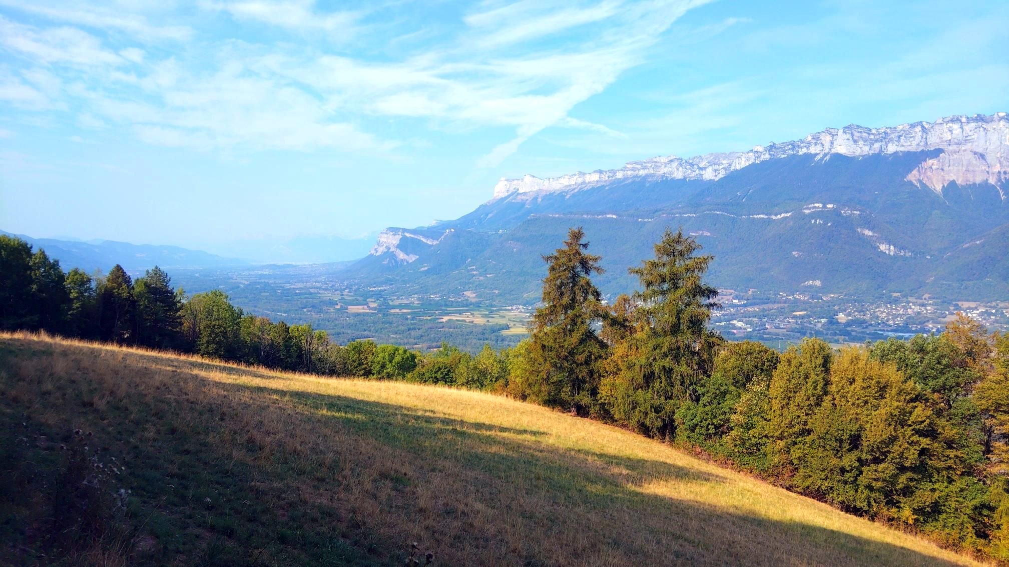
Today’s objective was Brame-Farine, the long wooded mountain that rises almost 1,000 metres above the Grésivaudan and separates the main Isère valley from the smaller valley of Allevard.
It is a mountain I see all the time from the other side of the valley, but it had been around ten years since I last climbed it by bike. The name itself is rather evocative. One explanation traces Brame-Farine back to the cries or roars of wild animals in the forests that once covered these slopes, perhaps even bears. There are other theories, but “the mountain of the roaring beasts” seems particularly appropriate for this heavily wooded ridge.
I started by taking the valley cycle route north. It really is an excellent piece of infrastructure: flat, quiet and almost completely removed from traffic, allowing the kilometres to pass very easily before the climbing begins.
At le Cheylas I left the valley floor and started upwards by the Route de Fontanil. Rather than following my usual route, I decided to experiment with a new variation through Le Crey, crey being an old Alpine word for a ridge or crest, an appropriate name. The map suggested that it ought to work.
It nearly did.
The Route de Crey climbs nicely through the scattered hamlets on the western slopes of Brame-Farine, but eventually it became apparent that it didn't quite connect with the road I needed higher up the mountain. There was, however, a solution of sorts: a tiny track dropping across a stream and climbing back up the other side.
For a couple of hundred metres it became more cyclocross than road cycling. Bike on shoulder, across the stream and up the narrow path, before emerging, slightly improbably, back onto tarmac. Not perhaps a route to recommend to someone with pristine white cycling shoes, but perfectly workable and considerably more entertaining than cycling all the way to the valley.
From there came the real climb towards Brame-Farine.
There were roughly another 400 metres to gain and this was where the ride became properly hard. The climb produced several sustained efforts of between five and twelve minutes with my heart rate mostly in the mid 160s, eventually reaching 173 bpm. The strongest quarter-hour gained just over 200 metres of altitude, equivalent to a VAM of a little over 800 m/h.
Those numbers probably make the effort sound more structured than it actually was. In reality it was simply the usual rhythm of a steep mountain road: climb hard, ease off where the gradient relents, then climb hard again. Over a two-and-a-half-hour ride I spent around half an hour working quite hard, but the rest remained very much an endurance effort.
Brame-Farine itself is an interesting geographical oddity. It is not really part of the high Belledonne in the usual sense, but rather one of its western foothills: a long ridge running north-east to south-west between the Grésivaudan and the hanging glacial valley of Allevard. At around 1,230 metres it is modest compared with the 2,000 and 3,000 metre peaks just behind it, but from the valley floor its slopes are substantial.
The descent towards Allevard was less enjoyable.
I remembered the road being rough when I last rode here about ten years ago and, unfortunately, a decade has done remarkably little to improve it. It is one of those descents where it is difficult to relax properly: instead of looking through the bends you spend rather too much time looking immediately in front of the wheel for broken tarmac and potholes.
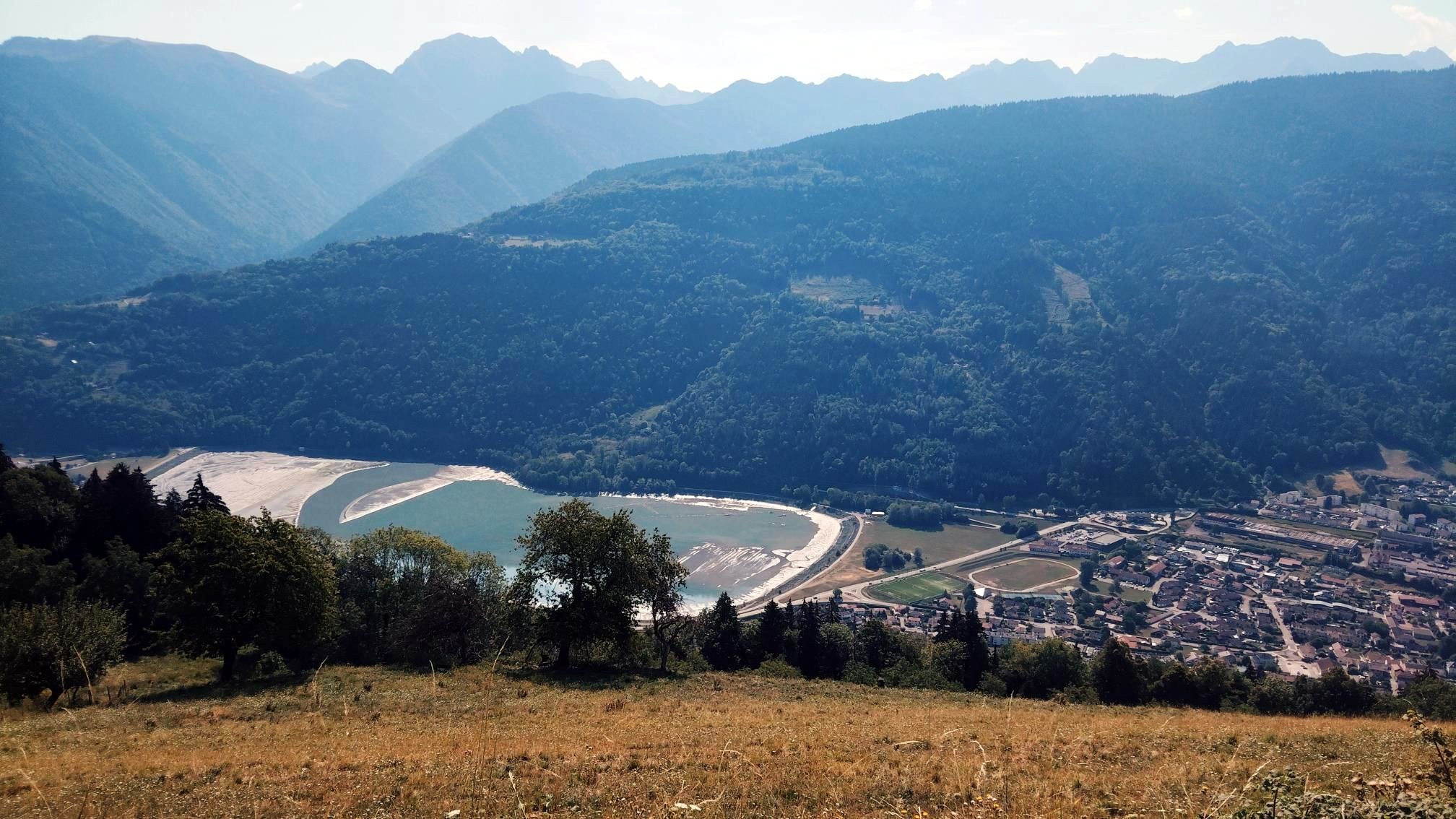
Down in the Allevard valley, the most striking sight was the reservoir. The water level was extraordinarily low. After the prolonged dry spell since April, large areas normally covered by water were exposed. It gave the landscape a slightly strange late-summer appearance, despite still being only the middle of August.
From there the ride became much easier. The road gradually loses height towards Goncelin, eventually dropping back onto the floor of the Grésivaudan. Once there I rejoined the cycle path for the run home.
In total it was about two and a half hours on the bike: mostly steady endurance riding, punctuated by a surprisingly substantial block of climbing at close to maximum sustainable intensity. More importantly, though, it was a satisfying little exploration of a mountain that is almost on the doorstep.
Brame-Farine is perhaps easy to overlook because the much higher peaks of Belledonne rise immediately behind it. But viewed from the Grésivaudan it is a mountain in its own right, rising almost a vertical kilometre from the valley, covered in forest and crossed by a slightly eccentric network of old roads, tracks and hamlets.
And, as I discovered today, at least one route that requires carrying the bike across a stream.
Very warm from the start at 9am.