Ski-Areas > Northern Alps > Savoie (73) > Maurienne > Les Karellis > off piste > La Grande Chible
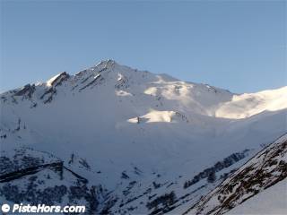
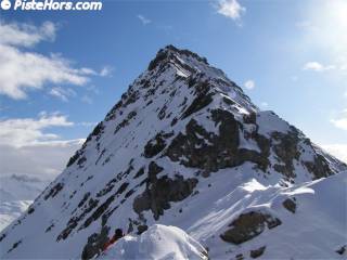
As you enter Albanne take the first road on the right, this leads to ski slopes. From here follow a track above the ski slopes to the south. After about 500 meters you reach a cross-roads by ski slopes and snow canons. Follow a small track signposted to la Plagne and la Pisée. Continue to the south-east and climb out of the forest below the Pisée chalet. You now enter the combe des Moulins below the ski slopes of les Karellis. Follow the contour via a summer path, you encounter a concrete reservoir then the track that follows the bottom of the combe des Moulins. The track climbs up into the bowl, from here you can track south to the Col de Pertuité (see variations) otherwise continue up the steepening slopes to the south-east which end in a steep couloir exiting around 2900 meters on the north-west ridge. The climb to the summit is exposed.

It is best to descend by the track that follows the bottom of the combe des Moulins. Be careful at the level of Prario (small zig-zag between barbed wire fences) not to take the track to Albannette. It is also possible to park at the Church and follow the ski slopes from the town center.
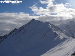
The south-east side can be climbed via the Pas de Pertuité. It is best with spring snow conditions when it should be tackled early in the day. It is possible to descend the summit ridge but it is airy. A rope and crampons are not a luxury. From the combe des Moulins around 2100 meters traverse south to reach the Col de Pertuité (2520m) between the Paroi du Midi and la Grande Chible. This col is not named on the IGN map.

Traverse to the south-west on a plateau to cross above the Pas de Pertuité (2550m). Climb the steep south-east face to the east rdge of la Grande Chible (2880m). You can reach summit on foot via the ridge, the rock is a bit rotten at the start but improves closer to the summit. There is a small couloir off the summit.

| Mountain Range | Pays d'Arves/Haute-Maurienne |
|---|---|
| Summit | la Grande Chible |
| Altitude | 2932 meters |
| Orientation | North-east |
| Starting Altitude | 1680m |
| Vertical | 1250 meters |
| Maps | IGN Top 25 3435 ET Valloire |
| GPS Waypoint | N 45.1808°, E 06.3736° |
| GPS Route | Google-Earth:Les-Karellis |
| Grade[1] | Danger: 1, Climb: PD, Ski: 3.1 |
| Comments | 30° over 300 meters - source IGN 1:25000 map |
| Snowboarders | Grands Moulins track is flat in places |
| Equipment | Ski Crampons, crampons / rope for summit ridge |
| Road Access | Chambéry -> Saint-Jean de Maurienne -> Montricher-Albanne |
| Refuges | |
| Author | davidof |
There is not much snow around for a mid-December due to some warm temperatures and foehn wind over the last few weeks. As we set out from l'Albanne a dark band of clouds hung over the border mountains with Italy, a sign of lombard winds and a depression somewhere around Corsica.

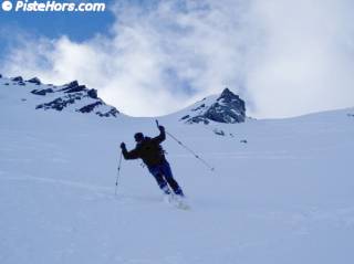
We managed to climb on skis from the car on about 10cm of snow compacted by skiers. Above 2000m the snow cover is quite good with a base but there are still some nasty rocks present. The snow was heavy powder with freeze/wind crust in places. Towards the ridge there were some small, hard slabs and some of the base snow had begun to destructure in the cold. We didn't make a detailed examination though. Dr Bruno suggested we taken in Pointe d'Emy to add up to 1750m of vertical.
Contributed by davidof on the 16 December 2006
<< Les Karellis Off Piste | les Karellis | la Pointe d'Emy south-east face >>