Ski Areas > Pyrénées > Hautes-Pyrénées > Vallee de Ossoue > Le Grand Pic de Tapou
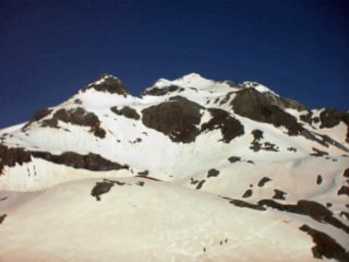
From the cabane de Milhas (1680 m) take the road in the direction of the d'Ossoue following the GR 10. After a small mound in the middle of the valley cross the Ossoue and climb the vallée de la Canau. On a flat secton at 2200 mètres there is a cabin (it is possible to sleep or refuge here). The route is now a series of bends. Turn to the north and pass between the Pic Rond and Pic Pointu (to your left), then turn west to the lacs du Montferrat (small descent). The route climbs through a narrow and steep valley before exiting onto a plateau. A short, steep slope take you to a bowl, climb the right bank to reach the ridge which takes you to the summit.
| Mountain Range | Hautes-Pyrénées |
|---|---|
| Summit | Grand Pic de Tapou |
| Altitude | 3150 meters |
| Orientation | North |
| Starting Altitude | 1680 meters |
| Vertical | 1470 meters |
| Maps | IGN Top 25 1647 OT |
| GPS Waypoint | |
| GPS Route | Google-Earth: |
| Grade[1] | Danger: 1, Climb: PD-, Ski: 2.2 |
| Equipment | ski crampons |
| Road Access | Lourdes (N21) -> Luz St Sauveur (N21) -> Gavarnie. Take the road to the barrage d'Ossoue (sign). Park at 1525 meters in a small car-park just before an avalanche. The cabane de Milhas (1686 m) can be reached on foot or mountain bike after crossing a couple of avalanches. |
| Refuge | Cabane de Milhas, Refuge de Baysselance |
| Author | davidof |
This was to be the biggie. We made an effort to be up earlier than the day before but in the end we didnt get away much before 7.30. From the cabin it was easy to trace the winding route that leads up to the Grand Pic de Tapou. The mountain stretches out towards the horizon. Even though there was only some 1500 vertical meters to be tacked it reminded somewhat of pictures Id seen of Everest base camps. The clutter of the campsite then a distant peak with swirling clouds kicked up in the humidity of a spring morning.
We climbed up the track to the dam at the end of the lake we crossed a wooden footbridge. This lead onto a series of little foothills, which quickly brought us to a snowfield. Here we were able to fill up with water and fix our skins for the climb. Initially we climbed due south, to a large plateau at around 2200 meters. There is a small refuge here, not shown on the maps and apparently difficult to find in fog or at night. This refuge lies on the Pyrenean Haute Route, a forty-day crossing from Atlantic to Mediterranean. This is a difficult undertaking in summer but there are at least some guarded refuges where it is possible to re-supply en-route without descending into the valley. In winter the Haute Route becomes a real exercise in logistics, it being necessary to either have friends or to cache supplies along the route in advance. Given that the winter weather rarely holds for the month needed to complete the trek it is little wonder that few have attempted let alone succeeded on skis.

From this plateau the route becomes a series of curves as one crosses first to the right and then the left of the numerous pics that guard the Tapou. We first turned northward to pass between the well named Pics Rond (round) and Pointu (pointed).
Up until this point Id been keeping in front of the group with Guy. I knew that with less acclimatisation, both to the altitude and warm weather and with my heavier gear I would fall behind later. Now I started to be overtaken, one by one, until I was alone.
I climbed to the west with a small descent passed the Montferrat lakes before disappearing into a steep and narrow valley that exited onto yet another plateau. At this point I caught another skier, swaying from fatigue and heat he was barely coherent. He said he was stopping and with that collapsed into a heap on a mound of grass. Spent.

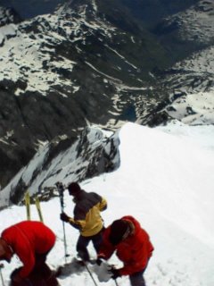
Over the last slopes one attempts to follow the contours while trying to climb in the thin mountain air finally climbing directly up to the summit ridge of the Tapou. It is best to keep your skis on as far as possible, in the warm spring sun the deep snow on the ridge was as soft as marshmallow and the final few meters was hard going in knee deep snow. From the summit the Brèche de Roland and the Pic du Midi du Ossau were clearly visible.

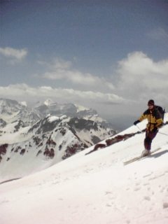
The descent was pure joy, perfect conditions. We skied down the other side of the Pic Rond towards the cascade du Tapou in order to take advantage of the snow for as long as possible. Finally, at 1780 meters, just above the lake, we stopped for a sun bathe and picnic. Here we met the skier Id talked with earlier, in better shape but still tired.

Category: Trip Reports
<< Brèche dEstom Soubiran | Vallee de Ossoue | Le Cerbillona >>