Ski Areas > Pyrénées > Hautes-Pyrénées > Vallee de Ossoue > Brèche dEstom Soubiran
From the dam at 1800 m cross to the right of the Oulettes river up to cliffs and a waterfall. At the cascade there is a short but steep pitch taken in a series of conversion turns. This lead to the summer path which traverses high above the stream. 500 meters of scramble brings you into the steeper Oulettes valley. At 2200 meters turn north into the barranco d'Ossoue following the right bank of the valley. It is best to cross all these slopes early in case of wet snow slides on the sunny slopes. Turned west, passing the lac de gentianes (2650m) on the right and the Brèche.
| Mountain Range | Hautes-Pyrénées |
|---|---|
| Summit | Pic d'Estom Soubiran |
| Altitude | 2729 meters |
| Orientation | North |
| Starting Altitude | 1680 meters |
| Vertical | 1050 meters |
| Maps | IGN Top 25 1647 OT |
| GPS Waypoint | |
| GPS Route | Google-Earth: |
| Grade[1] | Danger: 2, Climb: PD-, Ski: 2.1 |
| Equipment | ski crampons |
| Road Access | Lourdes (N21) -> Luz St Sauveur (N21) -> Gavarnie. Take the road to the barrage d'Ossoue (sign). Park at 1525 meters in a small car-park just before an avalanche. The cabane de Milhas (1686 m) can be reached on foot or mountain bike after crossing a couple of avalanches. |
| Refuge | Cabane de Milhas |
| Author | davidof |
At dawn the fire had died to nothing and it was distinctly chilly. After the approach march the day before everyone was a bit lethargic. We roused ourselves at 6am, looking out of the cabin it was obvious that the rain we had heard had fallen as snow above 2,200 meters. A mixed blessing. The snow lower down would be heavy going and if waterlogged, liable to slide. Higher up we would find the nirvana of all skiers, la peuf fresh powder.

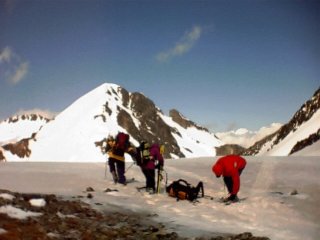
We finally got started at 7.30. Although there were patches of snow along the road we were not able to put our skis on before the dam, at around 1800 meters. We crossed to the right of the Oulettes. In the distance there were whistles and scurrying fur. Marmottes or Ground Hogs, keen to be out and about after their long winter hibernation were calling out a warning. With skis back on our feet in the upper Oulettes valley we followed the snow. Near the end I filled my water bottle from a waterfall and the others waited some way ahead for me to catch up. A little effort brought us to the Brèche. We were struck by a strong wind but it was not unpleasantly cold. We decided to picnic there and then. Lionel, Guy and Christian were keen to go on, to make a tour to return via a couloir they had spotted earlier on the climb. The rest of us wanted to conserve our energy for the following days.

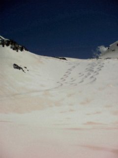
We skied down, powder flying out from under our skis, almost as far as the Oulettes valley. A welcome surprise for the Pyrenees, in May. At the start of the summer path we decided to stop in the warm sun. Up above, Isards, Pyrenean versions of Alpine chamois, scampered up and down the snowy slopes. They made climbing look effortless, although it was obviously hard work for them in their thick winter coats. A large male dug a hole in the snow and settled down for an afternoon nap. Animals perfectly adapted to the harsh winter environment. We would see a lot of wildlife over the next few days. More than in the crowded Alps.
The sun was setting when the others finally returned. They had made a wrong turning and covered even more ground than theyd anticipated. Close to 2000 vertical meters, not bad when you consider that Guy is in his 60s.
Category: Trip Reports
<< | Vallee de Ossoue | Le Grand Pic de Tapou >>