
Ski-Areas > Northern Alps > Isère (38) > Oisans > l'Alpe d'Huez > Off Piste > Pic Bayle By The Grand Sablat

Le Pic Bayle
Depending on the snow line you can start from Clavans le Haut (1398 m), the sixth hairpin after the hamlet of le Perron or at point 1867 m on the 8th hairpin after le Perron. Even quite late in the season the road, although generally snow free, can be blocked by avalanche debris after le Perron. Despite being south-east facing the route is practicable through to June with some walking as the snowline seems to resist well around the 2150 point, probably due to the flat terrain in the Grand Sablat valley.
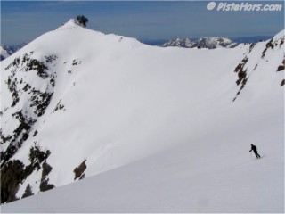
Telepherique du Pic Blanc
The route climbs to the north-west up some steep, potential avalanche, terrain to the Sablats plateau at 2150 meters. It traverse north for a short distance before resuming its north-west climb up the bottom of the Grand Sablat valley. There is a steep section at 2900 meters which is taken by a left movement around some rock outcrops. Here the cable car station of summit of l'Alpe d'Huez is clearly visible. Turn to the north to cross the glacier, note that crevasses are indicated on the IGN map. The Pic Bayle is obvious straight ahead. It can be climbed by the south-east spur. From a point around 3350 there is a short couloir that leads down to the to the glacier du Malatres. Either leave skis here or fix to your rucksack to climb a very steep but short step that leads to the final ridge and around 75 meters of climbing.
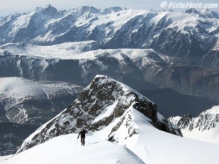
Climbing the south-east ridge
The south face is about 150 meters of steep slope but with little exposure as it runs out onto the glacier. Local guide Roger Canac told me that the summit is named after an 19th century clergyman who preached in Huez and who wrote a small book about the area.
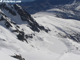
Glacier and Lac des Quirlies
This is a classic off-piste run from the top of the resort that finishes at Clavans le Haut and gives skiers 2000 meters of vertical. It is best tackled earlier in the day due to the south-east aspect and the vertical means that all types of snow conditions can be encountered from hard icy surfaces on the intial steep slopes to slush lower down. From Clavans either pre-book a taxi to return to Auris by road or enquire about the SAF helicopter taxi service (groups of six) from l'Alpe d'Huez altiport (note we do not like to encourage the use of helicopters in this fragile mountain environment). It is also possible to return on climbing skins via the col de Sarenne.
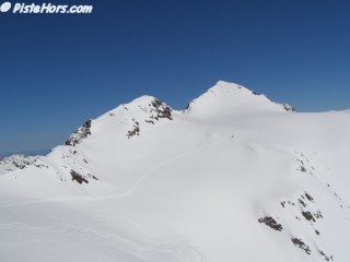
Tracks across to the Pic Bayle and Grand Sablat
From the Pic Blanc cable car ski down below the level of the glacier chair lift keeping to the left bank. The off piste is protected by large netting, more to prevent skiers crashing off the runs than to stop off-pisters. Climb under this at a suitable point and follow the contour line to the north under the col du Millieu (Middle Col). The initial slope is quite steep. Afterwards follow the right bank down the valley, the couloir du Sablat joins at this point. The valley is a mix of some steepish sections with traverses but on skis it is possible to keep enough momentum not to have to pole much. At the terminal moraine of the glacier angle to the south and the steeper slopes above le Perron. It is also possible to cross the plateau of the Sablats to reach the col de Sarenne directly then the lifts of l'Alpe d'Huez. This is 2km of very flat traverse (about 150m of vertical over this distance).
An alternative is to take a steep couloir directly in front of you after you pass under the netting. This couloir runs out into the Glacier du Sablat.
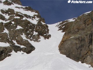
Couloir du Sablat
| Mountain Range | Grandes Rousses |
|---|---|
| Summit | Pic Bayle |
| Altitude | 3465m (11370') |
| Orientation | South East |
| Starting Altitude | 1748m |
| Vertical | 1717 meters (5635') |
| Maps | e.g. IGN TOP 25 3334 OT Chartreuse Sud |
| GPS Waypoint | |
| GPS Route | Google-Earth: |
| Grade[1] | Danger: 1, Climb: PD+, Ski: 3.3 (4.1 for the couloir du Sablat) |
| Comments | 36° over 150m on the S face of the Pic Bayle with a short passage at 40°. The route is on the Grand Sablat glacier but this is not heavily crevassed |
| Snowboarders | Yes but the plateau below the Pic Bayle and the flat valley floor of the Grand Sablat require you to use the terrain. Snowboarders should consider collasible climbing poles |
| Equipment | Ski crampons, crampons for climb to Pic Bayle |
| Road Access | Grenoble (N91) --> Vizille --> Bourg Saint Maurice --> (D25) Mizoen --> Clavans le Haut --> le Perron |
| Refuges | |
| Guide Books | L'Alpe D'Huez by Francis Ginet, Amazon-UK:2910672034 |
| Author | davidof - 17th May 2006 |
Good snow conditions around mid-morning with a few tracks.
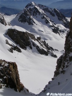
Le Grand Sauvage
Contributed by davidof on the 01-Apr-2006
Mid May requires an early start for these east facing routes so we set a rendez-vous in Grenoble for 3.30am! The road up to the col de Sarenne was blocked by an old avalanches at the right-hand hairpin at 1810 m. No obstacle to cycles but we had to leave the car here and walk up to the 1867 m hairpin where we climbed on a track to the Sablats. The continuous snow began at 2150 meters. The left bank of the valley presented the easiest slopes but we found black ice between 2500 and 2800 meters, possibly due to overnight rain. Even on the relatively gentle slopes we had to fix ski crampons.
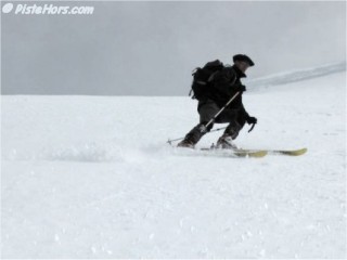
First meters on the face
We skied down at 10am in excellent snow near the summit, a small covering of fresh powder. However the earlier icy section, which had worried us, was now soup and pratically unskiable. Below this older firn snow provided a good surface. The summit face was protected by a small cornice.
Contributed by davidof on the 17-05-2006
<< Pic Bayle by the Grand Sablat | L-Alpe-D-Huez-Off-Piste | le Grand Sablat >>