Ski Areas > Northern Alps > Belledonne > Pays d'Allevard > Grands Moulins Couloir SW
This is a general template for ski routes.
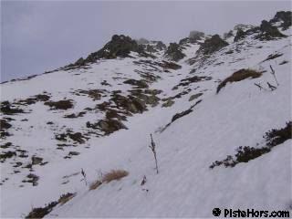
After le Molliet the road is not maintained and it is normally possible to drive to 1100m in winter, then to around 1350m in the spring, there is usually ice cover after la Tornerie. Follow the road to Val Pelouse, at the last hairpin to the left there are two choices, continue to the old ski resort and traverse across the Grande Montagne d'Arvillard or at the hairpin take a small track to the south, this descends to a stream then there is a fork. Take the left fork which climbs steeply to reach some open slopes above the hairpin. These slopes can be avalanche prone. Climb to the walking trail and traverse to the south-east to reach the Perrière refuge staying pretty much on the 1830 contour. From the refuge continue SE to round a small ridge, the couloir starts at point 1936m on the IGN Map. You can either climb the couloir using crampons or continue via the Grands Moulins south face.

The couloir is around 500 meters long at an average slope of around 36° with passages of 42°. I've put the dange as 2 because the couloir turns at its summit and it terminates in small cliffs and woods. I spoke to a climber who fell in the couloir and it doesn't sound like a pleasant experience.
The couloir should only be attempted in spring snow conditions. It is in condition an hour or so later than the south face. If the couloir remains icy it is possible to descend by this route.
| Mountain Range | Belledonne |
|---|---|
| Summit | Grands Moulins |
| Altitude | 2495m |
| Orientation | South-West |
| Starting Altitude | 1100m |
| Vertical | 1395m |
| Maps | Carte IGN TOP 25 3433 OT Allevard |
| GPS Waypoint | |
| GPS Route | Google-Earth: |
| Grade[1] | Danger: 2, Climb: AD+, Ski: 4.1 |
| Comments | The couloir is quite narrow. The slope averages 36° degrees from the summit with a maximum angle of 42°. |
| Snowboarders | Yes but a flat traverse from the refuge de to Val Pelouse |
| Equipment | Crampons, ski crampons, ice-ax, helmet |
| Road Access | Pontcharra -> la Rochette -> Arvillard -> Val Pelouse |
| Refuges | refuge de la Perrière?, refuge de Férices? |
| Author | davidof |
The ski station of Val Pelouse closed in 1986. The road has minimal maintenance. The buildings and lifts were dismantled in the 1990s. It is still possible to see the lines the lifts and runs took through the woods.
Add information about any outing here, include your name and the date of the outing
Contributed by _ on the _
<< Grands Moulins south face | Pays d'Allevard | Grande Montagne d'Arvillard? >>