
Ski Areas > Northern Alps > Belledonne > Pays d'Allevard > Grands Moulins Couloir NNE Diretissima
The Grands Moulins (big windmills) is a mountain's mountain. It sits appart from the other summits and roughly presents three skiable faces to the north-east, south-east and south-west. These faces are etched with a series of couloirs of varying difficulty with some very long descents to the North and South-West. The mountain had caught my attention some ten years previously but I had to beat a hasty retreat from the south face (or normal route) due to an unexpected thunderstorm. I was too late in the day, slowed down by a long traverse from the former ski station of Val Pelouse.
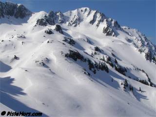
The north-north-east face offers the ski mountaineer a choice of four couloirs. The easiest are at the extreme left (1) and right (4) of the face. Around 40° over 150 meters vertical. The extreme left couloir seems to be the most skied. It is oriented towards the north so transforms later in the day and would also conserve powder snow for longer. The right couloir is oriented to the north-east. It eventually joins the steep north-west couloir and the summit is only reached after a short, mixed climb over rock and ice. The two direct couloirs (2 and 3) are slightly steeper, the first two or three turns have to be made on a 50°, although this varies depending on the snow conditions. These couloirs probably rate 4.2 in difficulty although the steep sections are quite short. Couloir 2 has a rock feature before opening out onto the main cone and couloir 3 is exposed if you fall at the top with a small cliff. Finally there are two other couloirs which join the north-east ridge between the Grands Moulins and les Trois Dames.
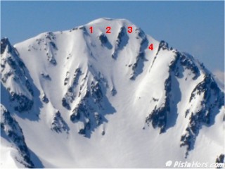
Grands Moulins Couloirs
The easiest way to reach the North-East face is from the Valley des Huiles and the road leading from Preslette. In winter this is not cleared beyond 800 meters giving any skiers a long day. By last April it is possible to drive to the summer parking at 1220 meters although often short sections of old snow can bar the road. The route as far as les Sources du Gargoton is described in the les Trois Dames topo. From there the choice is either to continue to les Trois Dames via the lac Vert path then traverse across a short but exposed slope to the moraine at the bottom of the Grands Moulins or to climb up the Arber Neuf bowl towards the Col de la Perrière? then at point 1854 meters on the IGN map double back onto a large, North-West facing slope. Take care, this is angled around 35 degrees so there is a chance of both avalanches in the winter months and falls in the spring with serious consequences with the 10-15 meters cliffs waiting at the bottom. After some climbing the foot of the Moulins is reached. For the descent this is by far the best option and the route is fairly obvious at the bottom if you ski off to the left before reaching the top of the cliffs.
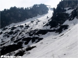
Access to the main slope
I had been keen to ski the Grands Moulins this season. Either by the long south-west couloir or this face. It looks much steeper than it actually is. I had headed this way on teh 19th of April but had decided to climb the Rognier another objective. Taking in the two with a limited overnight refreeze was too ambitious. Eleven days later the weather was good enough to make a second trip. I was surprised how much the snow line had moved. It was possible to ski to 1320 meters before, now continuous snow started at 1550 m. I decided to climb by the lac Vert route, in lightweight running shoes then ski boots for the traverse. Finally couloir 4 to the summit. This had spring snow on the left bank that had caught the early morning sun but hard icy snow on the other side. With a slight haze over the sun it didn't look like much more transformation was going to happen. At the summit I watched a pair of climbers scale the central couloir (3). They told me that the snow was close to being skiable. We had a chat, I looked around at the other routes down for future reference while the surface of the snow melted.
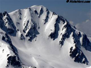
Les Grands Moulins North East Face
There still seemed to be snow in the south-west, north-west and east couloirs but some people who had skied the east couloir a few days before said it was very thin in places. On the west slopes there was a layer of black ice. I was very circumspect as to how far I ventured. A wise move as there would be a series of accidents in the Belledonne that day as people lost their footing. This would include two deaths.
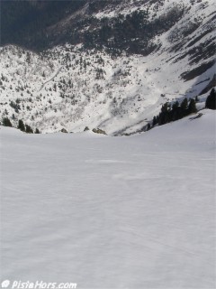
The climbers headed back down couloir 4. I clipped into my skis and made sure that there was no ice which is a cause of pre-release on Dynafit TLT Speed bindings. I skied down a break in the cornice and was struck by the steepness of the slope. The guidebooks had talk of 45 degrees but a quick check with my clinometer showed the initial turns would be on 50 degrees. Keeping to the left bank gave the best conditions, straying too far to the right, where the sun's rays only struck the slope obliquely, showed just how frozen the snow was at 10h40. Another half hour at the summit would not have done any harm. At the bottom of the couloir I tracked completely over to the left across couloir 4 to ski some excellent, if steep, spring snow.
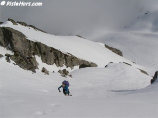
Diretissima
The worst conditions were at the flat plateau at the base of the mountain which was still deep frozen with some corrugations. I checked with the climbers who had reached this point about the route down then wished them a good day. The next slope was almost perfect and gave some very good skiing on not too steep slopes. At the bottom a little traverse to the left took me into the valley and a gentle ski back to the forest. Normally the skiable snow stopped on the path that traversed across at 1630 meters but there was a little couloir of snow that lead into the valley. Eagerly I grabbed this last chance to ski and made it into the forest at 1550 meters.
- 30th April 2006

GPS: N 45.4067° E 06.1987°, 2495 meters
Orientation: NNE
Toponeige Rating: Danger: 2, Climb: PD, Ski: 4.1/4.2
first 25m: 50°, first 75m: 46° - measured with a clinometre on the 30/4/2006
40° over 175m (IGN map), 34° over 650m (IGN map)
Climbing: 1275 meters (from summer parking)
<< les Trois Dames | Pays d'Allevard | Col de la Perrière - gargoton? >>