Ski-Areas > Northern Alps > Isère (38) > Chartreuse > Col du Coq > Dent De Crolles
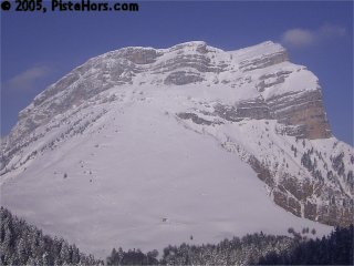
The Dent de Crolles is the emblematic summit for, well Crolles. Situated above the defunct ski station of the Col du Coq it is one of the precious 2000 meter summits of the Chartreuse mountains. It would seem that these kind of altitudes would somewhat limit the skiing but in fact the mountains see a lot of snow as they are first in line for any cold Atlantic weather systems tracking across France from the North-West.

The route
Dent is French for tooth, and the Dent de Crolles is a veritable molar of a mountain. To reach summit the skier only has to climb some 660 meters and being clearly visible from the A41 motorway and Grenoble it should be more visited than Chamchaude?. However it is Chamchaude that is the hot peak for Grenobles after work ski touring community being an easy 20 minutes by road from the town center. The Dent de Crolles has better defences in the form of the Pas de lOeille, a small 40 degree passage that guards the summit from the large, south-west face. Chose the wrong moment, hard snow or ice, and a slip above the high ramparts could well prove fatal. It all depends on the snow.
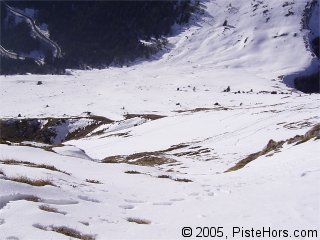
As you drive to the col du coq you will take a left hand hairpin at 1220 meters which has a barred forest track dead ahead. Park here and follow the path that climbs to the north through the forest following the ridge line of the Dent de Crolles. You can check out the ravine from this vantage point. You climb out of the woods on the south-west face of the Dent de Crolles. At 1780 meters there are the traces of a path that loops around under the summit walls. This is the entrance to the Gorgette. You can carry on to the summit from here. Otherwise plunge into a steep and narrow ravine which joins the forest trail at the entrance to the forest at 1350 metes. This is a small rockband at the base of the ravine.
The route is rated 5.1 with an exposure of 2. 45° over 200m.
| Mountain Range | Chartreuse |
|---|---|
| Summit | Dent de Crolles |
| Altitude | 2062 meters |
| Orientation | South-West |
| Starting Altitude | 1400 meters |
| Vertical | 660 meters |
| Maps | IGN TOP 25 3334 OT Chartreuse Sud |
| GPS Waypoint | N 45.3080°, E 05.8554° |
| GPS Route | Google-Earth:col-du-coq |
| Grade[1] | Danger: 4, Climb: D-, Ski: 4.1 |
| Comments | 40° in the Pas de l'Oeille - danger of death if you slip |
| Snowboarders | Yes |
| Equipment | Crampons, Ice-axe, ski crampons |
| Road Access | Col du Coq |
| Refuges | Refuge du Pravouta? |
| Author | davidof |
A Dent de Crolles linked with a Dome de Pravouta... without touching a single stone. Rare for the 30th of May, you would almost think we were in winter again. The col du Coq was closed due to snow but was passable with a 4x4. The strong north-west wind and dense snow formed a skiable layer even if there was no base.
A little evening trip to take advantage of the setting sun and cold fresh snow. The conditions were quite good, powder on the plateau (n/w facing) with heavy powder in the pas de l'Oeille then transformed snow on the large south face. Very little snow under 1400 meters.
David, from Crolles Council, decended towards Perquellin via the plateau, I'm not sure exactly which route he took.
I left the car-park under sunny clear skies but clouds bubbled up pretty quickly. Finally I stopped at the Pas de l'Oeille, frozen ski and raquette tracks and holes left by walkers didn't tempt me in the poor conditions. The south face was pretty good, a fine covering of fresh snow on a hard base (-6C).
The conditions couldnt have been much better. A long period of clear, sunny weather had stabilized the snow and made it easy to ski. Like a painting by Picasso the summit is full of false perspectives. From the valley the large face looks to be angled at around 45 degrees and the Pas de lOeille, somewhat steeper but once on the mountain things are flatter even if the summit is reached only after a stiff 1h30 climb. Ski crampons are essential, even on sunny days and crampons, ice axe and perhaps a length of rope might be useful for the Pas in less than ideal conditions.

On reaching the Pas it became obvious that climbing on skis and skins was a case of diminishing returns, lack of snow obliging us to continue on foot for around 150 vertical meters, covered in 20 minutes after a U turn to collect a lost ski crampon. If you are using Diamir bindings better to stow your crampons safely in the rucksack when carrying skis.

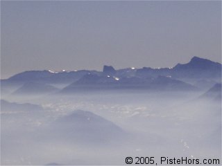
The summit is marked by a large iron cross. Recently these crosses have been disappearing from the mountains surrounding Grenoble as a group opposed to religious signs has been cutting them down. The valley was surrounded by haze but two symbols of French alpinism, to the north-west the Mont Blanc and to the south-west the Mont Aiguille, were clearly visible. The history books recall that in 1492 the king sent a party of men to scale the Mont Aiguille. Using the same tactics for besieging citadels the party reached the summit by way of iron ladders. An achievement the great climber Lionel Terray would recognize when he coined the expression the Conquerors of the Useless.

The descent is rated 4.1 by local expert Volodia Shahshahani with the maximum exposure of 4. Certain death according to the guide book if you fall. Something to think about. No shame is slide slipping some of the narrower and steeper sections although today the snow was soft and easy to ski. The main worry was of a snow slide perhaps close to rock outcrops where the sun rays are conducted deep into the snow pack. A few small jumps, and I mean small, less than a meter, not the stuff to set Seth Morrisons heart a flutter and we are back on the relative safety of the face. Here we can relax and carve turns on the spring snow until all too quickly reaching the car-park.
Category: Trip Reports
<< | Col du Coq | Dome de Pravouta >>