Fri, 4 May 2001
Vertical Climbed: 1,400 meters (4,593 feet)
Vertical Descended: 0 meters
Rating: 2.3
Avalanche Risk: -
Snowline: 1,780
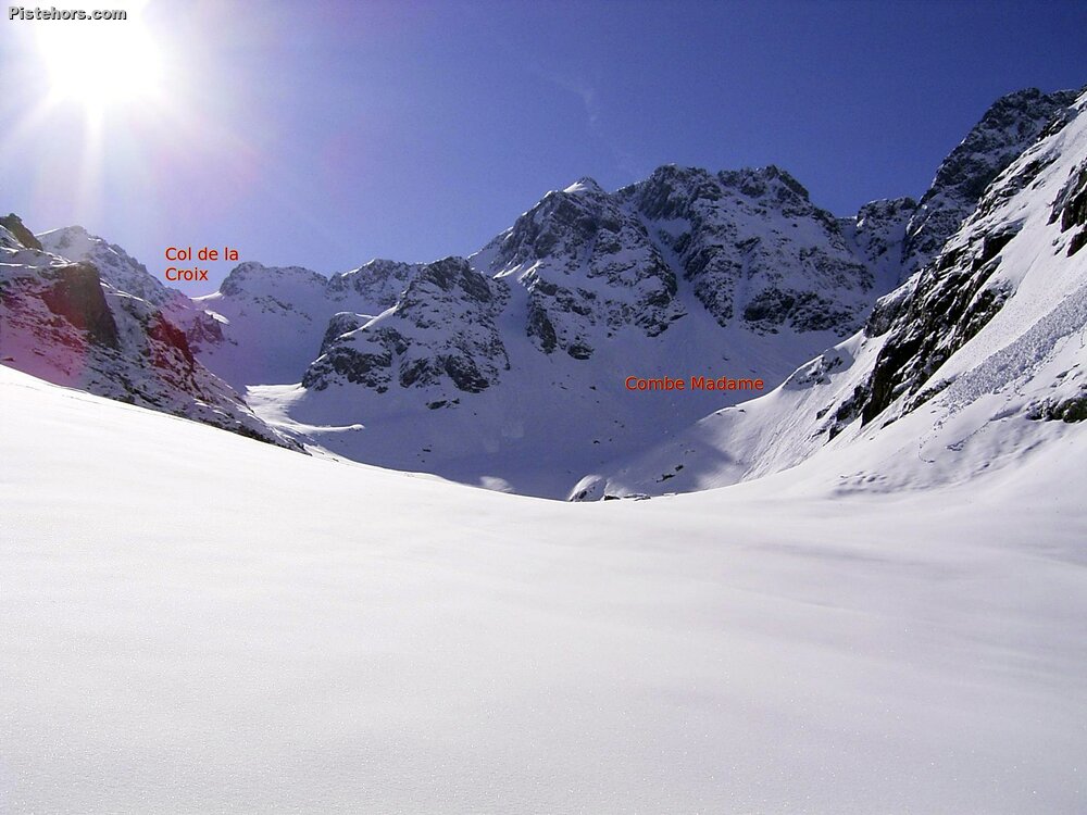
Route
From La Martinette follow the summer trail. At the exit of the forest, continue in the bottom of the Combe Madame. Continue in the Combe Madame, at 2150, directly above the Col de la Croix, go up the slopes and remains of the glaciers of the Combe Madame and the Rocher Blanc to the southeast. And finally, the top!
Accomodation
Nemoz gite or in the refuge de la Combe Madame (unguarded in the winter but open). Thing about bringing some paper and firewood from the forest.
You are not allowed to park in the village of La Martinette or in "Le Nemoz" car park. There is a "hiker" parking lot on the main road at 1050m
Trip Report
Finally I went just below the Col de la Croix but the visibility was too bad to continue (without GPS). A bit dangerous given the conditions and a waste of time really.
The refuge is open and there are 5 mattresses and even a bit of dry wood. Super refuge to spend the night at 1784 meters. Can put on skis from here.
Low cloud from 2000 meters, zero visibility, spring snow.