Météo-France has issued an Orange avalanche alert across much of the Northern Alps with Very High (5/5) danger in several massifs on the European avalanche scale for Thursday 12th February 2026. Parts of the Southern Alps are also under a High (4/5) forecasts. Authorities warn that road closures and disruptions to mountain infrastructure are possible, especially at higher elevations. The snow line will fluctuate from 1200 to 2100 meters around the region. Heavy rain will overload the snow-pack below these altitudes leading to purges.
The avalanche danger is rated 5/5 (Very High) in the Mont Blanc, Aravis, Chablais, Haute Tarentaise and Oisans massifs. Generally High (4/5) elsewhere Forecasters describe a “generally remarkable” avalanche situation, potentially exceptional near Mont Blanc and in Haute-Tarentaise.
30 to 50 cm of snow has already fallen in the past 24 hours above 1,800 m in the inner massifs, and above 2,000 m in the most western ranges.
Over the next two days, fresh snow totals could exceed:
Storm-force winds are also expected to create additional wind-loaded accumulations (deep slabs, drifts, and large cornices).
On Thursday, forecasters expect numerous large to very large natural avalanches at altitude as snowfall intensifies, with a possible peak early in the morning during the heaviest precipitation.
These avalanches may reach:
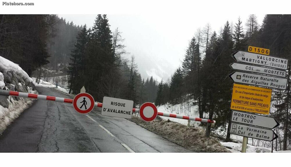
Forecasters also warn that an exceptionally large avalanche could, in rare cases, run much lower into valleys, potentially down to 1,200–1,400 m.
In the Mont Blanc, Chablais and Aravis mountain ranges, the avalanche bulletin highlights an exceptional situation driven by fresh snow, storm winds and a persistent weak layer within the snowpack.
Overall snow cover is described as seasonally adequate, with skiing possible from around 1,300–1,400 m. However, forecasters report numerous drifts and large cornices.
Thursday morning estimates:
Forecast models indicate an additional 30–50 cm of snowfall during Thursday above 1,800 m.
Forecasters are expecting an EXCEPTIONAL SITUATION in the Haute-Tarentaise, with very large avalanches potentially reaching villages, ski resorts and roads. The avalanche danger level is rated Very High (5/5), with an orange avalanche vigilance currently in effect or forecast for the massif.
Exceptionally large avalanches are expected. Releases are possible overnight from Wednesday to Thursday and throughout the entire day on Thursday.
Particularly exposed sectors include:
These avalanches could:
The accidental avalanche risk is described as MAXIMUM on all aspects.
Numerous thick and highly reactive slabs are present. Avalanches may be triggered locally or even remotely, with instability widespread across all slope orientations.
Snow cover has been slightly below seasonal averages, but ongoing snowfall since Tuesday is expected to significantly improve coverage above 1,500 m. Below that elevation, forecast rain is likely to further weaken the snowpack.
Skiable elevations:
At lower elevations, snow is waterlogged. In mid-mountain areas, snow remains humid up to around 1,800 m. Above this level, very heavy fresh snowfall is expected, with totals reaching 1 metre or more by the end of the episode.
Further south in the Oisans, forecasters warn of heavy snowfall through Thursday, with the potential for very large avalanches, sometimes reaching valley floors.
Above 2,000 metres, the avalanche danger is rated High (4/5) and is expected to rise to Very High (5/5). At lower elevations, the danger remains High (4/5).
From Wednesday evening onward, large avalanches are expected at altitude, particularly on slopes exposed to strong south-westerly winds. The snowpack contains buried weak layers above approximately 2,000–2,200 m, increasing the risk of wide and thick spontaneous slab releases.
By Thursday daytime, fresh snow depths are forecast to reach:
Numerous large to very large avalanches are expected to sweep through couloirs and steep slopes. Some may descend into valley floors or mid-mountain areas, potentially affecting roads such as those near Rochetaillée, Ornon, Saint-Christophe and La Grave.
In the Haute Romanche valley, several avalanches were already reported on Wednesday down to around 1,800 m.
At high altitude, the presence of a persistent weak layer could allow for occasional very large, atypical avalanche paths, with fracture depths potentially exceeding 2 metres.
High alpine terrain is described as effectively off limits due to extremely unstable conditions. Fractures may occur easily under the weight of a single skier.
The accidental avalanche risk is considered widespread, especially above 2,000 m, but remains significant even away from ridgelines due to intense snowfall and strong winds.
In mid-mountain terrain, authorities advise avoiding the base of couloirs and steep forest clearings, where wet snow slides are possible during brief mild spells below 1,800 m.
Conditions are described as highly unstable, windy and snowy from mid-mountain upward. The snowpack is evolving unfavourably, particularly at high altitude and in couloir terrain.
Recent days saw slight humidification and settlement only below 1,800 m (around 2,200 m near the Taillefer). Above these elevations, multiple poorly bonded buried layers remain present on cold aspects, contributing to the instability.
Given the combination of very heavy snowfall, storm winds and unstable snowpack layers, backcountry travel is strongly discouraged. Residents and visitors are urged to limit high-altitude travel, anticipate road closures, and follow official updates closely.