Fri, 11 February 2011
Vertical Climbed: 1,550 meters (5,086 feet)
Vertical Descended: 1,610 meters
Rating: 3.3
Avalanche Risk: 1
Snowline: 1,000
Route
Start at le Replat (1000 m) taking the Autoroute de la maurienne, Col du Glandon exit, retrace your steps a little on the D74, before St Rémi, at Girard, take the road towards the plateau and stop at the snowline (usually around 1050 in the Spring). In winter, it's best to start from Servion which is ploughed to 1000m for a phone mast.
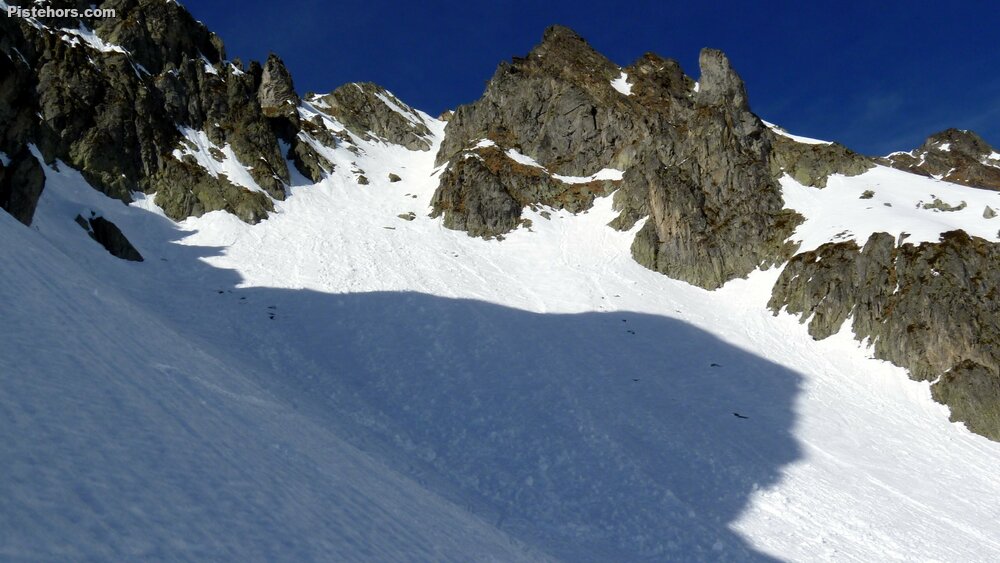
From the terminus, continue until you reach the forest road coming from Servion (another possible departure point) and continue along the slope until you reach a bridge before the Chalet de la Lescherette. Go up the valley on a path that follows the right bank, la Lescherette is on the right. Enter the Vallon de la Pierre on its right bank at around 1550m. Continue until you reach the Col de la Pierre slope (1700m). From here, turn north to climb the south slopes of Grand Miceau. At around 2300 m, a plateau leads to the foot of the South couloir, which is obvious from here (35° for 100 m, then 40° for 200 m). From the top of the couloir (2630 m), you can easily reach the summit via a snow slope and then the summit ridge.
Equipment: crampons if the couloir is frozen.
Trip Report
On Friday I decided to return to the legendary Lescherette valley. The north facing approach track is reputed for holding snow and seemed like an ideal spot for these late season, mid-winter, conditions! I made the mistake of taking the Servion road which was blocked at 1098 meters by a 100 meter patch of sheet ice. It left me a long traverse of 2km and 150m of extra climbing. Avoid the track that passes by the revers de Chamorand, about 100meters has been washed away leaving an ice covered couloir to cross, Zoiks!
Indeed sheet ice is the big message from this trip. It is everywhere and very dangerous.
The climb was relatively easy up to 2300m where I had a half hour rest in the sunshine before tackling the final slope.
The last meters need to be climbed on foot. I didn’t bother with crampons but had them in the sack just in case. The top of the couloir is a thin ridge, not much room for a party. The the descent is not too steep. I skied down at 2pm, later than some groups but it was colder than earlier in the week and thin clouds were obscuring the sun. The snow was fine but there is a line of rocks down the fall-line of the couloir to watch out for terminating in a large outcrop. For this reason I have put the exposure as 2 (likely injury if you fall). Near the bottom of the couloir were lots of “fish mouths”, holes that open up at rock outcrops near the surface melt through the snow. Some were very big, over a meter deep and would be nasty to fall in. I wonder what the 20cm of fresh predicted for Tuesday will do? Just bridge them enough to form a nasty trap?
Lots of ice lower down. There was a lot of old avalanche debris from 1900->1700m which I crossed high then from 1550m was the “border cross” down the ridge which was very skiable. I took off my skis at 1100m, pretty good this year.