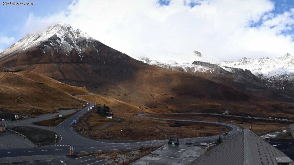
With fresh snow expected this week Meteo France's avalanche forecasters went out to the col du Galibier to check out the snowpack. The Galibier road is closed to traffic so access was on bikes, a number of other locals had opted for the same means of reaching skiable snow. This sector is popular at the start and end of the ski season due to its high altitude road pass but it has also been the scene of a number of fatal avalanches over the last years, frequently due to persistent weak layers.
After some good snow at the end of October conditions have been anticyclonic, ideal for forming weak layers in the snowpack. This fine weather has been frequently accompanied by foehn type winds keeping air temperatures relatively mild for November. Some temperature records have been broken. There has also been a sand layer deposited.
The nivologes were able to tour from 2400 meters altitude. They found mixed conditions: crust, wind hardened snow, old powder and even spring snow. All on the same route. There was no avalanche activity but a reptation or whale mouth was observed on the Maurienne side of the ridgeline. On the lee slopes they encountered old powder (facets) with snow transport due to the wind onto north faces.
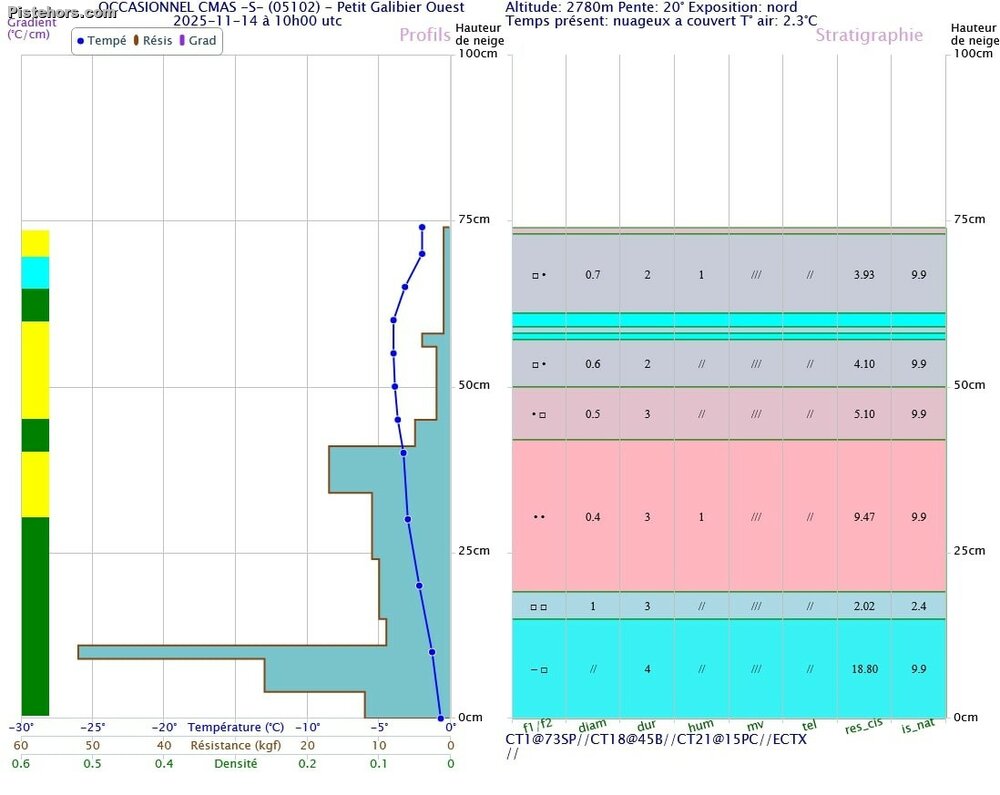
A snow pit on the north side of the ridge was taken at 2,780 m on a 20° slope. It was overcast and very mild (air temperature +2.3 °C), total snow depth was 74 cm. On the surface, there is a thin layer of wind-blown snow (1 cm) resting on 10-15 cm of mostly facetted snow mixed with some fine grains. This layer of snow corresponds to the last snowfall on 2 November, which gradually lost its cohesion due to the strong temperature gradient to which it was subjected in recent days (shaded slope, clear nights favouring very low snow temperatures due to radiation). Next, there are a few thin crusts, followed by a snowpack that gradually becomes more solid with greater cohesion (fewer and fewer facets and more and more fine grain). At the bottom of the snowpack, there are angular grains (facets) that have now gained cohesion or crusts.
A Stability test with break height relative to the ground at 74 cm gave the following results: CT1@73cm SP: the small wind-blown surface layer reacts easily to the layer of flat faces present near the surface, but this small wind-blown layer is very thin at the measurement site. CT18@45cm B and CT21@15cm PC: a few positive tests were observed at greater depth, but after a high number of taps (18 and 21), and with unclear breaks. ECTX: negative test, no breakage or propagation observed at ECT (3 tests performed).
There are particular problems currently on this snowpack, except for small superficial slabs that formed at high altitude on Friday with the strong southerly wind. However with the new snowfall, the situation will change, particularly on shaded slopes at high altitude where the new snow will settle on old snow with little cohesion, creating slab structures.
A trip into the Crachet Valley near the col de Vars today (17th Nov 2025) noted that recent snowfall has settled on facetted grains, acting as a persistent weak layer. This weak layer is probably widespread on all slopes with little sun exposure at altitudes above approximately 2600 m, and may be easier to trigger in less windy areas. It will probably remain throughout the season. Below this altitude the thaw at the start of the weekend probably neutralised these layers. As we move into winter skiers will probably encounter stable conditions with a rapid transition onto this weak layer. Avalanches will not be easy to trigger on this layer but will have high consequences. You have been warned.
https://skitour.fr/sorties/180929
https://skitour.fr/sorties/180934