Sun, 25 October 2020
Vertical Climbed: 2,263 meters (7,425 feet)
Vertical Descended: 2,263 meters
Rating: 5
The Cormet d'Arêches are how Grand Tour cols used to be: nasty, long and brutish and the cherry on the cake, the top 6 to 7km are unsurfaced. To add to the GT myth if you look at the Strava top 10 you’ll see the Jumbo Visma team including Tom du Moulin, Robert Gesink, Steven Kurijswijk and Wout van Aert use the col as part of a 6000 vertical meter training odyssey in July 2020, all that on skinny tired carbon bikes.
I’d been hemming and hawing about the climb for a few years. Which side, how to tackle it etc? Most people so a loop via the Cormet de Roselend starting at Beaufort and when I’m fit I’d have opted for this too. But late in the year, wind, cold at the top, maybe even the risk of some snow on the ground. Way over 3000 meters of vertical, that was too much.
Regarding which way to ride. The north side has around 4km of unsurfaced road, around 2km on the south side. So it seemed logical to tackled it north to south on a road bike. After thinking a long while I had a brainwave. Start at Albertville, much less driving to the start and return via Moutiers so around 45km of climbing and 55km of downhill.
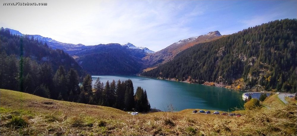
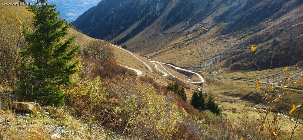
So I set off from Albertville quite early. Around 9h30 winter time. It was chilly but I was in shorts, hoping to warm up on the climb. There was a lot of Sunday traffic on the road to Beaufort and beyond. After Beaufort the road to the Cormet de Roselend was blocked for road works so the traffic continued on the detour and my climb. There was even a traffic jam in Arêches and on the steep hairpins afterwards. Eventually I took the turn to the St Guerin dam and left some of the traffic behind. This part of the climb begins with a shonky metal bridge with gaps in the same direction as your wheels, take care. The road is steep with some ramps and narrow. You reach the dam at 1650 meters and the road continues, with a reasonable surface to a cross roads at 1820 meters and the start of the track.
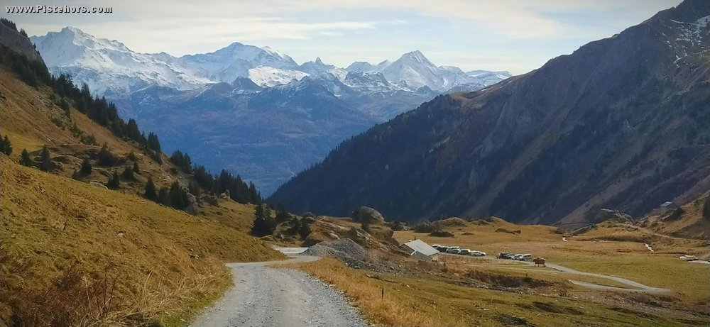
The track is rough and rocky but you can find a reasonably smooth band of dirt on one side or another, there are still cars travelling up and down, quite busy in fact. Some stop at a lake at 1900 meters, others go on to the col. After the lake the road passes under cliffs and was wet and muddy but fortunately there was only another 150 vertical meters to the summit at 2111 meters. Over 1800 meters of climbing from Albertville over 45km.
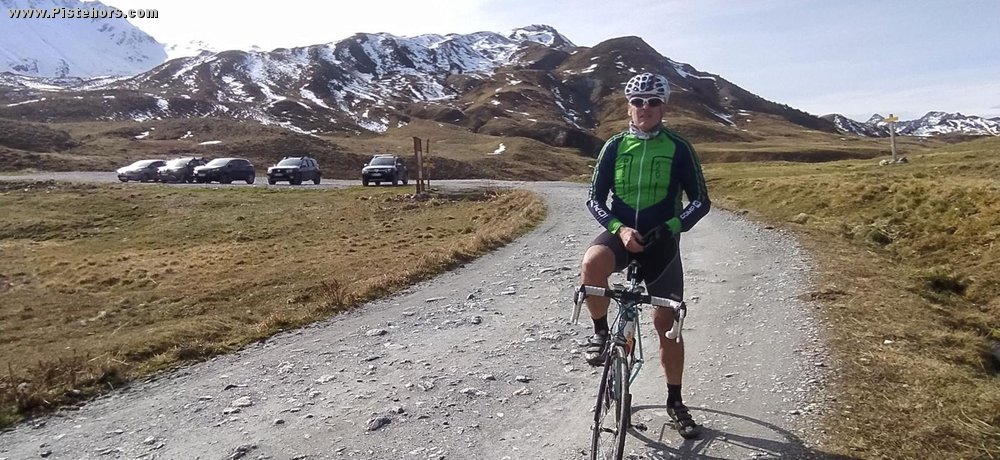
The col was, thankfully, snow free. Something that was not obvious on the climb. The snowline was around 2400 meters thanks to a foehn that had blown during the week. There was a brisk southerly wind at the col. I asked a couple to take a photo of me, they were none too pleased complaining I might be Covid positive. I can tell you after climbing 1800 meters I certainly had no symptoms of being short of breath.
The descent on the track isn’t bad. Just a ford to cross that had quite a flow of water then you pick up rough tarmac at 1950 meters. There are a lot of metal drainage channels across the road, you have to take care but finally, after another short climb there is the long, fast descent to Aime la Plagne.
Interestingly at Centron you no longer take the viaduct, bikes are now forbidden, but a new cycle path along the old road then a short, steep climb, to a special tunnel for bikes rather than the road tunnel. Progress!
At Moutiers I stopped for a Coke at the kebab shop opposite the station then the final 25km tackled in time trial mode back to Albertville.