Sat, 9 August 2025
Minimum altitude: 486 meters
Distance: 63.1 km
Slope Aspect: South-West
Vertical Climbed: 1,883 meters (6,178 feet)
Vertical Descended: 1,854 meters
Rating: 5
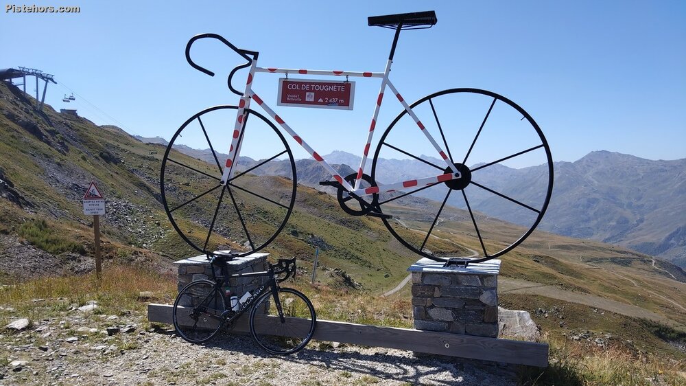
According to several sources, the Tougnète Pass via the D96 is the most difficult climb in France. I suppose it depends on whether you are a climber capable of constant bursts of speed on the ramps. Personally, I find it much easier to grind up the Galibier with a constant 10% gradient.
I started around 8 a.m. There was already a lot of traffic in Moutiers, but I saw hardly any cars on the D96. It was a very pleasant climb through several hamlets. At around 10 km, the road joins the main road to Les Menuires. This was very busy, so I took a 1.5 km detour through the village of Saint-Martin-de-Belleville to avoid the traffic. A cycle race had just started and was also heading towards La Tougnete. This was useful for me, as I had some ‘pilot fish’.
The cycle path leading to the pass was similar to the one on la Loze Very steep ramps, false flats and descents. I'm not sure that simply tarmacking a track without reporofiling it is a good idea. The average gradient of 7% includes several sections at 15% and even a final section at over 20%. The col is about 2400 meters altitude but the cycle track continues to a ski lft at 2437m. I went a bit of the way up but in the end it was too steep for me to cycle.
The track is also quite steep and narrow for descending, and the road after Les Menuires has suffered from winter use. I decided to descend via the D96, as I knew at least that the surface was in good condition.
It's not a pass I'd want to do again, but at least it's done. Until someone invents a new pass to climb.
Very arm. 22°C at the pass. 29°C in Moutiers around 1 p.m. The D96 and cycle path are in very good condition. The main road between Saint-Martin-de-Belleville and Les Menuires is in poor condition.