Fri, 3 March 2023
Minimum altitude: 2,018 meters
Distance: 20.2 km
Slope Aspect: North-West
Vertical Climbed: 736 meters (2,415 feet)
Vertical Descended: 736 meters
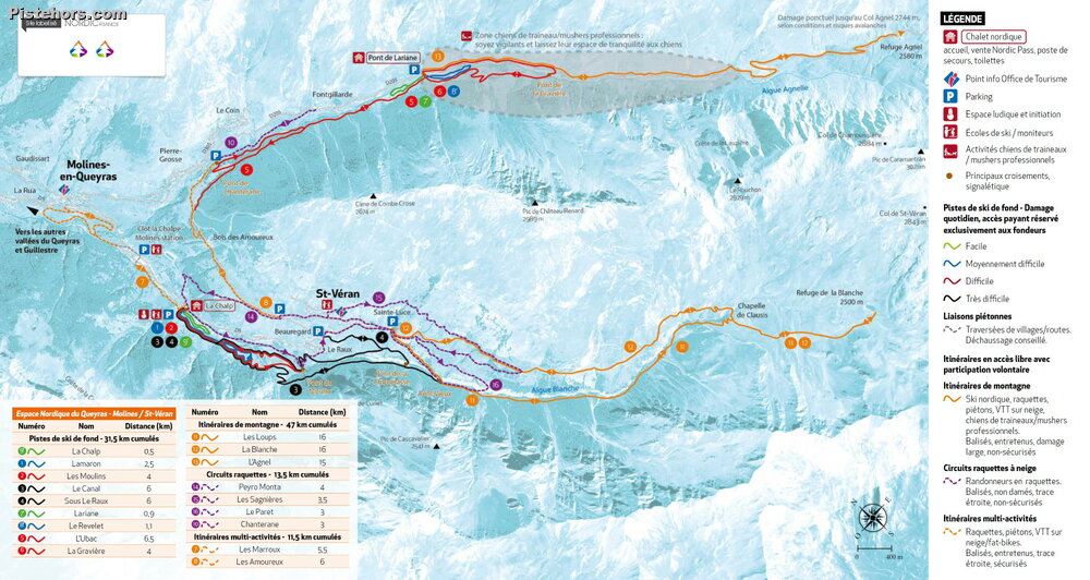
The villages of Molines / Saint-Véran offer 19 kilometres of cross-country ski trails, groomed for skating and classic styles, between 1768m and 2744m altitude. The Nordic ski area with 6 trails has a direct connection with the Alpine ski area of the two villages.
The Nordic ski centre is located at Chalp d'Arvieux. the red runs on the Molines side between the Coin and the Pont de Lariane (Gravière/Ubac, 7km), les Loups itinerary (black, 8km). In addition to these tracks, there are two mythical routes, groomed every year: the Col Agnel and the Refuge de la Blanche.
This is an umissible Nordic ski tour in the Saint-Véran area: it allows you to discover the village of Saint-Véran, via a black run, along a balcony loop between the Chalp and the Chapelle Sainte-Elisabeth (and return via Saint-Véran), over a 2h30 climb, 5h in total (photo breaks included).
The itinerary is a black track, groomed and prepared for skating and classic styles. It is intermediate level with some nice climbs but not impossible over a distance 8km
The start is at le Chalp de Saint-Véran, at the cross-country ski chalet. Cross the bridge, put your skis and go! The black les Loups trail is shared with the red trail Le Canal until the Pont de Choumasse. Between le Chalp and the Pont du Moulin, the track makes some nice turns in the middle of the mountain pastures, enough to warm up. At Pont-du-Moulin, the trail makes several turns to finally join the forest trail a little higher. This part in the forest up to the Pont Vieux is a real treat: you can see the village, the sun is shining through the larches. From the Pont Vieux, a short climb to warm up, then a short descent to the Pont de Choumasse, where the trail continues to follow the summer path (GR58 path in reality) that leads to the Chapelle de Clausis from the left banks of the Aigue Blanche.
Here the level rises, the slopes too with small but very achievable ramps. You just need to have your arms warmed up by a few days of cross-country skiing beforehand. Of course, it's possible to skate as well as classic. At the foot of the Chapelle de Clausis, the trail turns left to go up towards the Chapelle Saint-Elisabeth: still on a balcony, but the view changes!
From the Chapel, you then have to follow the road to the Chapelle de Clausis, which is groomed in winter, which will take you past the start of the Observatory trail, then to the Sainte-Luce car park. There, take the groomers' path so as not to take off your skis, it leads to the Choumasse bridge. Here you have two alternatives: either take the same path as on the outward journey (left bank), or take the upper path which passes on the right bank below the village and reaches the Raux. It all depends on the snow conditions and the sunshine (sometimes we prefer the shade of the larches).
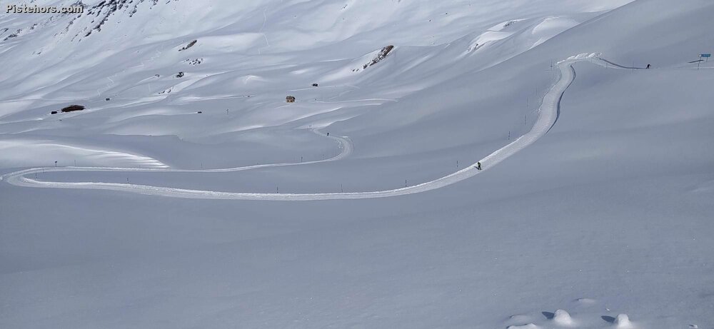
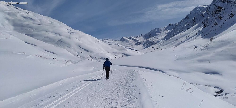
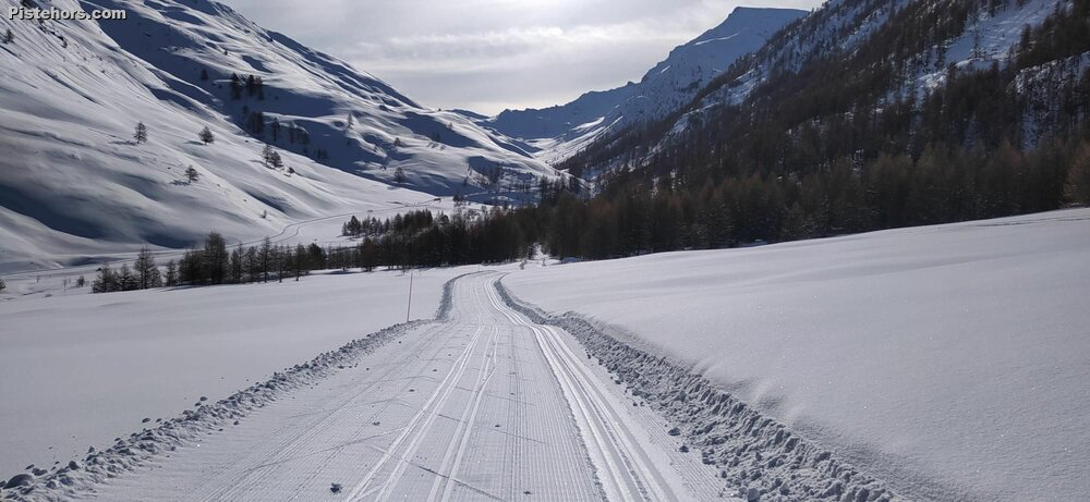
This Nordic ski itinerary takes you to the Col Agnel from the Pont de Lariane giving 720 meters climbing over 19km, you can also climb from le Pont de la Chanterane, 25km/840m round trip and maybe better for warming up. The route is groomed for skating and classic but also used by walkers, snowshoers, ski tourers and dog sleds. Best bet is to hit the trail on the morning after grooming (generally once per week).
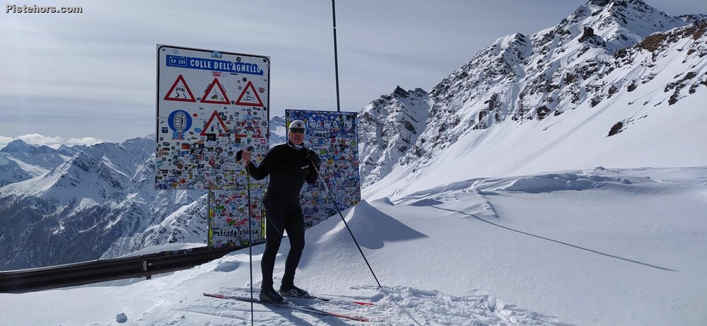
The track follows the Col d'Agnel high mountain road pass which is closed from the Lariane bridge in winter. The climb is not too hard for the first few km, there are even some flatter sections where you can V2 skate but it begins to ramp up before the first hairpins where the slope eases a bit towards the refuge d'Agnel. Here you are in the high mountains where the lack of oxygen will make itself felt. The refuge is open in the winter / spring for refreshments or even an overnight stop. A last effort over a few hairpins on grades close to 10% brings you to the col and the view into Italy and the Queyras
This was the big one, climbing to 2750 meters. A third less oxygen at this altitude. A retour de l'est had dumped 30cm of fresh snow on the Queyras on the Italian border and the resort had delayed pisting the road by a day to take advantage of the return to sunny weather. I decided to start at the Pont de Lariane as I had to head home around midday. 9am and I was off, 9km to climb. The trail started on the left bank and climbed sharply but rejoined the main Col d'Agnel road after 2km. From here there were groups of ski tourers respectfully keeping to the sides. I slowly overhauled one group, then a second, then a third. My progress must have looked slow but I was concentrating on keeping moving in the thin air and grippy snow. A left hair pin, 5km, past the half way point and the slope flattened for a bit before ramping up again. The col was visible and now the refuge. Again the slope varies between steep but skiable and steeper ramps then the final right hand hair pin and things calmed down on the final 500 meters to the col but my head was spinning in the thin air. Not too cold at the col with spectacular views over the surrounding mountains. Ski tourers were having a field day in the fresh powder.
The ski down in the loose snow was excellent. Very reassuring. Careless climbing skiers the only obstacle. A little shout of "hop hop hop" to warn them to leave a bit of room. I took the right bank all the way back to the car park before crossing back over the river to complete 20km of skiing. Incredible experience.
Freshly groomed snow. A bit cold so not very slippy but ok to ski, especially on the way down. A bit cold at the col but it is nearly 2800 meters.