Thu, 16 February 2023
Vertical Climbed: 10,427 meters (34,211 feet)
Vertical Descended: 10,430 meters
The ski resort of Val Cenis - Lanslevillard - Lanslebourg is located at the top end of the Maurienne valley in the Savoie department of the French Northern Alps. The lift served area extends from 1400 metres to 2800 metres although the highest point of the villages is actually the 3612 meter Pointe de Ronce. It is possible to ski 1400 meters of vertical over a wide variety of runs from the top of the resort reached via the Met lift. The generally north to north-west facing slopes keep their snow well but in deep midwinter the pistes can be hard. There is significant snowmaking on the runs even at altitude. It is a good bet when the weather closes in as there is tree lined skiing between 1400 and 2000 meters.
The Vieux Moulins Gondola lift from Lanslevillard gives comfortable access to 2080 meters. In winter the Col du Mont Cenis is closed and the N6 main road is transformed into a ski run of over 8 km.
There are over 70 km of lift served runs but a link to Termignon was opened in 2007/8 and brings the total claimed skiing to 125km. There is some limited cross country skiing at Val Cenis and it is possible to link to Termignon via the Chemin de Petit Bonheur. There is limited cross-country skiing and some marked snowshoes trails. The resort has a snowpark.
The best pistes are the Pont Noir black in Lanslevillard, the tree lined Chamois blue and the Michele Jacot black which frequently has moguls.
There are a number of 3, 2 and 1 star hotels. Rental accommodation has expanded greatly since 2000 and there are now 15,000 rental beds, this has meant considerable urbanisation of the space separating the communities of Lanslebourg and Lanslevillard.
There are all the usual shops you would expect in a small French town, a couple of discos, a range of bars and restaurants and 3 high altitude restaurants.
Val Cenis offers some excellent off-piste. There is tree level skiing and wider open slopes between 2800 and 2150 meters. There are also some excellent ski tours accessible from the village. Note the slopes are avalanche prone and route finding can be difficult. Consult with specialists or hire a guide or qualified ski instructor who knows the resort.
From the top of the Solert drag (2565m) in the Lanslevillard sector the off piste is found between the Solert drag and the Arcelle run. It is a good introduction to off piste skiing. It is north facing so keeps its snow with slopes between 20 to 30 degrees. Watch out for cliff bands to the right looking down the mountain.
This sector offers three tree lined valleys with gentle slopes of around 25 degrees and 600 meters of vertical. They can be reached from the Arcelle itinerary at around 2350 meters by traversing right off the piste and following the contour 100 meters above the chalets de l'Arcelle. The first route is just below the chalets de l'Arcelle to the right of the Arcelle run. It is best when there is a lot of snow, continue down through a skiable forest to rejoin the Arcelle run on a left hand bend. The next valley is found by traversing further across above the chalets, the route crosses the valley that descends from the Signal du Grand Mont Cenis. It is a wide cut through the forest but better later in the winter when there is a lot of snow as there is a lot of brushwood. Just after this cutting you find the third valley just after a stand of trees, the path is clear and swings right to rejoin a track (Chemin de l’Ours) that takes you back to the resort.
From the top of the Plan Cardinal chair follow the piste to the left (north). You can ski down to the chalets de l’Arcelle. Be careful of the avalanche risk from the slopes above.
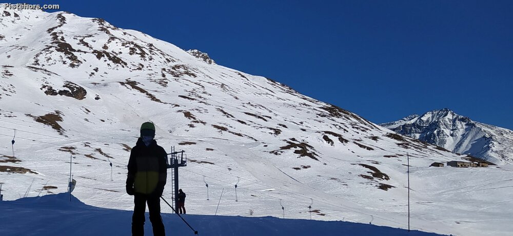
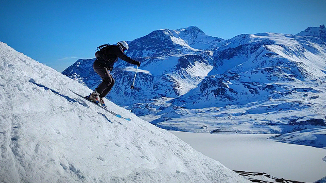
Accessed from the top of the Met chair then the Met red run (right off the lift). The three couloirs are off to the right. The first couloir is around 30 degrees slope. The second couloir zig-zags between rock bands and is around 45 degrees. The final couloir is not as steep, around 35 degrees but there are rock bands. Scope out the couloirs from below beforehand. The second and third couloirs are very difficult due to the slope or exposure. (see photo). The catex cables warn that these couloirs are avalanche prone.
A very steep couloir best attempted in spring snow condition. From the Met run climb around 100 meters to the summit of the Ouillon des Arcellins then ski the north face. Slope of around 40 degrees over 260 meters.
Follow the ridge north-westwards from the summit of the Ouillon des Arcellins to the Arcellins chair. Around a 35 degree slope.
These are four wide tree lined valleys and reputed as the best off piste skiing in Val Cenis. Maximum slope steepness is 30 degrees. From the top of the Arcellins II chair, take the Berche run to the north-east. The valleys can be seen off to the left between the Arcellins and Berche chair. They all end on the Escargot piste and offer 250 meters of vertical.
Found to the left of the Tomba chair and run looking down the mountain. At the top of the Tomba lift traverse to the west. The slope is quite steep at first but offer fantastic open skiing on north facing down to the runs below. It is also possible to ski to the right of the Tomba drag.
From the top of the Mets chair either climb to the Ouillon des Arcellins (2665m - 20 minutes hike) or cross at the Col de la Tomba (2652m - signpost) to ski the south facing slopes down to the Col du Mont Cenis. You should be able to see the buildings at the col and there is a restaurant here for a lunch stop if you tackle the slopes just after they transform in the morning. It is possible to walk or take a husky sled ride from the col on prepared trails towards the lake.
It is possible to climb to the refuge de Vallonbrun on snow shoes or touring skis. Take the Grattais forest trail 5km north east of Lanslevillard.
Hard snow on piste after a long period of cold, dry weather. Chalky powder off piste on north facing slopes, windblown at altitude. Transformed snow on south facing slopes after midday.