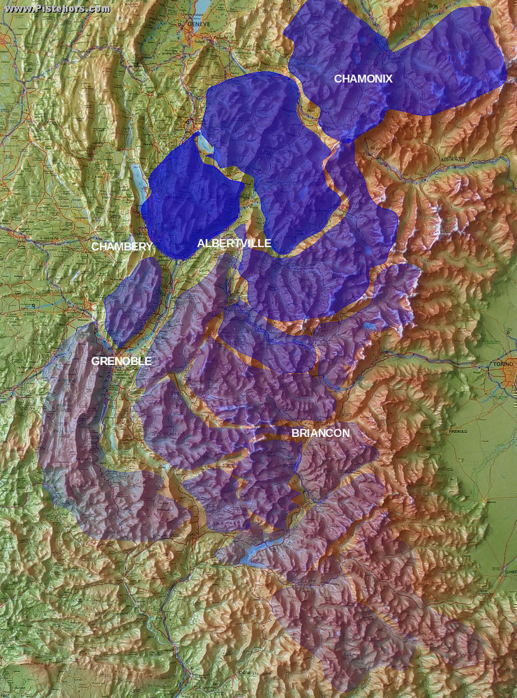
This image shows where the recent snow has fallen in the French Alps. It is taken from Meteo France figures from 1st Jan through to the predictions for Wednesday's dumpage. Darker is more snow, from 115cm in the Bauges through to 10cm in the Mercantour to the south.
We can see the series of Atlantic lows hit the West and North hardest and as the storms pushed inland and south the snowfall abated. This is fairly typical. The inner ranges are often dryer (rain shadow effect) except on the Italian Border where they can benefit from the famous "retour d'est" - a Mediterranean low pressure bringing copious amounts of snow to the Italian alps, but not this year.

New snow for French alpine ranges From Friday through to Wednesday (final figures are forecasts but don't change the overall picture):
Bauges: 115cm
Beaufortain: 110cm of new snow
Aravis 98cm
Mont Blanc: 88cm
Vanoise: 85cm
Chablais: 83cm
Haute-Tarentaise: 80cm
Maurienne: 68cm
Chartreuse: 64cm
Grandes Rousse: 51cm
Thabor: 51cm
Pelvoux: 51cm
Belledonne: 49cm
Haute-Maurienne: 48cm
Oisans 46cm
Champsaur: 44cm
Queyras: 37cm
Embrunnais: 36cm
Vercors 32cm
Devoluy: 31cm
Haut-Var: 25cm
Mercantour: 10cm
For the Haute-Tarentaise (Tignes, Ste Foy, Val d'Isere) Meteo France posts these figures
#dump1: 3cm (Thursday/Friday 1st Jan)
#dump2+3: 45cm (Saturday/Sunday)
#dump4: 17cm (Monday/Tuesday)
#dump5: 15cm (Jan 5/6 - forecast)
total: 80cm to Wednesday night of new snow