
Articles > Google Earth
Google Earth is a 3D mapping system that covers the whole planet and available for free in its basic version from Google.com. The main drawbacks for the basic version are that it does not support direct import and export to GPS (Global Positioning System) devices and the images of the French mountains are not high resolution.
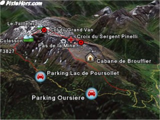
Ski Touring routes visualized with Google Earth
Google uses the Keyhole Markup Language (KML) to describe tracks and waypoints. Google Earth was initially developed by the Californian company Keyhole until it was bought by Google in 2004. KML is a documented format is understood by an Open Source program called GPSBabel. Using GPSBabel it is possible to read and write tracks and waypoints to many common GPS Transceivers and to formats used by other digital mapping systems such as the French IGNRando.
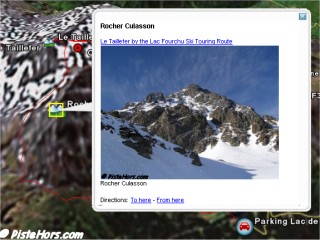
Detail about a waypoint
We have decided to start making skiing, walking and mountain biking routes available in KML format from PisteHors.com and you can contribute your own routes. Where possible we like to record routes directly using a GPS. We currently use the tiny Garmin Geko 201. The main disadvantage of this GPS are the small AAA size batteries.
This section gives some basic information for converting to and from digital mapping and GPS file formats to Google Earths KML format.
GPSBabel can import directly from your GPS. For example this line read all the track data from a garmin GPS unit on the com2 serial port and outputs the tracks as Google KML data into a file called vtt.kml:
$ gpsbabel -t -i garmin -f com2 -o kml,points=0,line_color=ff0000ff -F route.kml
You may have a route in IGNRando format. To generate a KML file run the following command:
$ gpsbabel.exe -i ignrando -f route.rdn -o kml,points=0,line_color=ff0000ff -F route.kml
This will take the IGNRando file found in the Randonnées directory called route.rdn and will output a kml file. The points=0 option tells GPSBabel not to generate waypoints for each point in the track. You can open route.kml directly in Google Earth.
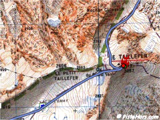
KML file translated to an IGNRando route
There is a graphical version of GPSBabel but it doesnt give access to all of the options described above.
It is possible to extract tracks and waypoints from KML files to upload into your digital mapping program or GPS receiver. For example to extract the second track from a KML file to IGNRando format run this command
$ gpsbabel -i kml -f route.kml -o ignrando,index=2 -F track2.rdn
The resulting file can be copied to the IGNRando directory and opened.
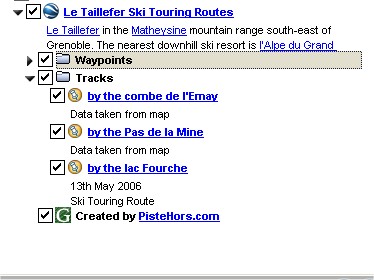
Track view in Google Earth
The next problem is how to organize routes for download. Should this be by individual routes, summits or whole mountain ranges? Each has advantages but finally we have decided that all the routes and waypoints relating to a summit should be stored in a single file. This gives the user an overview of the various possibilities. Where possible routes should provide ski and climb difficulties using the toponeige rating system and whether the data was obtained on the ground or via a digital mapping program. Waypoints should include useful information such as summits, refuge, cols (passes) and starting points and can give detailed information such as the number of beds in a refuge and link to photos and route information on PisteHors.com or elsewhere.
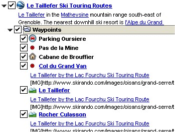
Waypoint view in Google Earth
You can send your tracks and waypoints either in one of the GPS formats understood by GPSBabel or directly in Google Earth KML format. The structure is a top level folder named after the summit. This then contains folders for waypoints and tracks. If you follow the structure created by GPSBabel we should be able to use it. Have a look at this example:
for an idea of how to structure your information:
Note: we publish using the kmz (compressed KML) format for space reasons. You can save as KML using Google Earth.
GPS Visualizer is an online tool that can convert from common GPS file formats to Google Earths KML and it can also set a number of parameters.
http://www.gpsvisualizer.com/map?form=googleearth
GPSBabel can be downloaded from:
Google Earth Download (for Windows or Mac OSX)
http://earth.google.com/download-earth.html
<< Produire les Films en Formate DivX | Articles | Hiking >>