With freezing levels at 2500 meters coupled with rain today it is officially one of the worst starts to winter for 25 years; although Meteo France is more measured calling it a “once in a decade” event. The snow cover in the Northern Alps is virtually non-existent below 1500 meters.
However the situation is different from the disastrous winters of the late 1980s and 1990s. Then the problem was a dry conditions, a snow drought, which saw little precipitation all winter. Today there is ample rainfall just not low enough temperatures to turn it into snow, at least not at resort levels. 2014 has been exceptionally warm in France. Paris has not had a day of frost for over a year; something that has not been seen since records began in 1873. It is the warmest start to December since 1988 in the Alps.
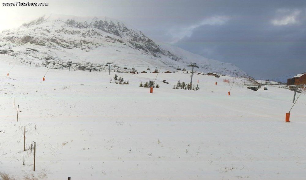
Conditions are variable. The Southern Alps and Pyrenees benefitted from autumn storms. Snow cover is only slightly below average in the Pyrenees with skiable snow from 1800 to 2000 meters. It is even above average in the extreme Southern Alps and on the Italian border with skiable snow from 1800 meters and 130/190cm at 2500 meters.
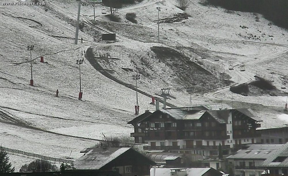
In the Northern Alps, particularly the two Savoies the winter can be compared with those of 2006, 2001, 1994 and 1989. Outside of ski runs slopes are only skiable from 2000/2200 meters with 25/40cm of snow in the Chartreuse/Bauges/Belledonne and 10/20cm in the interior ranges. Obviously there is no skiing in the low-lying Vosges and Jura. In the Massif-Central the Sancy ski resorts should open 50% of their runs this weekend but there is no off-piste skiing.
The warm temperatures have limited the amount of snow making resorts can do. High level Chamrousse and l’Alpe d’Huez, both south facing, have opened resort runs thanks to man made snow and the slopes have improved significantly with the fresh snow on the 17/18th but lower down artificial snow has not made much of a difference. At the same point in 2001 l’Alpe d’Huez could only open resort runs on a thin strip of man-made snow due to dry but cold weather. Val Thorens, at 2300 meters, is running normally.
So will things improve? We are currently in a situation similar to mid-November, which means the season is 4 to 5 weeks late. There is little prospect of significant snowfall over the Christmas holiday week. Winters with poor conditions in the second half of December are typically short with limited skiing outside of runs served by snow canon, at least below 2000 meters. A single snowfall of 50-100cm would be a game changer and that is impossible to predict with any accuracy at more than a day or two out. Meteo France are still sticking with their forecast of a colder and snowier end to December.
If you are heading to France the Pyrenees or some Southern Alps resorts are probably your best bet today. Isola 2000 close to Nice has 100% of its ski area open and Serre Chevalier 70% with all four sectors operating. In the Northern Alps Flaine, le Grand Bornand, Megève and Villard-de-Lans are closed and even Chamonix only has 4 runs open for skiing. Resorts that are open could be busy either due to closed pistes or skiers coming from elsewhere. There have not been many cancellations but last minute bookings are rare. With the drop in the Rouble resorts may face the perfect storm in 2015. Season workers are bracing themselves for lay-offs in the New Year.
http://www.morznet.com/webcams/
http://www.alpedhuez.com/fr/hiver/menu-header/webcams.html
http://www.meteofrance.fr/climat-passe-et-futur/bilans-climatiques/bilan-2014/point-sur-l-enneigement
http://pistehors.com/the-ski-industry-faces-up-to-climate-change-23594231.htm
http://pistehors.com/news/ski/comments/0678-mid-mountain-resorts-hit-hard-by-snow-drought/ - 2006/7