Snow and Avalanche Report: Week 46/2004
This is the first of our Snow and Avalanche reports. We hope to produce these on a weekly basis before each weekend until the late spring. At the moment the best snow for ski tourers can be found in the Central Pyrénées. The summer ski area of Tignes is the only resort that is open but the cable car is out of action for a few days following an incident. Grand Montets in the Mont-Blanc area was scheduled to open on the 11th of November for weekends only.
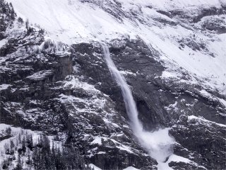
Sluffs caused by rising temperatures
We don’t normally associate the early season with avalanches but previous years have shown that they are a real danger. In 2002 five skiers died at the start of December in two incidents close to la Grave and last year there were two deaths and an injury in three separate incidents at the start of November.
Where there has been considerable fresh snow, for example over the last few days in the Pyrénéees small snow sluffs are a danger with warming temperatures. These can carry skiers over cliffs and into terrain traps. Another danger is the formation of facetted snow crystals with little cohesion. The ground is still quite warm from the summer and this can lead to strong temperature gradients in the snow pack. This forces water vapour through the snow transforming round snow crystals into pyramid shapes known as cups or gobelets in French. These can create a weak layer in the snow pack which can persist through the season.
Northern Alps
In the Haute-Savoie the snow is almost non-existent mid-mountain areas. On north facing slopes snow can be found at 2400 meters and at 2800 meters on south facing slopes. At 3,500 meters snow depths can reach 1.5 meters at 3,500 meters altitude. There has been no recent snow except on Thursday on the Italian side of Mont Blanc. The snow pack is stable below 3000 meters and even higher on southerly slopes where it has been stabilized by a freeze/thaw cycle. At higher altitudes the conditions are cold with the presence of some snow slabs, particularly on north facing slopes where they may not be obvious due to fresh snow.
In the Savoie the snow cover begins around 2500 to 2900 meters depending on slope and range. There is some 25cm on the ground at 2700 meters in the Haute-Maurienne and 40cm in the Vanoise at 3000 meters. The mid October snow that was recorded at the monitoring station on the Bellecôte near la Plagne (3000 meters) pretty much melted but was topped up by 40cm in the last week of October. Recently winds have been light to moderate, around 20km/ with gusts to 40km/h. Ski mountaineers at Val Thorens found the snow very hard and icy with a sun crust at altitude. It was skiable to 2600 meters with some care.
The foehn (south) and lombarde (east) and north winds have moved snow around and formed some slabs. Some of these are on unstable snow layers particularly on Nord-Est and Nord-Ouest slopes above 3000 meters. Fresh snow is expected at the end of next week.
As last year Val Thorens has had to delay its opening scheduled for the start of November due to poor conditions. Les Grands-Montets is scheduled to open this weekend. Val d’Isère is scheduled to open at the end of the month.
Isère
There has been around 40 cm of fresh at the start of November at altitude with a dusting over the last days. Currently the snow pack is only good above 2800 meters. There is around d80cm of snow at the automatic monitoring station on the Glacier de Bonne Pierre at 2940 meters. Skiable snow can be found at around 2400 meters on north facing slopes. The snow has been blown around by a strong wind, up to 80km/h, from the south-west. There is a risk of slab avalanches on lee slopes above 2700 meters. A wind crust of 1 to 2cm is present on the surface of the snow. The wind direction will swing round to the North and will remain strong and may form some new slabs.
Skiers have been heading to the Galibier sector to find snow over the last days. The Galibier pass is currently closed by a barrier at 2000cm.
Southern Alps
The monitoring station at 2550 meters on the Col du Restefond currently shows less than 10cm but the snow levels increase rapidly to around 50 to 80cm at 3000 meters with over a meter in the Champsaur range dating from weather fronts in October. Below 3000 meters the snow is hard with the presence of some recent thin but fragile slabs, higher up the snow is dry and still not stabilized. There may be some larger slabs in northern sectors on lee slopes which have not yet stabilized and a wind from the North-East may form some fresh slabs on the border ridges with Italy. Care should be taken on ridgelines and convex roll-overs as a single person may be sufficient to start an avalanche.
The ski resorts of Serre Chevalier, Risoul and Vars open their lifts on the 4th of December, followed by la Grave, Devoluy and Puy St Vincent and the re-baptized Orcières 1850 a week later.
Further to the south a thundery weather front on Wednesday brought a few cm of snow to the Mercantour but this was blow around by an east wind from Italy (Lombard). The snow cover is poor and has formed into snow pillows (congères). There is around 10 to 20cm of snow above 2600 meters.
Pyrénées
Temperatures in the mountains are finally dropping below freezing and there has been around 50 to 70cm of snow in the Western Pyrenees at 2000 meters altitude over the last few days accompanied by northerly winds of around 50km/h towards the Atlantic. These will have moved quite a bit of the fresh snow onto lee slopes. Care should be taken on ridgelines and cols particularly as the weather improves and warms on Friday and over the weekend. The automatic monitoring station the Lac d’Ardiden shows over 90cm of snow on the ground, above average for the time of year. This is great news for ski tourists who can find a skiable base at 1600 meters.
In the eastern Pyrenees snowdepths are around 30cm at 1800 meters. The monitoring station at Port d’Aula at 2140 meters is already registering around 90cm of snow most of having fallen over the previous days. Further to the east at Canigou (2160m) there is around 20cm of snow on the ground. Winds have been moderate, around 20km/h except on ridgelines. Summits and ridges therefore have little snow but skiers may find depths of well over a meter in sheltered bowls and lee slopes.
This will please the resorts of Andorra (Grand Valira) and Piau Engaly which both hope to partially open their domains at the end of November.
Corsica
Corsica has about 20cm of new snow at 2000 meters. This is not sufficient to ski.
This report is based on information from Météo France, [url=http://www.skirando.ch]http://www.skirando.ch[/url] and local observations.
Posted by
davidof on Friday, 12 November, 2004 at 02:06 PM
There is some discussion of the Tignes cable car incident on the Snowheads forum: http://snowheads.com/ski-forum/viewtopic.php?t=3349
Snow Bounty for the Pyrénées
With excellent snow in the Pyrenees it seems that 3 resorts, maybe more, will open on the 20th of November for the weekend. At Ax-Bonsacre there is close to 1 meter on the pistes. Ax installed a new cable car last year and the motorway link has made access much easier from Toulouse. If you are down that way Telemark Pyrenees in Ax is worth a visit for ski touring gear.
The other resorts scheduled to open are les Angles and Formigueres.
added 15 November:
A snow report from Font Romeu in the Pyrenees:-
We had a snow blizzard last night! Sun shining today so crackly snow and a few skidding cars who still think they can boy-race without chains...My desk says the temp is 11.9 but my feet don’t have the same opinion!
[url=http://www.clos-st-savin.com]http://www.clos-st-savin.com[/url]
Posted by
davidof on Friday, 12 November, 2004 at 09:16 PM
Page 1 of 1 pages
Comments are now closed