After around 30cm of fresh snow at altitude over last weekend the weather is sunny with late spring conditions in the Alps and Pyrenees. The recent snow has stabilized with a good freeze-thaw cycle above 2000-2500 meters. Most slopes are now purged of the recent snow. North-east facing slopes catch the sun early in the day and snow conditions can be quite humid below 2000 meters whereas south sector slopes can still be frozen at this altitude. A breakable crust, difficult to ski, is present at some altitudes, particular west facing slopes in the morning. Lower down the surface of the snow is uneven. With the sun so high in the sky all slopes, except for the most sheltered couloirs, catch a lot of sun for a greater part of the day.
Recent snow has purged from steeper slopes
Most ski resorts have now shut down their lifts although there is still snow down to 1400 meters on some ski pistes and on north facing slopes off-piste. The principal dangers to backcountry skiers at the moment from slipping on icy slopes earlier in the day and from wet snow avalanches. East sector slopes should be treated with care from late morning with the danger moving to south then west slopes during the day. Off-piste travel should be restricted to mornings with care taken on exposed slopes. Poor snow at altitude over the winter snow bridges on glaciers are also not that well bridged. With the zero isotherm rising to 4000 meters over the weekend spring snow conditions will be found at quite high altitudes. Some rare slabs may persist at altitude on well shaded slopes.
The situation in the Pyrenees remains excellent although with the current temperatures there is virtually no freeze/thaw cycle below 2500 meters. Ski tours should be restricted to early in the day to avoid wet snow avalanches some of which could be large. North facing slopes can be skied to 1500/1600 meters.
Update Saturday 30/04/2005
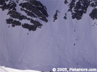
After a 4.55am start we set out for the Pic de la Belle Etoile - a 2750 meter summit in the Belledonne range. There are a number of routes but I had a rendez-vous at midday so we started out from Prabert at 6.20, about 20 minutes drive. The first snow on this west facing valley was at 1500 m but I climbed on foot to 1750 as the track often has bare patches where it catches the sun. The overnight freeze was okay from 2000 but I noticed some crust with rotten snow underneath climbing to the Aigleton at 2250 meters. With the Aigleton behind us at 8am we removed skins and descended around 100 meters on an north-east facing slope into the Allemont valley. The snow has just seen the first rays of sun but was already transforming. A pleasant 600 m climb, using harscheisen (ski crampons) followed although I put lightweight 10 point crampons on for the final climb in the 40 degree couloir. We arrived at the summit a little before 10am, amongst the first. With the snow fast melting this peak is a magnat and by 10.30 there were 30 people chatting away at the top. By now the sun had had 20 minutes to work on the couloir. Spring skiing is a delicate balancing act between having safe conditions at the top and not having a nasty surprise lower down. The final climb back up the Aigleton was soggy and I found my band of crust on the other side, nothing else for it but “dre dans le pentu”.
So if you are out tomorrow, don’t leave it too late. I was back at the car by 11.30am and figured the timing was just about right. Not too icy up top but not too rotten lower down.
Update - Monday 2nd May - Phew! Whata Scorcher
The temperatures got increasingly warm over the weekend, touching 29C in the valley on Sunday with temperatures in positive temperature at 3000 meters since the 30th. This means a poor overnight refreeze, even where the surface snow is frozen (in general above 2500m at the moment) the refreeze is very limited with humide snow below the crust. Cooler conditions are expected from Tuesday.
Update - Wednesday 4th May
The weather system on Tuesday night brought some fresh snow. About 10-15cm in the Haute-Tarantaise and Haute-Maurienne above 2000meters. The zero isotherm dropped to around 2200 meters overnight. Valleys in the Northern Alps are sunny but the summits remain cloud covered which should keep temperatures a bit lower during the day.
References
This information is a summary of current conditions and is provided for information only. It is based on direct observations and information from the following sources.
Météo France currently issues twice weekly updates to its avalanche bulletins.
SkiTour conditions database, Camp2Camp and Bivouak have trip reports with observations of the snow conditions.