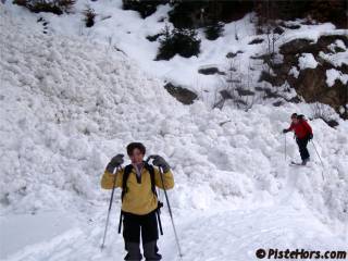
Some pictures of the recent snow from around les Arcs
http://www.mysnowsports.com/Blogs/mode=display/id=183.html
The fresh snow over the last 24 hours, 50 to 70cm over 2300 meters in the Northern Alps, has brought a high to extreme avalanche risk to the mountains. The snow below 2300 meters is very water logged and wet snow slides are also to be expected - especially in known avalanche channels where slides may cross roads.

Higher up new snow slabs will have formed, particuarly on north to east sector slopes under the influence of the southerly, veering westerly winds. This is sitting on older, unconsolidated snow which will form a weak layer and on residual slabs which may be overloaded by the new snow. The colder temperatures over the weekend should help consolidate this snow at lower altitudes but great care is required over the next few days with route choice, even on routes normally considered “safe”.
Update 23h30 - Thursday
The wind from the south-west has noticably strengthened since 20h00 with new snow in the Beaufortin and Haute-Tarentaise areas(this includes resorts such as la Plagne, les Arcs, Tignes and Val d’Isère). The total fresh snow in those areas may reach 1 meter by tomorrow evening in places. Meteo France has raised the avalanche alert to EXTREME (5/5). This means that widespread natural or human triggered avalanches are certain. There are extremely unstable slabs on most aspects and slope angles and large destructive avalanches possible.
Further information:
Snow and Avalanche Conditions - there is a link to the Météo France bulletins at the bottom of this page.
Some pictures of the recent snow from around les Arcs
http://www.mysnowsports.com/Blogs/mode=display/id=183.html