February 2008 Snow Conditions |
|
|
|
davidof |
| Posted: 04 February 2008 11:30 AM |
|
|
|
Administrator
Total Posts: 2234
Joined 2003-10-24
|
February already but finally something to be cheerful about. The weather system that crossed France on Friday night was stronger than expected and brought around 20 to 40 cm of fresh snow to the mountains with snow falling down to 800 meters. However all this was accompanied by some very strong winds. We had some fun up on the Saleve above Geneva on Saturday before heading to the Trou de la Mouche above la Clusaz for Sunday morning.

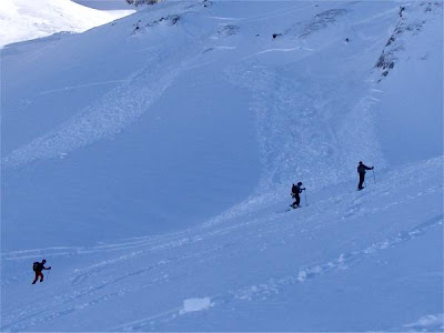
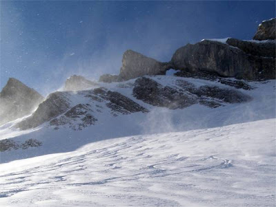
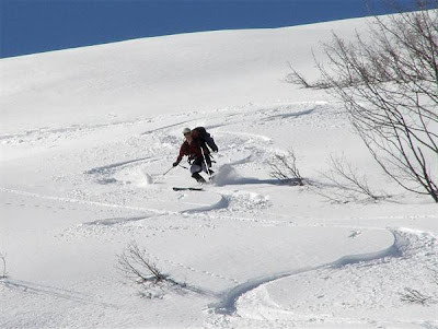
The avalanche risk was 3 above 1600 meters on Sunday but dropped to 2 on Sunday below 3000m. The snowpack has been well consolidated at mid altitudes by the strong January freeze/thaw cycle. The main risk was slabs sliding off the hard, old snow and was saw evidence of this on Sunday morning. These slides were trigged between when we climbed at 10am and when we skied back down at 11h30. Note the late skiers still heading pushing the summit. Not such a big deal in such a cold, shaded bowl. There is quite a lot of facetted snow on north faces which will form a weak layer. The fresh snow could be described as “slabby” - consolidated by the wind transport which you can see in this photo

There has been heavy precipitation overnight but it is warmer so snow has been falling about 800-1000 meters.
|
|
|
|
|
davidof |
| Posted: 07 February 2008 10:59 AM |
[ # 1 ]
|
|
|
Administrator
Total Posts: 2234
Joined 2003-10-24
|
Well Tuesday was finally the best day of this week after about 20cm fresh snow fell over much of the Alps down to around 600 meters. Unfortunately all this was followed by rain to 1500 meters on Wednesday :-( boo hiss boo. The result is that conditions are excellent above 2000 meters but the snow has a breakable rain crust on many versants below this altitude. Conditions are poor below 1400 meters, we seem to still be in “start of season” mode at this altitude.
The rain can help stabilize a snowpack but we probably had enough of a freeze thaw cycle over the 2nd half of January. The snowpack now has a number of layers. On some north-east slopes we traversed today the crust was on top of some pretty rotten snow and we noticed graupel (ball bearings) at around 1800-1900 meters. All of this can form some dangerous layers.
However the next 4 days looks like a return to spring weather with the zero isotherm around 2200 meters during the day. With clear skies and a deep overnight freeze this should bring good ski conditions on south faces in the morning.
|
|
|
|
|
davidof |
| Posted: 07 February 2008 01:17 PM |
[ # 2 ]
|
|
|
Administrator
Total Posts: 2234
Joined 2003-10-24
|
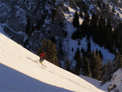
Here’s Bruno on the Roche Parnal this morning

[ Edited: 10 February 2008 10:10 AM by davidof]
|
|
|
|
|
davidof |
| Posted: 10 February 2008 10:19 AM |
[ # 3 ]
|
|
|
Administrator
Total Posts: 2234
Joined 2003-10-24
|
Our brief period of hope last Monday has been dashed by a return to spring weather and some record temperatures across France. People were even swimming off the south-coast as 20C+ temperatures swept in. At altitude, 2200 meters, we even ended the week with less snow than we started. At 1700 meters in the Vercors temperatures have generally been positive since mid-December.
Conditions are still pretty good above 2000 meters and the warm weather has at least stabilized the snowpack with what must be a record low in avalanche fatalities.
Yesterday I was out in the Chartreuse mountains. There is still some powder to be found on north-west slopes but elsewhere the snow is spring like with little refreeze below 1500 meters despite the clear skies.
|
|
|
|
|
KenR |
| Posted: 11 February 2008 03:45 AM |
[ # 4 ]
|
|
|
Sr. Member
Total Posts: 270
Joined 2008-01-31
|
davidof - 10 February 2008 10:19 AM Yesterday I was out in the Chartreuse mountains. There is still some powder to be found on north-west slopes but elsewhere the snow is spring like with little refreeze below 1500 meters despite the clear skies.
Thanks a lot for the updates, David. I gotta start planning for skiing for Tuesday thru Friday. I’m thinking the forecasts are showing a better re-freeze on Monday night, especially with clear skies. So I’m kind of thinking of focusing on SE thru SW slopes for decent (though perhaps not outstanding) ski-descent quality.
I’m having trouble understanding the MeteoFrance public 36-hour forecasts for the ski stations (e.g. Meribel) and also not seeing how to reconcile them with the skiinfo.fr forecasts (e.g. Meribel on skiinfo.fr).
Main problem is that it’s not clear to me what altitude the MeteoFrance reports are intended for. Like for Meribel, MeteoFrance gives the reference station altitude as 2040m, also low and high altitudes of 1400m and 2952m. I had been sort of assuming the “reference” altitude is intended, but the report I’m looking at 3:30 on Monday morning gives forecasted temperature for 7:00 of -6 degrees, but the 0-degree isotherm forecast is 1900m, which says to me that the intended altitude for the forecast is much higher than the reference station. What’s the trick for knowing the correct intended altitude?
Then comparing the forecasts . . . skiinfo.fr at 3:30 for 3000m altitude says -4.2C for 6:00 Monday and -7.7C for 6:00 Tuesday (getting colder). Meteo France at 3:30 says -6C for 7:00 Monday and -5C for 7:00 Tuesday (not getting colder). The isotherm forecasts are even more divergent. Any hints on which one to believe more in what circumstances? or is there some third website?
Thanks for any hints,
Ken
|
|
|
|
|
davidof |
| Posted: 11 February 2008 10:03 AM |
[ # 5 ]
|
|
|
Administrator
Total Posts: 2234
Joined 2003-10-24
|
I think the problem with Meteo France is that they have a few reference stations and they extrapolate data for other altitudes. I’m not sure what time the zero isotherm is given for - I assume around 2pm although the warmest part of the day, all things being equal, is shortly before sunset (of course many slopes go in and out of shadow during the day when the sun is so low in the sky).
You then get the inversion effect, where cold, heavy air sinks into the valley at night. This is what causes those bitingly cold draining winds in valleys that you get around dawn. The sun warms the air at higher altitudes first so you can go from cold to warm to cold again as you climb up the mountain. In the more extreme cases we end up with a cloud sea and it says cold in the valley all day.
The best information for the next day’s weather is from the departmental avalanche bulletins but Caplain - an amateur weather forecaster (well kind of, he works with the INPG)
http://geo.hmg.inpg.fr/mto/mto38.shtml
makes some pretty good long term forecasts although more for the Isere department.
Here are some other forecasts:
http://www.meteo-chamonix.org/
Meteo Chamonix normally has good local predictions but the Mont Blanc weather systems have a mind of their own.
|
|
|
|
|
KenR |
| Posted: 11 February 2008 02:18 PM |
[ # 6 ]
|
|
|
Sr. Member
Total Posts: 270
Joined 2008-01-31
|
davidof - 11 February 2008 10:03 AM You then get the inversion effect, where cold, heavy air sinks into the valley at night. This is what causes those bitingly cold draining winds in valleys that you get around dawn. The sun warms the air at higher altitudes first so you can go from cold to warm to cold again as you climb up the mountain. In the more extreme cases we end up with a cloud sea and it says cold in the valley all day.
Now I’m seeing why just predicting temperatures can get more tricky than I would have guessed for the mountains.
davidof - 11 February 2008 10:03 AM The best information for the next day’s weather is from the departmental avalanche bulletins ...
As soon as you say that, it makes a lot of sense. The avalanche bulletins don’t offer that super-easy tabular format for temperature—I was forgetting that accuracy and clarity about what it means are more important.
davidof - 11 February 2008 10:03 AM … Caplain - an amateur weather forecaster ...
http://geo.hmg.inpg.fr/mto/mto38.shtml
makes some pretty good long term forecasts although more for the Isere department.
Yes that’s very helpful (and easy to read).
I like the “bon regel nocturne” and the “sans vent” for the next few days—good incentive for me to get acclimatized quick and get out there.
Ken
|
|
|
|
|
KenR |
| Posted: 12 February 2008 11:51 PM |
[ # 7 ]
|
|
|
Sr. Member
Total Posts: 270
Joined 2008-01-31
|
South slopes worked for me on the Cornettes de Bise in the north Chablais on Tuesday afternoon. The top is just over 2400m and the bottom of the tour around 1100m. (I climbed up from la Chapelle d’Abondance the short way around the southeast, not around the mountain like Labande guidebook #86). Not great skiing, but I didn’t run into much that was like breakable crust, and lots of the turns in the soft snow were kinda pleasant.
The summit pyramid was kinda hard, I think from the wind, though mostly not icy (except in old tracks). The SW and S-facting slopes in the middle section were kinda mushy, and the slush got a little deep in the lower middle. (It was around 4pm, since I had just arrived in the Geneva airport that morning, so I wasn’t able to get to the snow and start climbing until around 1pm.) Then the lower section was hard, maybe a little icy, I think because it had been out of the sun for awhile, and the skier tracks are more focused together down low.
So I think I’m going to try some more of those southerly slopes in my tours in the next few days. If anyone has some suggestions, or might want to join for a mid-week outing, get in touch. (I’ve corrected the phone number in my contact info below.)
Ken
[contact me in France]
|
|
|
|
|
davidof |
| Posted: 13 February 2008 05:27 PM |
[ # 8 ]
|
|
|
Administrator
Total Posts: 2234
Joined 2003-10-24
|
That’s quite late on the Bise but it sounds like a great day. If you are back up North then one tour I did recently was the Pointe du Midi
http://pistehors.com/backcountry/wiki/Haute-Savoie/Pointe-Du-Midi-South-west-Couloir
You can make a longer tour by skiing down the Cu Deri couloir. However the south-west couloir will have nice spring snow.
One of the best sites out there for finding out the recent French/Italian conditions is MetaSkiRando, it is an agregator of a number of websites. For example to see the recent trips to the Bauges mountains
http://metaskirando.free.fr/?str=&zon=Bauges
and you see this listing.
2008-02-11 Mont Colombier, En boucle depuis Aillon Station Bauges 3.2 pascal conceillon [skitour]
2008-02-10 Pointe des Arlicots, Boucle de la Lanche Bauges 3.1 hom [skitour]
Mont Margeriaz, Par les pistes Bauges 1.2 carlsson38 [skitour]
Beau Mollard, versant Nord Bauges 2.3 Jip [skitour]
2008-02-09 Pointe de Chaurionde, Face Nord-Ouest #NIS Bauges 3.3 noel [skitour]
Plan de la Limace, par Allant Bauges 1.3 jongieulan [skitour]
Petite Chaurionde, Combe NO Bauges 2.3 pols [skitour]
Mont d’Armenaz, Face N en boucle Bauges 4.3 Fabrice [skitour]
...
So you get the date, the route and the difficulty (Toponege rating)
|
|
|
|
|
KenR |
| Posted: 13 February 2008 11:31 PM |
[ # 9 ]
|
|
|
Sr. Member
Total Posts: 270
Joined 2008-01-31
|
Thanks for all that new info for me to digest. Who’d have guessed the ski-touring reports had reached the “meta” level.
Maybe the Pointe du Midi is something I can explore on Friday.
Ken
|
|
|
|
|
KenR |
| Posted: 14 February 2008 12:09 AM |
[ # 10 ]
|
|
|
Sr. Member
Total Posts: 270
Joined 2008-01-31
|
South slopes worked on the Grand Galibier for me on Wednesday afternoon. Not that most of the skiing was great, but at least not much like breakable crust. I made it all the way down from the summit in less than hour, including a short re-climb on skins. Big views, interesting route, perfect weather—with skiing conditions overall decent enought not to get in the way. And one section of snow was outstanding at the right hour.
. . More details on snow conditions below the photos.
. . Tomorrow I might go again for some Southerly (with an early start)
. . if you might be interested get in touch.
I skied the Southeast Couloir route up and back (it’s part of the standard route in the Olizane guidebook for Haute-Alpes). Near as I could tell, I’m the only one who climbed up and skied down the couloir in the last week or so. The snow in the couloir was excellent around one or two o’clock. And likely would be again tomorrow - (and now there’s a boot track in the upper half.)
Looking up the Southeast Couloir:

(I skinned up to the rock, then booted to the top, which only gets part of the way to the summit. Olizane Haute-Alpes guidebook says its steepness is around 35-40 degrees.)
Northwest to the Grand Galibier summits from the top of SE Couloir:

(West summit on left is higher, final section not skiable)
Group of about 8 skiers on the upper mountain:

(my guess is that they started + finished at le Pont de l’Alpe, an easier but much longer route than mine)
Larger and more photos on this page.
Snow conditions details:
I think my tour started around 1950m, went up to about 3200m.
* Upper mountain (above the top of the Couloir) was a mix of straightforward hardpack, crust which was supportable if I skied with initiating gently and with some weight spread partly between both skis, and some which was sorta breakable crust.
* Couloir—The southeast couloir had like 10cm of soft snow at 1-2pm while I was climbing up. But when I skied down it later in the afternoon it had solidified, but not icy, easily skiable. (It would have great to just ski the couloir and go home, but I’d never been to the summit before).
* Traverse from bottom of Couloir to valley of normal Pic Blanc de Galibier tour: Mostly hardpack with some supportive crust. Snow was often rough (from wind erosion?) and chattery, but very skiable for me.
* lower half of Pic Blanc de Galibier. I avoided most of the breakable by staying more up on the crests and less down in the troughs. Some was still a bit soft in late afternoon. I didn’t find much trouble with breakable, more the transitions between harder and softer.
Ken
[contact me in France]
[ Edited: 14 February 2008 12:14 AM by KenR]
|
|
|
|
|
KenR |
| Posted: 14 February 2008 10:29 PM |
[ # 11 ]
|
|
|
Sr. Member
Total Posts: 270
Joined 2008-01-31
|
davidof - 13 February 2008 05:27 PM one tour I did recently was the Pointe du Midi
http://pistehors.com/backcountry/wiki/Haute-Savoie/Pointe-Du-Midi-South-west-Couloir
I just did the Pointe du Midi today, and it was great views, good skiing snow, perfect weather, interesting route up to the col and the summit. Thanks a real lot, David.
Started my descent from the col about 2pm. Everything was a bit mushy, but very skiable. I stayed to the N side of the valley to get the best Southerly exposure. The lowest narrow section is starting to show some rocks on the N side—I would guess that will increase getting into the weekend. Good coverage everywhere else. Except an exposed band just W above the col—so it really makes sense to leave skis at the col and boot to the summit from there.
The narrow couloir on the N side of the col looked kinda skied out. Anyway it violated my goal of enjoying southerly slopes.
No time for to post photos now—I’m trying to prepare for a truly early start for tomorrow.
Ken
|
|
|
|
|
davidof |
| Posted: 15 February 2008 04:43 PM |
[ # 12 ]
|
|
|
Administrator
Total Posts: 2234
Joined 2003-10-24
|
You’ve been covering a huge amount of terrain - both on skis and off, I’m impressed.
|
|
|
|
|
KenR |
| Posted: 15 February 2008 09:15 PM |
[ # 13 ]
|
|
|
Sr. Member
Total Posts: 270
Joined 2008-01-31
|
Dome des Picheres today didn’t exploit the south-facing strategy so well. I started before dawn in Champagny-en-Vanoise, followed the “south-east slope” tour #111 in the Savoie guidebook. It had big views and an interesting route, no wind up high and perfect blue skies—but on this day the skiing didn’t add to the experience. (I’m thinking that the snow was more consistently transformed in my earlier tours at lower altitudes.)
The range of altitudes was 1600m to 3300m. The first problem was that below the Refuge de Plaisance (2150m) lots of skiers off-piste from the La Plagne lifts have tracked up the snow. Skinning up the initial steep-ish slope climbing up from Laisonnnay, the re-frozen downhill tracks made it more difficult and more strenuous. Then when I got to the exposed ramp above the waterfall, the snow was so compacted and glazed that I was having trouble getting my cutters to penetrate the surface. Trying slightly different locations got the blades/points into the snow, but it was a stressful 15 meters. Later on descent it was sun-warmed and mushy—no problem at all.
From the top:
* Variable wind-blown SE from the summit down to about 3100m—some hard, some powdery.
* Traversing S along the E side of summit ridge around 3100m to 3000m I found a sort of “weak” powdery snow. Often it wouldn’t compact firmly under my ski, just sluff away (not so easy for breaking trail on a steeper slope). Then some was firm from wind, some soft, so it wasn’t fun for me. My interpretation is that there’s two causes of the lack of hoped-for transformation: most of these slopes are really E-facing, not SE, and surely not S-facing; and the altitude is too high for transformation of non-full-South slopes.
* 2900m down to 2300m the snow got more consistent, but still some variations that limited my trust.
* below 2150m lots of ski tracks.
Anyway at least I made it back down in a reasonable time.
My partner Sharon arrives GVA on Saturday morn, so for the next few days we’ll be looking for mellower (PD + F) and shorter tours (usually less than 1000 vertical meters). For those who might be interested in that sort of thing—get in touch with me.
Ken
|
|
|
|
|
davidof |
| Posted: 17 February 2008 10:03 PM |
[ # 14 ]
|
|
|
Administrator
Total Posts: 2234
Joined 2003-10-24
|
Well I met up with Ken at the American Consulate in Cluses to tacked the Pointe de Chalune in the Chablais. We opted for the spring snow option with a tour via the south-east and south faces of the Pointe de Chalune. The snow was just about softened from the summit at 11h30 but with the excitement of frozen ruts criss crossing the faces and glide cracks or “moats” as Ken told me they are called.
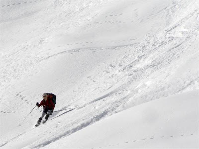
As you can see Ken is a pretty neat skier.

here under the col de la Bolire at 1500m

The powder was soft and heavy. In the shade below 1500m there was a hard but breakable crust. All in all a good day out. I’m sure Ken will be posting more reports of his adventures during the week.
|
|
|
|
|
KenR |
| Posted: 18 February 2008 09:48 PM |
[ # 15 ]
|
|
|
Sr. Member
Total Posts: 270
Joined 2008-01-31
|
Yes David took good care of me out there—lots of folks should want to get to ski with him.
A tour I would do again in similar conditions. Finding something powdery on a short northeast slope was a surprise.
The long south-facing slope off the summit had warmed up just right at the time of our descent—maybe the more E-facing slope would have been better for those making a later start. (A negative was lots of traversing tracks across the slope. My best guess is that lots of people had tried to ski it a few days ago before the snow had transformed, so the snow was more difficult, so they did a lot of “make one turn, then traverse a ways, then another single turn, etc”, instead of linking turns to go down.)
Here’s some photos - (for bigger + more see this page)
Pointe de Chalune in center

traversing under east side of summit

David climbing with the jagged Dents du Midi beyond

descending the SE slope from the summit

our tracks in unexpected powder-like stuff lower down

Ken
|
|
|
|
|
|
|

