This is an archive of the old PisteHors.com forum

News | Gear | Ski Areas | Hiking | Mountain Biking
Powered by Google™
   
 
Winter 2010 Predictions
Posted: 06 August 2009 09:42 AM  
Administrator
RankRankRankRank
Total Posts:  2234
Joined  2003-10-24

Ok here they are (seems we are having a rerun of 2005 -> 2006 with two good winters in succession).

October
Classic westerly airflow. Atlantic weather systems will cross the Alps and bring rain and heavy snow above 2000 meters. Some sunny and warm days of course.

November
North westerly air flows dominate. Snow at all levels. A good start to winter.

December
Continuing of unsettled weather alternating between cold, snowy conditions from the north and burst of warm, wet weather from the south.

January 2010
A surprising series of weather fronts, unsettled, cold and lots of snow.

February 2010
Continuing very cold and snowy.

http://www.tvmountain.com/index.php/meteo-6-mois/166-meteo-6-mois


Posted: 09 August 2009 03:12 PM   [ # 1 ]  
Newbie
Rank
Total Posts:  3
Joined  2009-08-09

I’m pretty inclined not to completely rely on a forecast made this far in advance. Especially after the met office getting it so wrong just 1 month in advance of our ‘BBQ summer’!


Posted: 11 August 2009 02:23 PM   [ # 2 ]  
Administrator
RankRankRankRank
Total Posts:  2234
Joined  2003-10-24

The BBQ summer was a classic… although when ever I organize a bbq it seems to rain so maybe it was just a case of interpretation. grin


Posted: 12 August 2009 09:30 AM   [ # 3 ]  
Member
RankRankRank
Total Posts:  58
Joined  2008-10-29

That’s quite worrying! Last year the weather did pretty much the opposite of these predictions… So I preffer when they say warm and no snow!


Posted: 12 August 2009 04:14 PM   [ # 4 ]  
Administrator
RankRankRankRank
Total Posts:  2234
Joined  2003-10-24

Hmmm… now you have me worried.


Posted: 05 October 2009 08:31 PM   [ # 5 ]  
Administrator
RankRankRankRank
Total Posts:  2234
Joined  2003-10-24

lastest forecast

October 2009
Westerly airflows. Mild weather, 2 or 3 weather fronts. Some nice sunny spells. A generally fine month.

November 2009
Westerly disturbed airlfows. Heavy rain and snow at high and mid altitudes. A couple of nice days between the disturbed weather.

December 2009
Continuing of disturbed weaterly airflows but noticably colder bringing frequent snowfall. During the breaks, cold and sunny.

Jan - Feb 2010
Noticable winter weather with a disturbed airstream from the west to north west. A lot of heavy snowfall down to valley levels. Strong wind in mid and high altitudes.

March 2010
After two months of winter March will be average with unstable cold snowy weather but the days will be warmer.

April 2010
Tending towards cold and unstable.

http://www.tvmountain.com/index.php/meteo-6-mois/188-meteo-6-mois

Remember that September has been exceptionally mild and dry in the Alps although there has been some fresh snow on the frontier with Italy over the last few days.


Posted: 11 October 2009 06:40 PM   [ # 6 ]  
Administrator
RankRankRankRank
Total Posts:  2234
Joined  2003-10-24

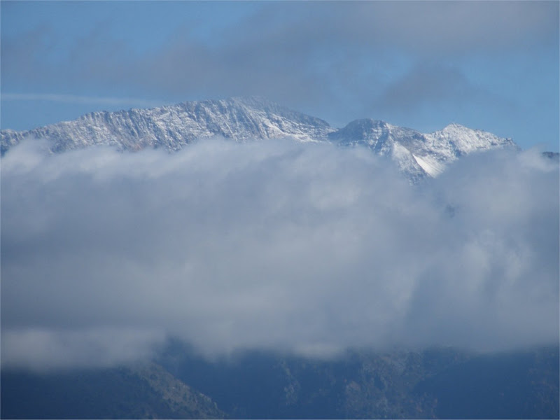
This is looking from just above my house over to the Grandes Rousses (Alpe d’Huez backside)

neige-11oct-2009.jpg

As you can see the rain over the last 3 days (first for a long time) brought a tiny bit of snow above 3000 meters but nothing on the tops opposite which are 2900 meters.


Posted: 16 October 2009 04:39 PM   [ # 7 ]  
Sr. Member
RankRankRankRank
Total Posts:  270
Joined  2008-01-31

The forecast by the serious scientists who don’t make specific forecasts, only probability distributions from a stochastic model, is that:
the probability distributions for this coming winter for precipitation and temperature in the western Alps are kinda similar to the probability distributions for the previous two years.
(though the probability distributions for the Massif Central might be skewed a little warmer)

Perhaps last year the reality for skiing last year in the French Alps was better than the mean of the probability distributions. So if we only hit the mean this year some skiers might be disappointed - (not me).

Ken


Posted: 02 November 2009 04:33 PM   [ # 8 ]  
Administrator
RankRankRankRank
Total Posts:  2234
Joined  2003-10-24

The heatwave is over, snow down to 1000 meters on the Jura this afternoon. I’ll get the snowshoes out tomorrow.


Posted: 03 November 2009 10:50 PM   [ # 9 ]  
Sr. Member
RankRankRankRank
Total Posts:  109
Joined  2006-03-05

Sancy all white top to bottom, but will have to wait until the end of the week for enough white stuff to ski snow not rocks!


Posted: 14 November 2009 07:26 PM   [ # 10 ]  
Administrator
RankRankRankRank
Total Posts:  2234
Joined  2003-10-24

TV Mountain Bulletin issued on the 1.Nov.2009

http://www.tvmountain.com/index.php/meteo-6-mois/203-meteo-6-mois

Novembre 09 & December 09
Disturb west to northwest airflow bringing frequent rain, snow in mid and high mountains. The weather systems are strong and at times, cold air will bring snowfall to the valley. Good start to winter with good snow cover at all altitudes.

January 2010
Generally sunny and cold with some weak weather ssytems. A pleasant change after 2 months of disturbed weather in November and December.

February 2010
Due to cold northerly airflows a long period of very cold and sunny weather. Artic temperatures in the mountains and especially in the valleys.

March 2010
Mild westerly air flows mixing with cold air will cause heavy snowfall transforming to rain in mountainous with rising temperatures. The sun and springtime in the second half of the month.

April 10
Mixed weather. Unstable weather with rain and snow mixed with warm sunny spells.

May 10
Milder but stormy.


Posted: 06 December 2009 11:25 PM   [ # 11 ]  
Administrator
RankRankRankRank
Total Posts:  2234
Joined  2003-10-24

Meteo France predicts this winter will be hot and humid (sounds like some dodgy ### tape to me).

http://france.meteofrance.com/content/2009/10/21247-48.pdf

They don’t give a prediction for the mountain regions though.


Posted: 13 December 2009 09:18 PM   [ # 12 ]  
Administrator
RankRankRankRank
Total Posts:  2234
Joined  2003-10-24

The December bulleting from TV Mountain

December 2009

Disturbed air flows will switch from the North-West to South West bringing frequent and plentiful snowfall. The altitude will vary according to the wind direction. Mid altitudes from the SW to valley floors from the NW. This situation will create an excellent snow pack at all altitudes and fill in the crevasses.

January 2010

The situation continues but colder and less frequent changes resulting in some snow fall but also some superb cold and sunny spells. Weather systems from the north west will bring snow to low altitudes.

February 2010
A favourable situation with the arrival of Siberain cold. At the beginning snow then cold dry air from the north east which will bring sun and very very cold weather.

March 2010
After the Siberain high pressue the cold continues a bit but the N/W airflows reestablish themselves bring warmer weather but also a lot of snow. Then warmer sunny weather.

April 2010
Nothing is sure. Some weak weather systems from the north west divided by sunny spells with warm air but nothing extreme.

May 2010
Continuing unstable n/w weather systems. Lots of rain and cold. Sunny weather is rare and temperatures are fairly cold.

-- http://www.tvmountain.com/