Fri, 28 March 2014
Vertical Climbed: 1,880 meters (6,168 feet)
Rating: 4.3
A confidential route in the Chartreuse that holds snow well and is very skiable in the lower woods.
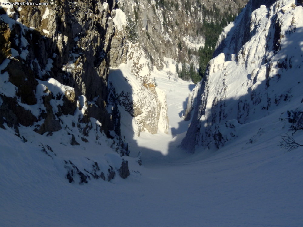
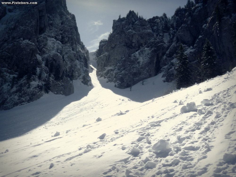
From the West bowl of the Charmant Som traverse to the NNW to the Chamechine ridge, the ridge brings you directly to the entrance of the Combe de l'If. A steep couloir with high rock walls. The couloir entrance is normally protected by a large cornice formed by southerly winds during the winter. You can either downclimb this cornice but you will have to break part of it first as it overhangs by some meters or abseil. To abseil you will need a rope of at least 30 meters, a dead-man, harnesses for each skier. You can either use a dead-man or one of the trees on the right bank.
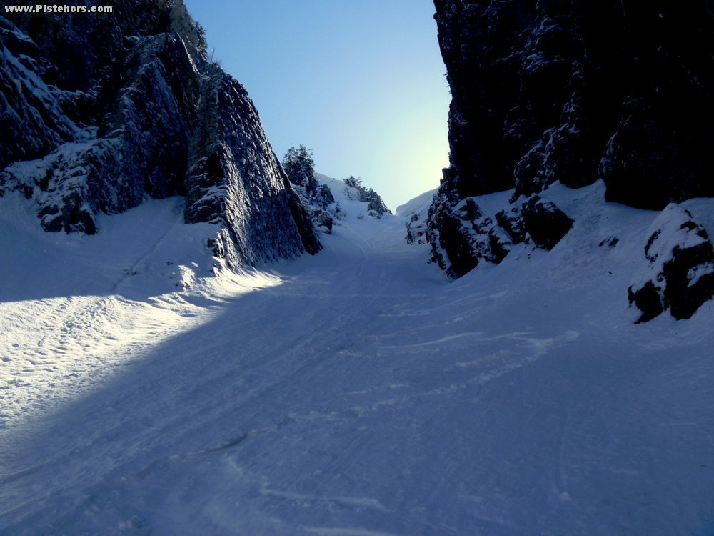
The start of the combe is very steep and at about third distance there is a step which can be icy, afterwards the slope flattens a bit. From the bottom of the couloir continue in the middle of the valley through woods that are quite skiable. At 960 meters you reach a T junction. To the left is the habert de Malamille, you can descend to this then follow the route via the Pont de Vallombré (923 m) to the Porte de l'Enclos and the main road to hitch back to the car. Alternatively take the left (west) to the Col de la Cochette (1263 m.)
Return via the Pont de Vallombré -> Le Collet -> Pied de la Voie du Collet
At 915 meters a forest trail climbs to the south to the Collet. At 1250 meters leave the forest trail to find a passage through cliff bands, continue on the summer path to the Collet at 1562 m, a weakness in the SW ridge of the Arête de Bérard. Traverse to the SW (right) to the exit of the forest at the base of the climb to the Charmant Som. From here you can ski to les Revols and les Cottaves (a tip at 1150m climb to the south (right) about 20 meters to a ridge, from here you can ski directly to les Guillets which leaves just 400m to walk back to the carpark.
BTW an If is a connifer tree: Taxus baccata, the kind of tall, dark greenish decorative trees seen in English gardes.
(see Charmant Som NW Couloir route http://pistehors.com/charmant-som-north-west-couloir.htm for the climb)
Comments on route: Slope: 45/50° for 50m 40/45° for 150m. The tree abseil (rappel) is airy and scary. Be careful walking on the cornice.
Access: Grenoble -> Le Sappey en Chartreuse -> Col de Porte -> D312, left after the pont d'Orgeval, park at entrance to the village on right (car park)
Equipment: Crampons, ski crampons. For the abseil you will need a rope of at least 30 meters, a dead-man, harnesses for each skier etc.
Country: France Area: Chartreuse Trailhead: Cottaves