Wed, 11 February 2015
Vertical Climbed: 1,075 meters (3,527 feet)
Rating: 3.1
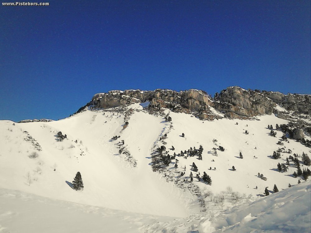
From the corner at 780 meters at the top of the village follow the Lanfray river to 921 meters (les Combes). Here take the trail that climbs through the woods to the left (pas de l'âne - Donkey pass) at 1350 meters. From the Pass continue NNW to exit the forest at around 1550 meters. Keep to the ridge, the bowl to the right can be avalanche prone, pass the col des Banettes. The ridge curves to the east, at above 1750 meters traverse 150 meters to climb a small couloir to the Rochers de Chalves (35°).
Descend by this couloir from the summit descend to a col and take a steeper, more expose couloir (40-45° at first). Regain the ridge and if the snow conditions are safe descend via the bowl which leads into a narrow valley (le Fournet), steep then flattening at the end before rejoining les Combes.
There is an unguarded refuge (des Bannettes) just to the north of the Col de Banettes with space for 7 people (Altitude: 1711m, Longitude: 5.69757 Latitude: 45.30158). You will need your own wood before leaving the woods.
The route is ideal for snowboarders as the climb is relatively easy on snowshoes - at least until the col de Banettes.
Comments on route: The climb and descent are above rock bands so there is a risk of hurting yourself if you fall. The Fournet valley is at risk of avalanches, if in doubt descend by the route you climbed cutting through the woods.
Access: Grenoble -> A48 direction Lyon -> Exit 14 St Egreve -> Chanceliere industrial estate -> Fontanil -> Mont St Martin
Equipment: Ski Crampons, Crampons, Ice axe
Country: France Area: Chartreuse Trailhead: Mont St Martin