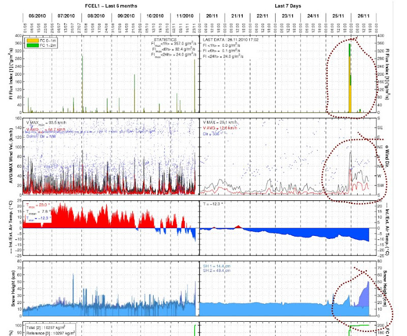
Alain Duclos has spotted this educational snapshot of the weather over the last 24 hours from his Flowcapt station at Celliers (Lauzière range near Valmorel in the Savoie)
A lot of snow transport during last night around midnight
Wind from the NW to 80km/hour (the dots give the wind direction)
Snow transport from the light blue area to the dark blue area.
 .
.
I looked at some of the other monitoring stations in the Alps. the recent snowfall (about 40cm of fresh) was accompanied by a lot of wind at the start of the episode. So you may get a layer of windslab with fresh powder sitting atop hiding the cohesive nature of what lies below.
Keep the avalanche eyes open if you are skiing, especially at altitude, over the weekend.