Sat, 6 December 2003
Minimum altitude: 1,273 meters
Distance: 4.8 km
Slope Aspect: East
Vertical Climbed: 550 meters (1,805 feet)
Vertical Descended: 550 meters
Rating: 3.3
Avalanche Risk: -
Snowline: 1,385
Access
Car park at 1273 meters before the Col de Prat de Bouc. From Clermont-Ferrand take the highway to the Massiac exit. Then the N122 towards Aurillac until you reach Murat. Turn left as you leave the village towards the col de Prat de Bouc (D39).
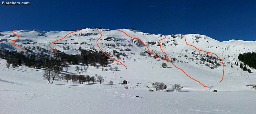
Route
From the bridge at 1273 meters climb NW towards Raveyrol, continue in the same direction to exit the woods at Chalamiere at 1430 meters. Continue to l'Aguillon (1665 m.). Follow the summit ridge avoiding rock bands on the east.
Variants
Le Col de la Molede 1329 m, passing by the summit of the Rocher des Sagnes du Porc. (ski 2.2)
Super Lioran: Follow the pistes to the pas des Alpins then turn NE to reach the summit. Descend the north face (ski 3.1)