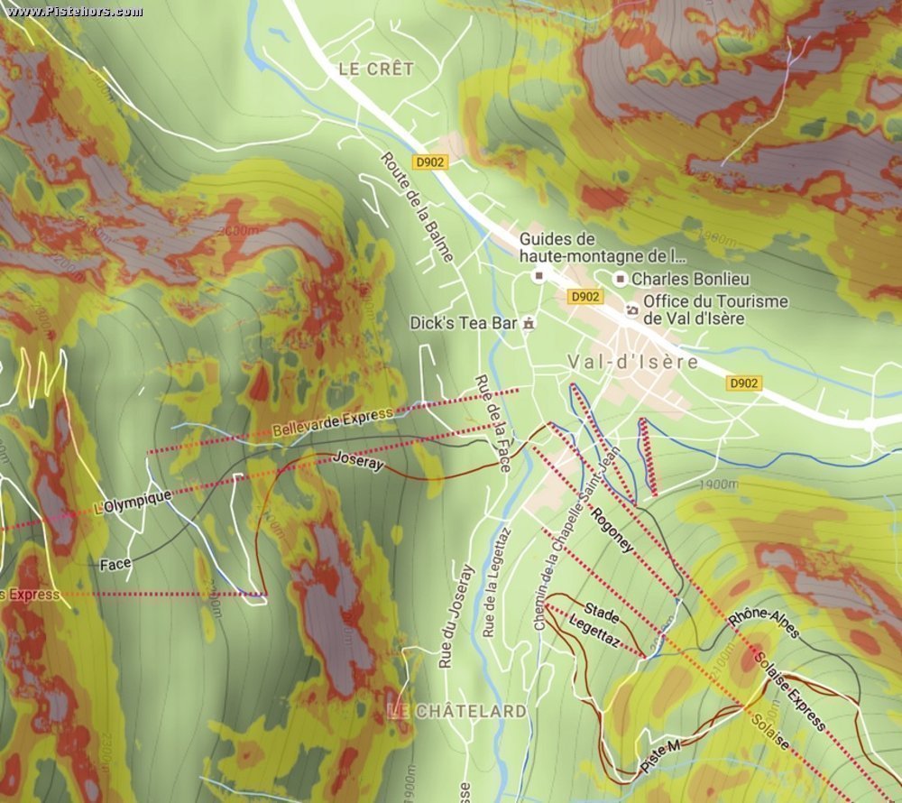
The French Mapping Organization (IGN - l’Institut national de l’information géographique et forestière) will update its mapping data with slope information for the winter 2016/2017. The idea is to indicate slopes of 30°, 35°, 40, et 45°. Critical for route planning for winter sports enthusiasts and used by a number of risk assessment methods such as Munther 3x3.
The idea is not exactly new. In France SkiTrack already took the initiative to superimpose 30° using the IGN75 and Aster 30 databases. However the IGN will use data with much finer 5 meters resolution from the RGE ALTI databases. The SkiTrack maps can miss small slopes above the critical angle. In general any slope above 30° is a possible start point for skier triggered slab avalanches. The information will be available with IGN digital maps such as those available on the Geoportail database and on partner sites such as SkiTracks.fr overlaid on open map data.
The change is part of a range of measures introduced by the government to reduce the number of avalanche fatalities. Last season resorts experimented with removing the yellow and black avalanche flags with Pictograms to represent each avalanche level. This change will be generalized this winter. It should be remembered that wet snow avalanches can occur on lower slope angles and the slopes both below, and even above, the 30° point are at risk.
