Just a few days after a disastrous defeat against New Zealand in the Rugby world cup that has left the nation shell-shocked the French have the 600th anniversary of the battle of Azincourt to remember. Not a good week. However there may be a ray of sunshine in a piece of revisionist history that could wipe out 150 years of hurt in the Alps.
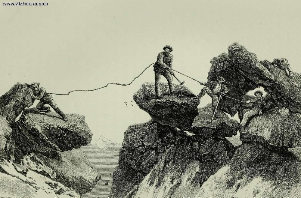
Any schoolboy knoweth that the English Gentlemen climbers, led by Edward Whymper conquered the Alps. From the Matterhorn to the Ecrins summit after summit fell to the dandy “grimpeurs”. A giant bronze statue of Whymper stands by the roadside at Argentière-la-Bessée and pointing to the Barre des Écrins through a valley, like a colossus taunting the locals.
Now research by Olivier Joseph and Paul Billon-Grand and complemented by Eugenio Garoglio of Turin University has cast doubt on the official version. The French army had an important project to survey the Southern Alps during 1851 to 1853. In order to assist the triangulation of various summits surveying poles were installed on the peaks by army officers assisted by locals who knew the access to the foot of the mountains. The researchers were surprised to find that a certain lieutenant Émile Meusnier had apparently climbed to the Barre des Écrins in the summer of 1853, a full 11 years before Whymper’s team.
Even more surprising was Pierre-Joseph de Bourcet’s survey during the summer of 1750 or 1751. According to the research, Bourcet and his men climbed the Viso and the Râteau a full 110 and 120 years before the known firsts by Mathews, Jacomb and the Croz brothers (1861) and by Miss Brevoort, Coolidge, Almer, Michel, Bleuer and Roth for the Rateau (1873). Perhaps more notably, 35 years before the Mont-Blanc was climbed.
The natives of the Alps have long been considered as poor, cretinous creatures but the archives show that locals from Valloire had climbed the Central Needle of the Aiguilles d’Arves in 1839. A feat repeated in 1853 by lieutenant Froester who probably also scaled the Jocelme in the same summer. It is also clear that from the time of de Bourcet’s survey the Barre des Écrins had clearly been identified as the highest summit of the mountain range and clearly localized from Vallouise as well as the Vénéon.
The maps were drawn-up by the military to prepare France against invasion. They were classified as top secret. However nothing about these early summit claims is certain. The researchers need to look more into the personal histories of the officers as well as the villages they passed through and where they sought assistance. It should be noted that Francis Fox Tuckett had identified the Barre des Écrins as the highest peak in the range in 1862 thanks to a map he’d procured from the French War office. Was this the famous map prepared in 1851? Although many locals had little time for the summits, cols and other paths that aided communications were well known. Shepherds would spend the summer on high mountain pastures and mineral hunters looking for precious gems and metals would venture even higher. It should be remember that prehistoric hunter "Ötzi" was found at over 3200 meters altitude in the Italian Alps.
At the same time it seems fairly incredible that the ascension of the highest peak in France, The Savoie and its Mont Blanc would only be incorporated into France in 1860, would remain such a secret for so long.