
Ski Areas > Northern Alps > Belledonne > Glandon > Rocher Blanc South Face
It is the end of May. For a east and south facing slope this means an early start. We set a rendez-vous for 4h15 at Claix just east of Grenoble. That meant at 3h20 start. Hardly worth going to bed. The lift of a ski mountaineer is hard in the last spring. The col du Glandon had officially opened a few days before. Normally it is passable with the natural melting of the snows but this year a large avalanche had blocked the road below the Grande Maison hydro-electric damn requiring the intervention of the highways department and their snow ploughs. The road is usually blocked during the winter and spring by large stones and a gate at le Rivier d'Allemont. Too dangerous too let people drive higher.
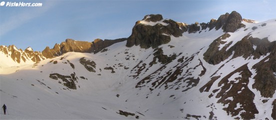
La Pyramide right with the Rocher Blanc just visible behind
We were suprised on reaching the damn to see a procession of points of light along the far bank. What could this be? Glow-worms? A strange religous cult? In fact it was the first day of fishing in the mountain lakes and litterally hundreds of fishermen were making their way along the bank. All around the lake camp-fires flickered in the chill mountain air. It seems fishing is even harder than ski touring.
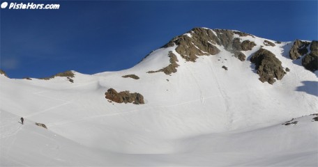
Col de l'Amiante and le Rocher Blanc
At the car-park, situated at 1750 meters, there was no sign of snow on our side of the mountain but we figured we would find the first tracks just behind a large outcrop some 150 vertical meters higher. Here the mountain is flat and follows the bottom of the valley. In winter it fills with snow and the sun's rays strike at an angle meaning less melting. The path is pretty easy to follow and 20 minutes later we were putting our skis on for the climb.

The final few meters
The route follows the Rau du Bruyant stream high on its left bank just below the Rocher Pilliozan. The two extreme couloirs that descend the east face of this summit were not in condition. Not enough snow and a large "goulotte" down the middle. As the valley steepens the route skirts around the bottom of la Pyramide to the right then climbs a 30 degree slope to the north. Jean opted to put on his ski crampons. I decided to climb without but an error on a conversion turn meant I slid a few meters down the slope severely grazing my arm on the hard snow.
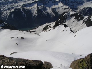
View from the summit to the reservoir Grande Maison
At around 2,500 meters the route swings back to the left directly towards the strangely names col de l'Amiante (Asbestos Pass). The south flanc of the Rocher Blanc is just to the right of the col. At the end of May the final few meters were tackled on foot via a rocky path. The summit has a large flat kairn with visitors book. This is hidden in a plastic tube on the south side. The May air was clear and the views breathtaking. To the north le Mont Blanc, south to the Ecrins and Grandes Rousses.
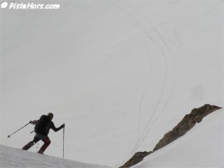
Jean on the slopes below the summit
We had left our skis at the bottom of the summit track. However it is possible to descend the north-east side of the summit then take a short couloir to the right. This is clearly visible in the photograph above. The alternatives are descents by the south west? or north west? couloirs. Both are steep and icy this time of year. The return is via the col de l'Amiante.
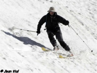
The descent
The snow had just transformed as we skied down at 9h30. Perfect timing. A section of east facing slope was a bit slushy. There were still lots of people climbing up, both on skis and on foot. They would find the descent heavier going.
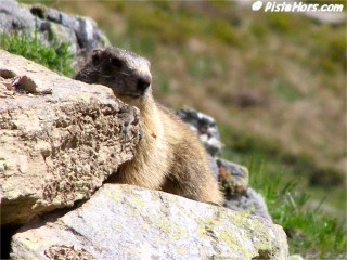
Hungry marmotte at the Rieu Claret
By keeping close to the Rocher Pilliozan were were able to find a passage through the snow down to about 1900 meters. Not bad for an east facing slope at the end of May and a testament to the good high altitude conditions this spring. At the parking a family of hungry marmottes were on watch. Jean was pleased to visit his home country of the "Savoy", if only for a brief few moments.
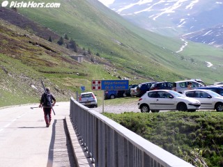
Sweet home Savoie
Because we were so early we were able to profit from the warm sunshine and watch the motorcylists hack over the pass. Ski tourers were out in force. Opposite a group had left tracks on the cime de la Cochette.
GPS: N 45.2416°, E 06.1077°, Altitude: 2928 meters
Orientation: SW
Toponeige Rating: Danger: 2, Climb: PD, Ski: 2.3
32° over 200 meters under la Pyramide - source IGN 1:25000 map
Date Skied: 27 May 2006
Google-Earth:Rocher-Blanc
<< | Glandon | Col de la Combe Madame >>