The avalanche forecasters from Météo-France have been out in the mountains the last week taking measurements and the bulletins are now available from the website. There are also some important evolutions in the avalanche forecast for this season.
Information about the trend for the following day has been improved. Previously it was just an arrow indicating the direction of risk. Now there is a risk estimate with some text giving details. This could be useful if planning a multi day tour or deciding which day to go out - perhaps better to delay the ski tour as the trend is towards stabilization. There is also a link to any current weather alerts.
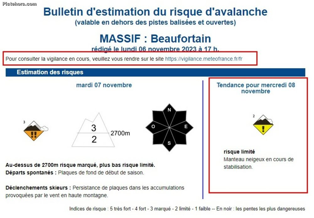
European standard pictograms are now being used to indicate the typical avalanche situation: wind-blown snow, fresh snow, wet snow, persistent weak layers and full depth avalanche. This helps readability, especially for non-native French speakers. Two avalanche problems are of particular note:
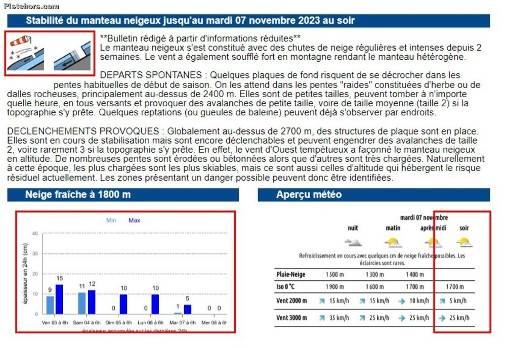
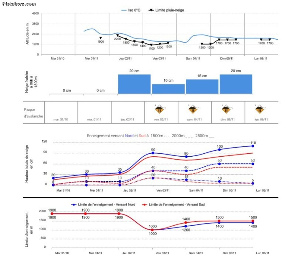
New snow now features a range rather than a precise value as the quantity of new snow can vary over the area covered by the bulletin. Over 20cm of new snow should be a red-flag for backcountry travelers to be extra-vigilant. The weather outlook is now split into four rather than three sections to give more detail and the rain snow limit, snowfall history and the 0°C isotherm information have been improved with indications for north and south slope aspects. Useful if planning a ski tour.
In the future Météo-France plans to cover dangerous conditions all year round such as high altitude summer avalanche risk. Guides have also been contracted to provide additional observations outside of ski areas and off-season as happens in neighbouring Switzerland.