It is a word that strikes fear into every winter sports enthusiast's heart. Foehn. That dreadful southerly wind that blows up from the ocean bringing warm air and destroying the snow pack like nothing else, not even rain is as bad. If you are out in the Alps at the moment you may have noticed the foehn blowing on and off since Friday.
So what do we know about Foehn winds. Well the word "foehn" means hair dryer in German so that probably tells you a lot. A hot, dry, powerful blast. Ever turned a hair dryer onto snow? You get the idea then. In the Alps they are typically associated with a low pressure somewhere to the south-west. Cyclonic winds head into the Alps and Pyrenees from the Mediterranean Sea.
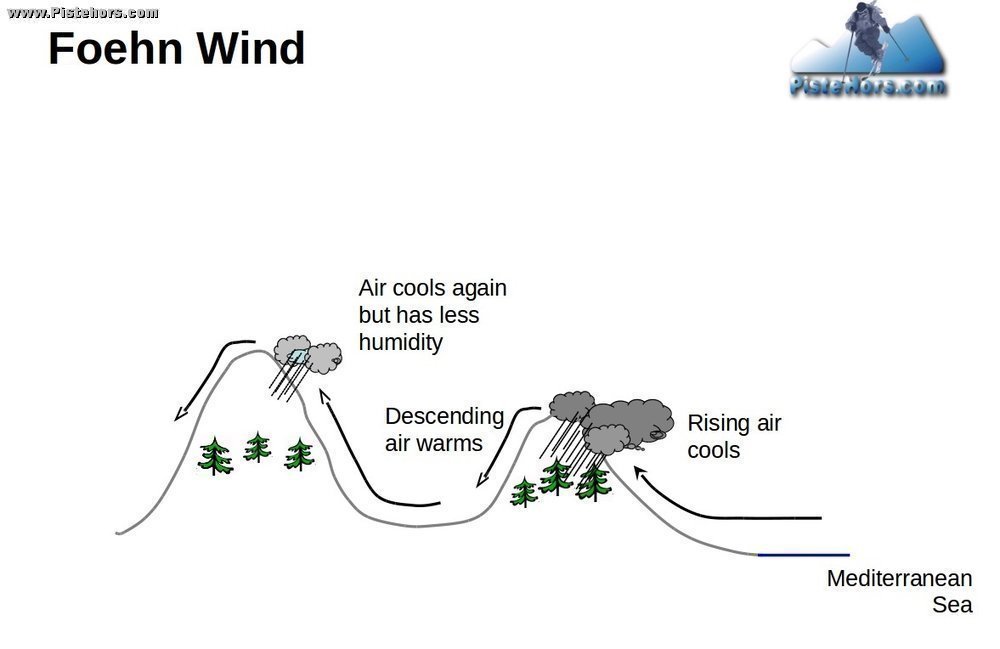
Air is pushed up the windward side of the mountain. As the air rises it cools (adiabatic cooling) and clouds form. This may even give snow or rain on this side of the mountain range as is currently the case in the Southern Alps above 2000 meters. The rate of cooling is approximately 6.5C per 1000 meters gained. The precipitation dries out the air.
As the air mass descends the other side of the mountain it is warmed by compression. And here is the rub, the warming is at around 10C per 1000 meters, much more than the cooling rate! Over 2000 vertical meters the air on the lee side can be 7C warmer (same altitude). The dry warm air thaws the snow and sucks moisture out of the snowpack. A foehn can eat through 30cm of snow in 24 hours. In short, it is a natural disaster. In America they are called "Chinook Winds" after an ocean dwelling Indian tribe, or more simply: The Snow Eater!
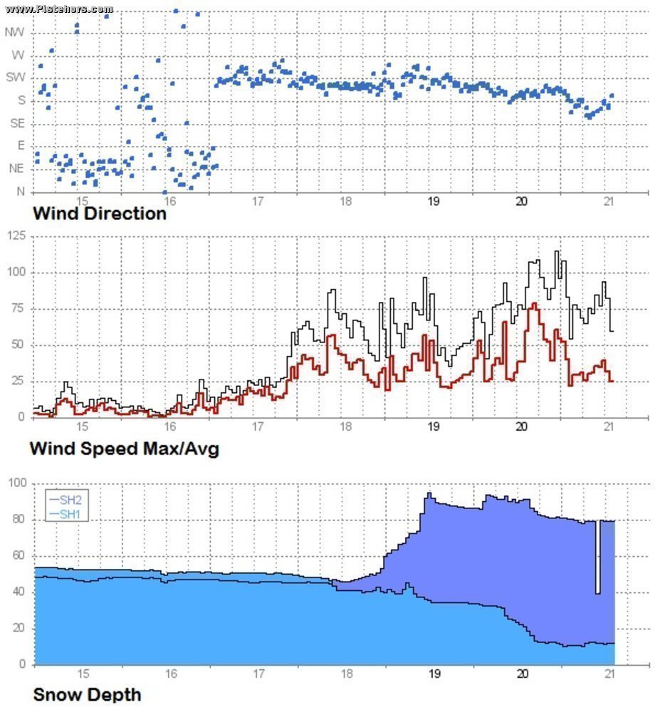
Foehn winds are very powerful, they can roll back colder air masses and lead to wind loading on lee slopes forming hard snow slabs. A potential avalanche hazard. The diagram above shows the Flow Capt station near les Deux Alps. It shows the wind swinging round to the SW then S on the 17th November (last Friday) and gaining in strength. The bottom diagram shows the North and South snow-depth, snow has been stripped from the south and pushed onto north facing slopes, there is around 40cm of extra depth on the lee slope at this altitude. These north facing slopes may already have weak layers in the snow-pack.