Mon, 20 March 2017
Vertical Climbed: 1,180 meters (3,872 feet)
Rating: 4.3
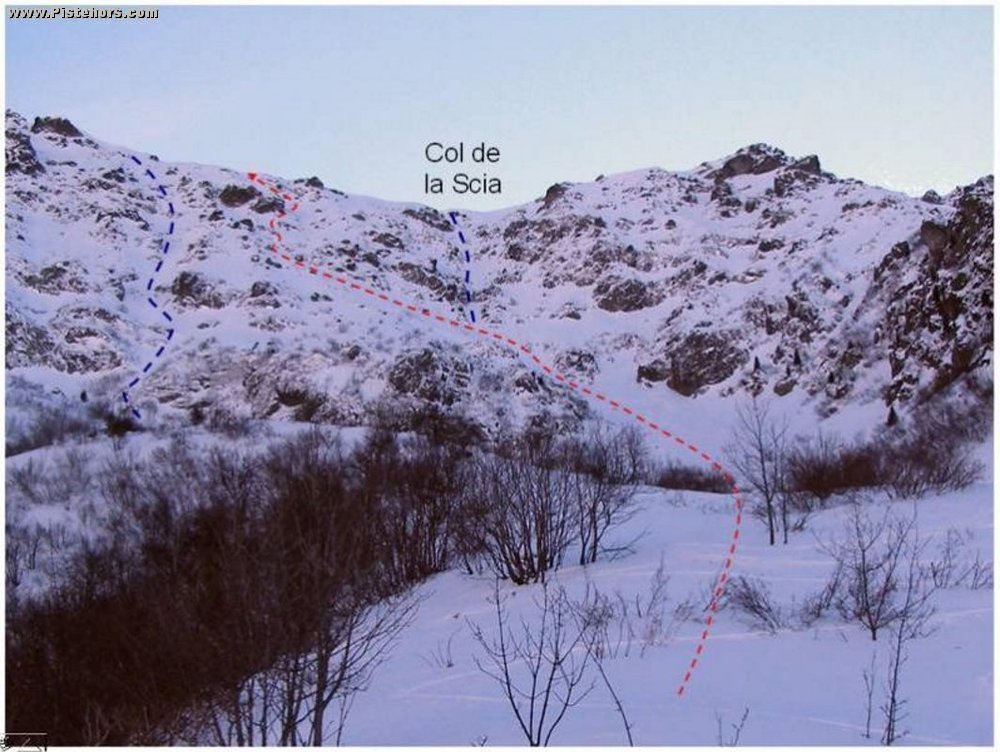
Follow the trail to the habert d'Aiguebelle (refuge, renovated in 2008 but closed). Take the path that climbs on the left bank of the valley and after 150 meters turn to the south-east to climb through a glade (pt 1500m - ravin de Muret). At 1650m there is a path that climbs to the south-web that traverses a zone of brushwood. You'll reach the Muret Ravin at 1750 meters.
Follow the ridge that leads to a wide bowl. Depending on the snow cover you can climb directly via a couloir on the left by zig-zagging between the rock bands. If you don't want to descend then you can pass via the Pas de la Coche.
Access: Grenoble Chambery autoroute. Brignoud Exit then Prabert to the snow line.
Equipment: Crampons
Country: France Area: Belledonne Trailhead: Prabert