As the avalanche forecasters at Météo France in the Pyrénées put it: “winter launches large offensive”. Last weekend was particularly miserable for anyone on the roads with routes in the Massif-Central and Pyrénées being cut. Three hundred British package tourists spent an uncomfortable 24 hours when their coaches got stuck on the way up to Andorra on Sunday and the ski resort of Puyvalador suffered a two day power cut which stopped the ski lifts despite excellent skiing.
Fresh snow in the Bauges
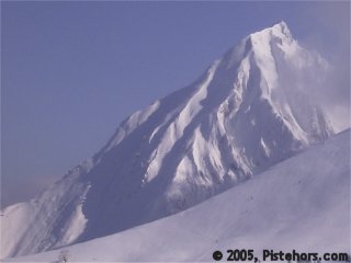
In the Pyrénées avalanches cut many roads and the alert was at 5 (extreme) for the first time this year. There was over a meter of snow over much of the mountain range and travellers were advised to check their itinerary before setting out. The picture in the Northern Alps was somewhat easier but the Aravis and Chablais mountains saw 1m70 of snow at 2000 meters. There were two serious avalanche accidents in the Savoie this week, a member of the piste patrol was caught by a slide during clearance work and a boy was killed by an avalanche at Courchevel in the Roche de l’Ombre while skiing off-piste with his family. Further snow is expected from tomorrow over much of the French mountains which will make both off-piste skiing and driving conditions very hazardous.
Last weekend and the early part of the week saw a lot of snow in the Northern Alps with rain to 2000-2300 meters on Saturday this was accompanied by a North-West wind. Snowfall was greatest in the North and West of the sector with over a meter of snow (170cm in the Aravis at 2000 meters!) there was around 40-60cm in the Vanoise with somewhat less in the Upper Maurienne and Oisans.
In many areas it is possible to ski from 600 meters altitude but the wind from the North-East has packed the snow on exposed slopes. Sunny slopes have a light crust but this will disappear as the slope humidifies in the sun.
Yesterday below 2200 in the Savoie we observed fresh powder snow on a hard crust – this was probably formed by the recent rainfall. The crust was none-breakable on skis. Below there was a deep layer of snow with little cohesion. There were some natural snow sloughs on sunny south to south-east facing slopes. There could be full depth avalanches below 2500-2700 meters. We also observed a surface slab of some 20cm depth where there had been an accumulation of snow to the side of a rock outcrop. With the recent wind from the North-West to North-East these small slabs will also be present on ridges and cols and might cause a secondary much larger avalanche. Higher up larger slabs have formed under the action of the North to North-East wind. These are sitting on snow that has been weakened by the cold weather. Larger slabs will need a considerable surcharge, say a group of skiers, to trigger but there is also the possibility of small slabs that could be triggered by a single skier, particularly in the Savoie and Isère. Soft snow slabs will be indistinguishable from powder snow. Safe travel procedures and route selection should apply. Take care on convex slopes, sectors with thin snow pack, steep slopes, rock outcrops and routes that have not been partially stabilized by skiing.
Southern]http://pistehors.com/backcountry/wiki/Ski-Areas/Southern-Alps]Southern Alps[/url]
The misery continues further south. Generally warm weather predominates in the and the snow cover ranges from poor to very poor in the Maritime Alps. Still no snow means little risk of avalanche! The Dévoluy and North-West of the Thabor ranges have seen about 10 to 20cm of fresh snow. It is possible to ski from around 1500 meters on northern slopes but many ridgelines and summits are without any snow cover. The surface is very variable. The recent snowfall in the Dévoluy and Thabor has been accompanied by wind from the North-East to North-West and some small slabs have formed. Backcountry travelers should take care on shaded lee slopes above 2300 meters. Some fresh snow is expected over the weekend in the areas close to the Isère and Savoie but it looks like the snow drought will continue.
Météo France has noted some avalanche activity. A 20cm thick slab was triggered by a skier in the Dévoluy at 2200 meters on a South-East facing slope and two skiers triggered a similar sized slab on the border between the Thabor and Queyras. This was at 2640 meters on an east facing slope, this took much of the face with it.
The snow cover in Corsica is good with around 20cm of fresh powder on a crust. There has been around 20 to 40cm of fresh snow. Most of this has been blown off ridges by a strong North wind and there are consequently large accumulations and some thin slabs on south-west facing slopes. However these are on a fairly stable snow pack and are only liable to cede under a high load on sufficiently steep slopes.
The next month is probably a good time for anyone thinking of tackling the Corsican Haute Route.
It is looking like another excellent winter in the Pyénées. Slopes are skiable to 600-800 m over much of the range. There has been 50cm fresh snow in the far West and over 1 meter elsewhere. In certain sectors in Puymorens there is over 5 meters of total snow depth! There is a lot of powder except for sectors exposed to the strong N/W winds. Last weekend saw rain to around 2400 meters, this caused a number of natural avalanches and has formed a hard crust on which later snow has settled. The unlying snow pack is still fragile and the new snow has not had time to stabilize. There are unstable layers on Northern aspects higher up. Some very large slabs have formed under the action of the wind and these could be triggered by the passage of a group of backcountry-travellers. Smaller avalanches are possible with the passage of a single skier. Many couloirs have large accumulations of snow which will also be sensitive to the extra load presented by skiers. Take care roll-overs, convex slopes and bottom of cliffs or by rock-outcrops.
References
This information is a summary of current conditions and is provided for information only. It is based on direct observations and information from the following sources.
Météo France issues daily avalanche bulletins for the French Alps, Corsica and Andorra. You should ideally consult at least the previous 5 days bulletins prior to your trip in order to have an idea of recent conditions.
recorded in Camp2Camp and Bivouac have trip reports with observations of the snow conditions.
Weather information is complemented by the USAF Public Weather Charts
Henry’s Avalanche Talk publishes a daily translation of the Météo France bulletin for the Savoie area.