Summer has been with us for a few weeks but it still feels wintry. In the Isere we are on the battle theatre as the South European Heatwave and the Northern Flood Zone. The result is that it has snowed on and off at altitude. It’s not unusual but not that common. The last time I remember skiable snow was the Skipass.com bash to Tignes on the 5th of July 2002 - 5 years to the day.
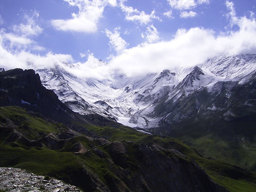
From the Columban Noire, 4km on the Savoie Side of the Galibier road pass, the vallon du Fond that leads to the Trois Evéchés is clearly visible. Or at least it would have been if the whole area hadn’t been swathed in dense, low cloud. As I got out of the car it was raining lightly. Not an auspicous start.
First thing you do is climb… down. 200 meters below is the Ruisseau de la Fontaine Lombarde. The IGN topo map suggests traversing the Gypsières - a maze of ice and snow filled potholes. You then end up in the vallon. From here it is a question of heading vaguely west avoiding the climb into the vallon de l’annesse which leads to the lower Pic Blanc du Galibier.
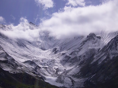
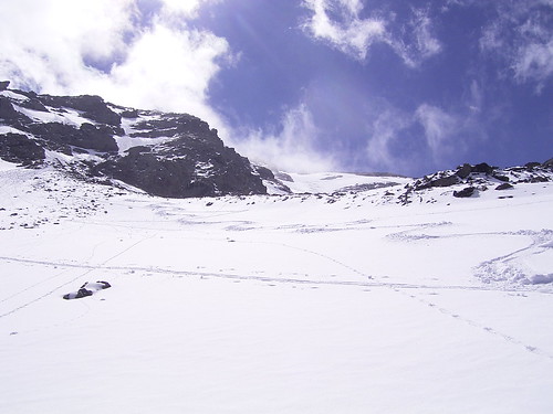
The route is a miracle of nature. Well known for end of season ski touring snow accumulates in a long ribbon up the valley like a ski piste. The skiable snow started at 2250 meters. Stepping onto it revealed 10cm of lightish cold powder sitting on a hard base. Ideal.
Hidden Peak
After the initial climb the route became less obvious. A number of ribbons of snow lead up between scree but which to take. I took a right branch which ended up below some cliffs. I then traversed across to the south but there seemed to be no obvious route up the valley - not that I could see much. The altimeter read 2850. I sat down for some food and waited for a hoped for clearing. Finally the Pointe des Lauzettes appeared from the clouds.
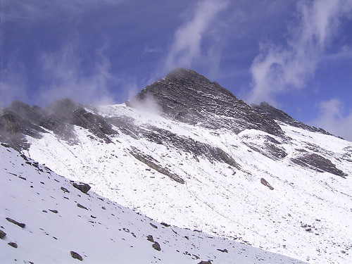
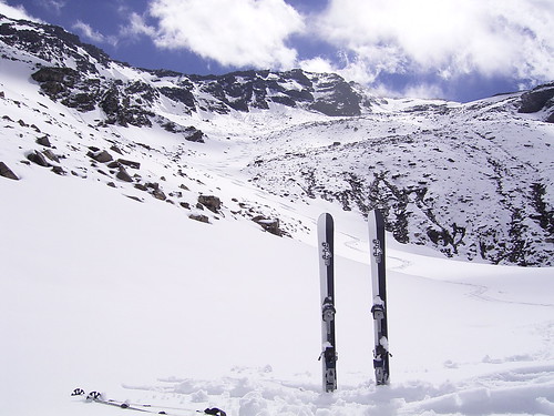
Time to head for the summit zig-zagging across the snowfields. I climbed to a col to the west. From here there were views over the Aiguilles d’Arves. The ski route ends at 3070m and from here it is a scramble over rotten rock to the summit which I decided to forego.
The slopes are not tricky. Around 30 degrees except for the first 100 meters or snow below the summit which are steeper. The snow was fantastic and this in July. I climbed the last section again to ski it a second time.
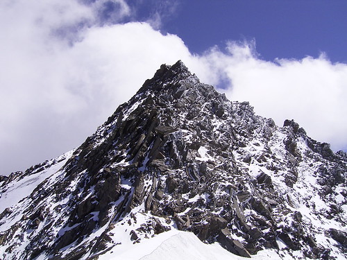
This is a view of the pitch, you can see the tracks under the summit on the right quadrant of the picture.
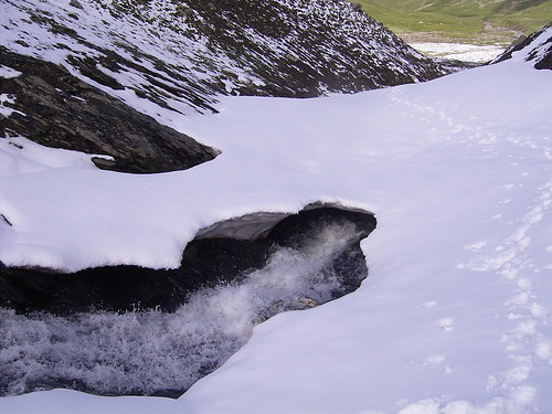
Despite the fresh snow the avalanche risk was pretty low. Gentle slopes and not enough fresh to do much, the best was well frozen. The main danger would be breaking through the neve into one of the streams below. A number of climbers and skiers have ended their day’s this way.
All in all good work for July and better than some of the summer skiing on offer.