This is an archive of the old PisteHors.com forum

News | Gear | Ski Areas | Hiking | Mountain Biking
Powered by Google™
   
1 of 2
1
December 2011 Snow Conditions
Posted: 05 December 2011 09:16 AM  
Administrator
RankRankRankRank
Total Posts:  2234
Joined  2003-10-24

+9C this morning in Geneva. Difficult to see if there was any snow on top of the Jura (1700m) due to the cloud, perhaps a little icing up high. The weather front that rolled into the Northern Alps yesterday evening, bringing heavy rain and even some flooding, had just about blown itself out by this morning. So lets have a look at what it brought in terms of snow.

The situation remains very poor with just a couple of cm on the ground from 1400m in the Northern French Alps this morning. The temperature dropped significantly at the tail end of the current weather system with the zero isotherm at 1700m at Chamrousse at 9am.
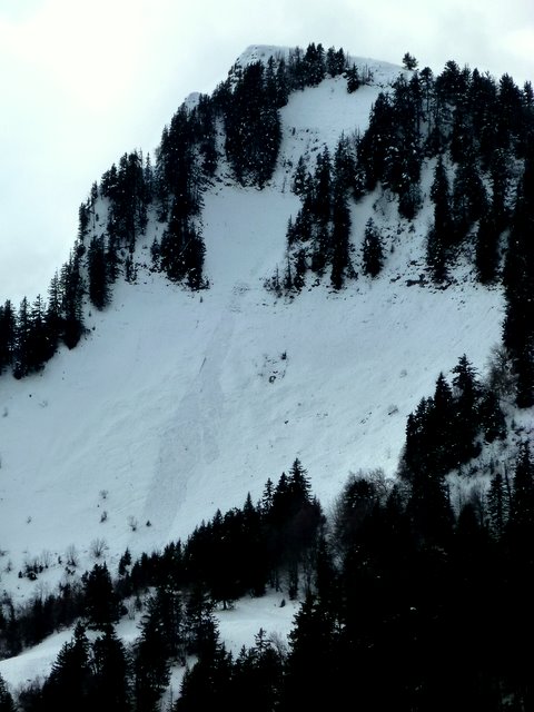
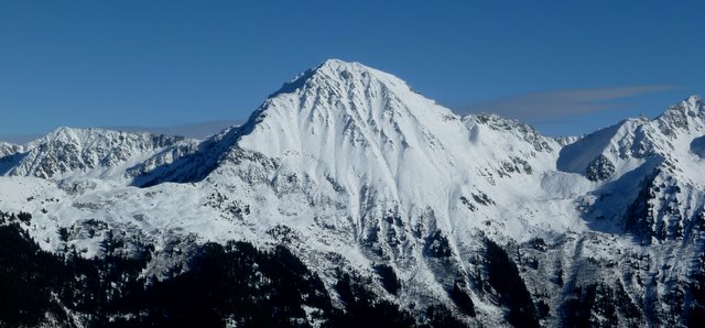
Northern Alps

The Northern Alps have seen around 25cm at 3000 accompanied by a lot of wind on Friday/Saturday from the S then from the NE/N. This was in two episodes on Saturday night and Sunday night with the second episode bringing slightly more snow. The zero isotherm has been around 2100m over much of the last 24 hours with some snow cover down to 1400m. Around 15cm at 2000m in total.

Italian Border

Very little fresh snow. 10cm at Bonneval at 2700m which has about 2600m on the ground. There has been some ski touring from the Col Mont Cenis over the last few weeks although the col is officially closed (the road forms part of a ski run at Val Cenis with snowmaking), there has been 15cm at Val d’Isere.

Southern Alps

The Mediterranean depression on Friday brought 20cm of fresh snow to the Maritime Alps (Isola 2000 etc) on Friday/Saturday. The Atlantic front hasn’t reached far south Orcieres picked up 10cm at 2300m altitude.

Pyrenees

The Pyrenees has seen a low pressure over the Mediterranean which brought around 10cm of snow on Friday. The freezing level has been around 2200-2500 m over the weekend which has caused a bit of a thaw. There is about 50cm on the ground at 2500m with 10cm at 2200m.


Posted: 05 December 2011 11:39 AM   [ # 1 ]  
Newbie
Rank
Total Posts:  11
Joined  2010-11-18

10 cm this morning at 1900 m and finally looks like a ski resort, another 30 predicted in next couple of days and lifts expected to open on Thursday


Posted: 05 December 2011 11:40 AM   [ # 2 ]  
Newbie
Rank
Total Posts:  11
Joined  2010-11-18

Thats in Alpe D’Huez


Posted: 05 December 2011 11:45 AM   [ # 3 ]  
Administrator
RankRankRankRank
Total Posts:  2234
Joined  2003-10-24

Thanks for the update, would have thought this week would let the 1800m+ resorts like Alpe d’Huez, Avoriaz, Flaine etc crank into gear.

Here is the view at les Bergers
last102.jpg


Posted: 05 December 2011 02:14 PM   [ # 4 ]  
Newbie
Rank
Total Posts:  4
Joined  2010-10-28

See you on the DMC on Thursday then Davidski.... cool smile


Posted: 07 December 2011 09:12 AM   [ # 5 ]  
Administrator
RankRankRankRank
Total Posts:  2234
Joined  2003-10-24

There was 30cm of fresh snow above 1500m in the Northern Alps with 60cm at 2300m. Towards the border area with Italy you can find a meter of snow on the ground. There has been little recent snow elsewhere.

After the long period of clear, fine weather a weak layer of hoar crystals has formed on shaded slope aspects above 2200-2400 meters. The avalanche risk will be high on these slopes. There was snow from 2000m on southern aspects in the Southern Alps and border area with Italy. This has seen a freeze/thaw cycle and is fairly stable. However with the quantity of fresh snow expect purges. Keep clear of suspect steep slopes and avalanche paths. The situation should stablize towards the weekend as the current storm cycle ends.


Posted: 09 December 2011 08:25 AM   [ # 6 ]  
Sr. Member
RankRankRankRank
Total Posts:  139
Joined  2005-05-06

Mt Chery, yesterday afternoon.

http://www.youtube.com/watch?v=Uqhkpb8zTXM

A great start to the season.

 Signature 

http://www.alpine-property.com


Posted: 10 December 2011 03:13 PM   [ # 7 ]  
Administrator
RankRankRankRank
Total Posts:  2234
Joined  2003-10-24

The annual Mon cherie extravaganza !

The tot and I were snowshoeing this morning. Snow is beginning to transform on south facing slopes where we’ll probably be left with 20cm of skiable snow at 1500 m.  We even saw a bit of natural avalanche activity

P1020920.JPG height=640 width=480

it always slides at this spot though, probably the snowpack got overloaded by the rain.

P1020921.JPG height=480 width=640

You can see the channels left in the snow by the recent rainfall. This fell to 1700m on Wednesday night. Zero isotherm was around 2500m on Friday, about 1900 meters today.


Posted: 10 December 2011 09:09 PM   [ # 8 ]  
Sr. Member
RankRankRankRank
Total Posts:  543
Joined  2006-01-24

A couple of views of Friday,

Glacier 3000 in the morning and you can see snow down to around 1000m in the surrounding area. I should have taken a shot of the some of the ridges around Isenau where there a large amount of natural avalanche activity.

20111209-115458.jpg

And that afternoon looking over to Villars from above Leysin.

20111209-153109.jpg

 Signature 

SwissMountainLeader.com & B&B L’Epicéa, Leysin, Switzerland


Posted: 12 December 2011 10:06 AM   [ # 9 ]  
Administrator
RankRankRankRank
Total Posts:  2234
Joined  2003-10-24

Nice!

A new weather system is moving across the region. Temperatures are quite warm, zero iso is around 1700 meters although dropping slowly. Wind is picking up in strength too from the south. Expect to see some loading on north aspect slopes and some purges during and just after the new snow.

P1020925.JPG height=298 width=640

Grand Moulins, yesterday


Posted: 12 December 2011 10:11 AM   [ # 10 ]  
Sr. Member
RankRankRankRank
Total Posts:  543
Joined  2006-01-24

slightly different here in Leysin, it’s binning down with snow &

0ºC, 7km/h, @ 1250m
-5ºC, 34km/h @ 2048m

 Signature 

SwissMountainLeader.com & B&B L’Epicéa, Leysin, Switzerland


Posted: 12 December 2011 10:16 AM   [ # 11 ]  
Administrator
RankRankRankRank
Total Posts:  2234
Joined  2003-10-24

Good news for the Swiss. I suspect with the Southerly winds we’re getting further south we’ll see big differences from valley to valley.


Posted: 13 December 2011 09:49 AM   [ # 12 ]  
Administrator
RankRankRankRank
Total Posts:  2234
Joined  2003-10-24

Cold overnight, feels like winter. Freezing rain in the valley with another 20cm of fresh above 1500m. Snow line down to around 900m on the Jura this morning.


Posted: 14 December 2011 01:54 PM   [ # 13 ]  
Administrator
RankRankRankRank
Total Posts:  2234
Joined  2003-10-24

Snow washed off the Saleve today (1400m) and it must be raining at 1900 meters now. (Zero iso about 2000m).


Posted: 16 December 2011 11:56 AM   [ # 14 ]  
Administrator
RankRankRankRank
Total Posts:  2234
Joined  2003-10-24

I was up at 1000m yesterday where it was raining in the Isere but this turned to snow overnight. Probably 30cm of fresh at 2000m in the last 24 hours and more like 80cm at 3000m over the last 3 days. That’s a lot of snow at altitude. We are getting on for 80cm total snow depth at 2000m now, a good base.

Zero iso is now at 1800m, a bit lower than the 2100m predicted by Meteo France and the snow/rain has let off now. Looking out the window I’d say it snowed down to 1200m last night but skiable snow is more around the 1400m level where there was about 10cm overnight.

Best low altitude snow in the Northern French Alps is probably in the Bauges. However with the warm daytime temperatures, high altitude rain and wind there is a high risk of both natural and skier triggered avalanches. The 60-120km/h winds are from the west to south-west and are loading sheltered north facing bowls. Risk 3-4 in much of the Savoie and risk 5 in the Mont Blanc massive today.

[ Edited: 16 December 2011 01:31 PM by davidof]
 
 
Posted: 17 December 2011 05:59 PM   [ # 15 ]  
Sr. Member
RankRankRankRank
Total Posts:  139
Joined  2005-05-06

I went out today at St Jean d’Aulps (Espace Roc d’Enfer), the top lift goes to 1800m the rain from yesterday got to there (and higher I’m sure) making for a very solid base with 30cm of light fresh snow on top that fell last night, maybe another 5 to 10cm during the day too. Very nice. I suspect that this rain will have stabilised the snowpack considerably.

http://france.meteofrance.com/france/MONTAGNE?MONTAGNE_PORTLET.path=montagnebulletinneige/DEPT74

Oh yes, so it has.

 Signature 

http://www.alpine-property.com


1 of 2
1