Sunday was going to be a big one, 2000 meters of climbing to Mont Tondu (Mount Baldy if you will) via the lacs du Jovets. Long also in terms of distance because after an initial climb to 1500 meters the route plateaus out below the col du Bonhomme before turning south under a long ridge with links the col to the summit of Mont Tondu. It was also forecast to be hot, very hot for February. More late spring in the middle of winter, still nothing new for this year.
By Jove!
Thibaut had said to bring crampons, not for the steep slopes below the summit but for a paved path called the Voie Romaine. I had trouble finding out much about this road. It seems it is a real Roman road linking the Arve valley with the Maurienne and Italy. Another clue was the lacs du Jovet… Jovet, Jove? Jupiter. The sky god. The Romans used to build temples on high mountain passes. There is even a theory that Hannibal passed this way with his elephants, but if he had he probably wouldn’t have had the trouble he had.
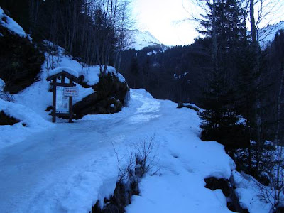
The path was an ice covered bob track. We saw people climb up without crampons and we saw them come down again but given tate of a snowshoer in the Racape du Grand Som the other day this seemed very imprudent. I wondered if the Romans had crampons on their sandals.
After the excitement of the Voie Romaine things were distinctly flat, the descent was going to be long, or so I thought. We passed under one of the numerous “cols du chasseurs” before crossing prudently on the left bank of the lacs du Jovets. Tracks went across but given the warm weather it didn’t seem worth tempting fate.
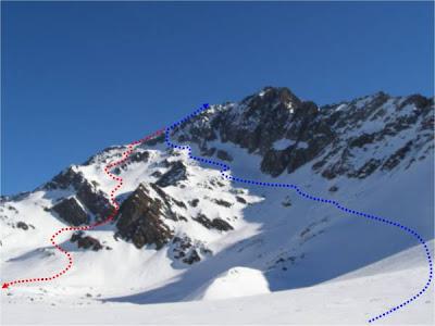
This was followed by a long traverse under the flanks of Mont Tondu before a steep and hot climb to the summit. I was “cooked” by the time we reached the shoulder at 3050 meters but Thibaut and Ken continued the 100 meters to the summit for some splendid views.
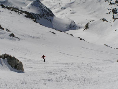
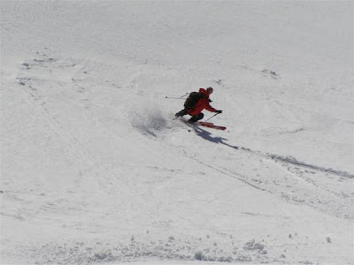
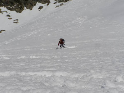
We skied down the north-west ridge rather than the steep but very hot couloir then turned south-west to follow a series of bowls linked by some steep but never too steep couloirs. Around 35-38 degrees max. It may have been better to ski down an hour earlier, the snow had a refreeze crust that had now almost melted but the was much softer underneath. Further down, above the lakes Ken and Thibaut headed off to find colder snow whereas I continued over velvet soft ice-cream down a spine. Great as long as you kept up a bit of speed. The boys were less pleased with their choice.
We recircled along the right bank of the lakes before entering into the shadow. The snow was firmer but was well tracked, a bit like a ski piste at the end of the day.In fact the flatter section was steeper than it had seemed climbing and we managed to reach the forest track without much pushing. Then it was time to fit crampons to tackle the icy Roman road, just think Julius Caesar had possibly passed this way 2000 years previously to conquer Gaul.