This is an archive of the old PisteHors.com forum

News | Gear | Ski Areas | Hiking | Mountain Biking
Powered by Google™
   
 
TR: Mont Blanc: Traverse of the Three Monts and Arête des Bosses
Posted: 07 September 2010 10:39 PM  
Administrator
RankRankRankRank
Total Posts:  2234
Joined  2003-10-24

Luc called me on Friday morning. Did I fancy climbing to Mont Blanc on Saturday? Interesting question. I’d been busy with other projects over the summer and not really done any serious walking since June. Luc had booked the refuge and two of his pals were coming. Richard and Benoit. Benoit I knew, we had done the Agneaux together the year before as well as the Combeynots. He was a strong climber. The weather looked good and although I had no particular designs on le Mont Blanc the spontaneous nature of the enterprise suited me. Nothing ventured, nothing gained.

We planned to traverse by the Three Monts route then descend by the Bosses ridge. First step was to catch the two stage cable car to the 3775 meter Aiguille du Midi. This is a 37 euro one way trip with the last tram at 17h00 (last return 17h30).

DSCF3281.JPG

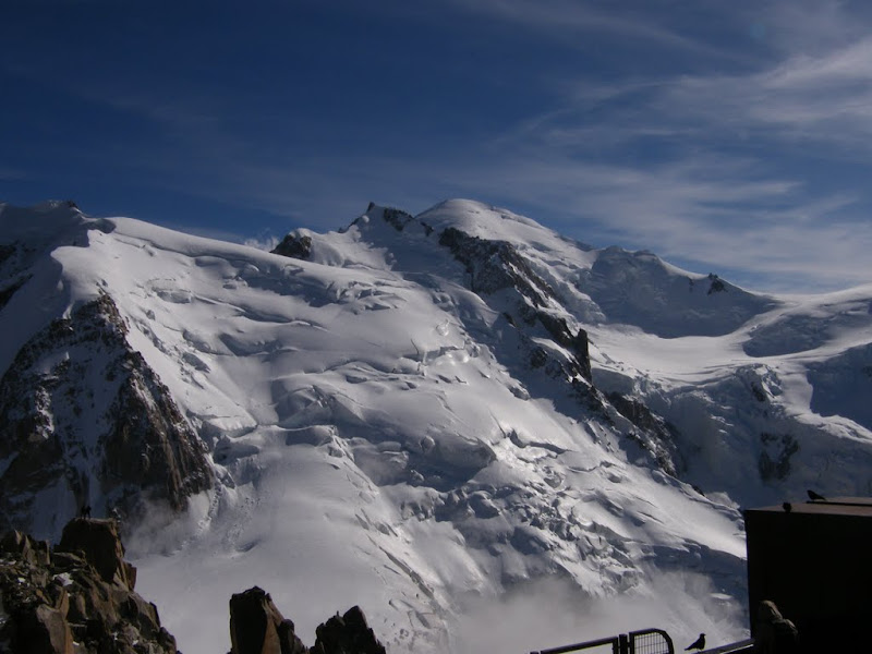
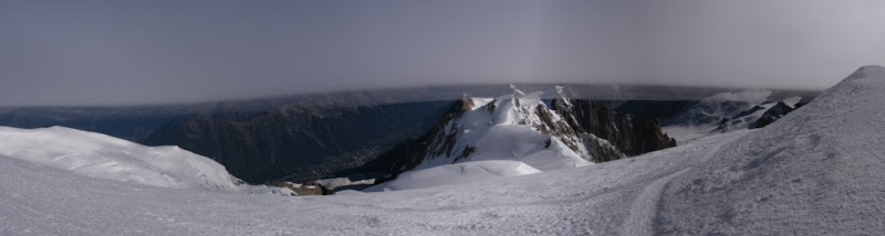
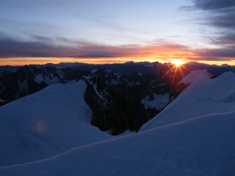
The view from the Aiguille du Midi is always breathtaking (well when it is not foggy) and I can see why people pay the 50 odd euros just to make the return trip. This photo shows the route we would follow the next day up Mont Blanc du Tacul, the col du Mont Maudit then to the summit of Mont Blanc.

DSCF3283.JPG

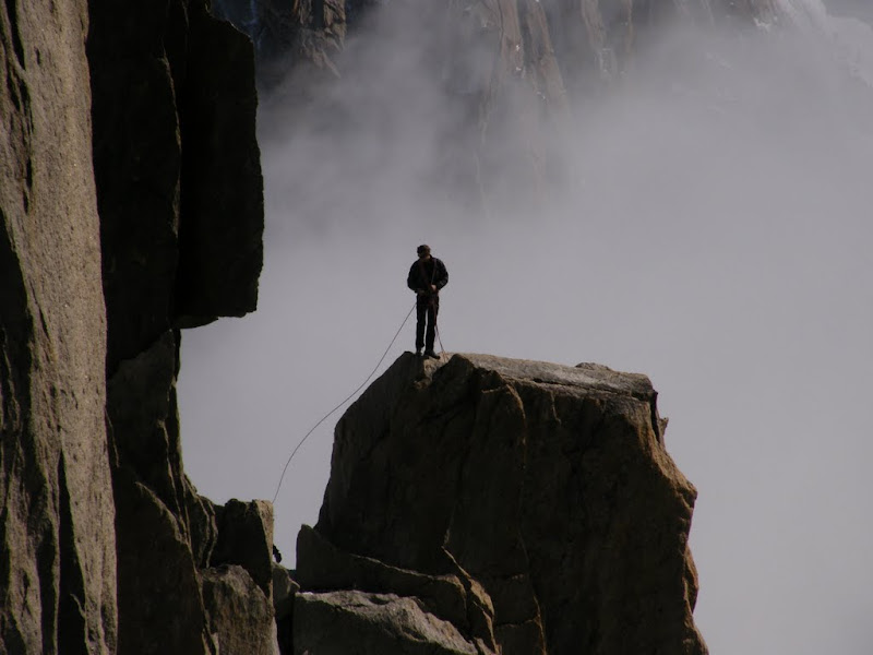
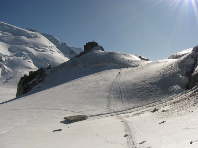
After sightseeing with the tourists on the observatin platform and admiring the “varappeurs” below the Aiguile du Midi it was time to head to the refuge. It was neary 17h30 and the last climbers were slaving up the ridge trying to make the last ride home rather than spend an icy night in the top station.

The ridge descends to the start of the Valley Blanche, you need to continue along the line of the ridge to avoid a rimaye (bergschrund) before doubling back to the south and the short climb to the Cosmiques (3613 m) refuge.

DSCF3288.JPG

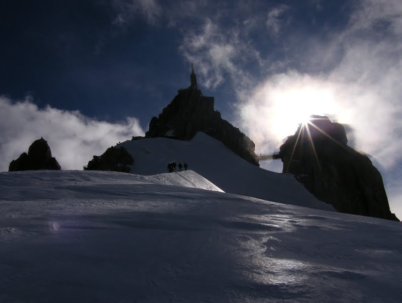
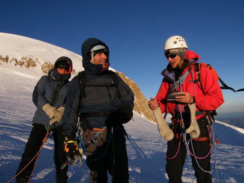
I put on my crampons and headed down to take some photos. Here are Luc, Richard and Benoit descending roped up. Richard is fairly new to crampon technique and was taking it easy.

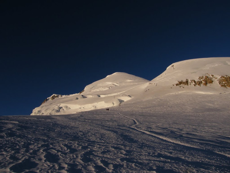
We left the refuge at 02h20, a bit late as there was quite a kerfuffle getting reading with a lot of guided zombies ambling round the refuge blocking doorways etc. It was not that cold, around zero at 3600 meters but a biting wind had got up from the North. We could see a long line of headlamps up the NW face of the Mont Blanc du Tacul (4028m). The snow was slightly loose on the surface as we began the climb which rapidly steepened but was never too steep. Towards the ridge a few crevasses and a rimaye appeared. The rimaye is usually crossed by a steep fixed ladder but we were able to avoid this on a snow bridge to the left. From the Tacul ridge you wind round to the left and then descend to a plateau to the col Maudit (4035m).
The Tacul offered much of the same, with steepening slopes, crevasses and rimayes. The track was well made and nothing was too difficult apart from the last 100 meters of ice climbing to the Col du Mont Maudit.

DSCF3289.JPG

It is worth noting that the first part of the climb is covered in darkness and you don’t really see a lot. Dawn is arrived just after the difficult Tacul section. It was bitterly cold with a biting northerly wind blowing. I could not stop for more than a couple of minutes before starting to go numb on my face and fingers then arms and body. The only way to keep warm was to keep moving.

DSCF3290.JPG

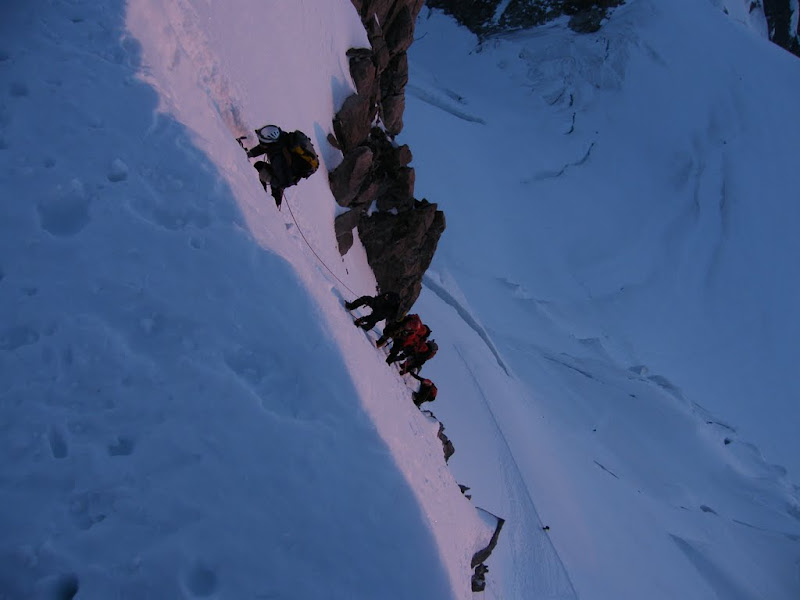
This is the hardest bit of the climb. Luc and Richard are leadng a group up the Tacul ice wall. It is around 55 degrees. The ice was pretty good for front pointing and held an axe well. The group in front of us kicked off a lot of ice boulders, hard to understand what they were doing as we didn’t dislodged anything. One boulder hit my helmet, leaving a large dent and another hurt my shoulder.

DSCF3294.JPG

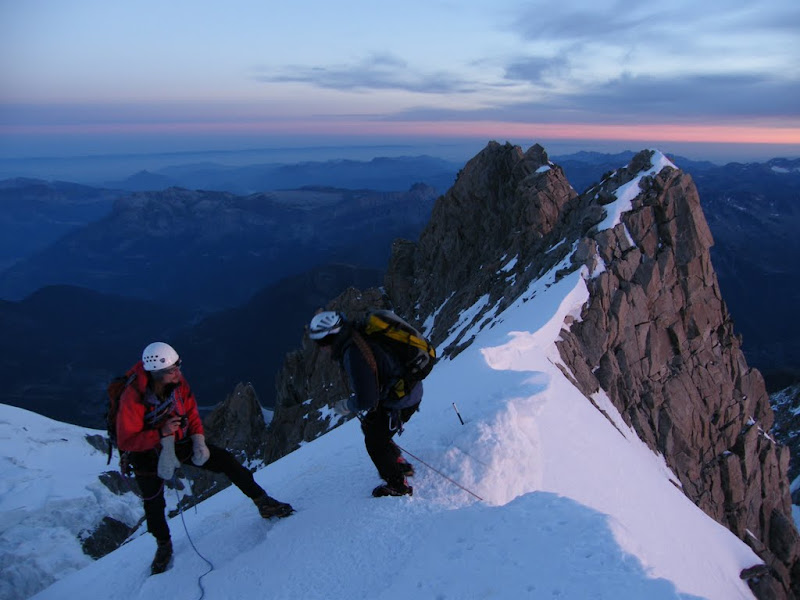
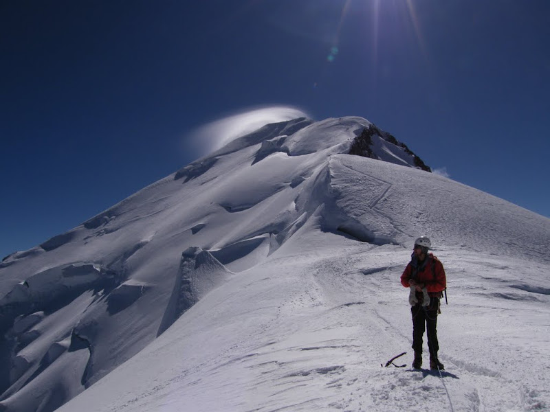
Luc and Benoit were pleased to finish with the crux and stop for a break. This section of the route has a number of fixed ropes but they were pretty mixed up. You can wait a long time here for climbers to clear the section and get very cold in the process. It is also a good point to slip on the way down with a large rimaye waiting to swallow you.

DSCF3292.JPG

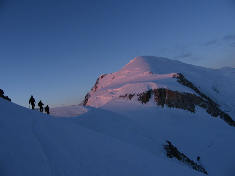
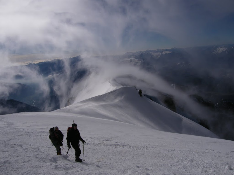
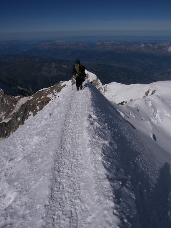
You again descend slightly to the Col de la Brenva (4303m) where there was another large crevasse. The day was dawning on Mont Blanc as the Three Amigos head over to the col de Brenva. Vincendon and Henry would have come here with Bonatti before their ill fated descent into the ice falls below the Vallot bivouac.
DSCF3295.JPG


Posted: 08 September 2010 09:16 AM   [ # 1 ]  
Administrator
RankRankRankRank
Total Posts:  2234
Joined  2003-10-24

The route climbs the short but steep Mur de la Côte, just another 500 meters to the summit. Not far now.
DSCF3296.JPG

Richard, Luc and Benoit make a rapid pit stop in the sun of the Brenva before the last lap.

DSCF3302.JPG

Finally at the summit, at last. The air currents of France and Italy were doing battle. Here we see the updraft from Courmayer. The Three Monts involve a lot of climbing and traversing above 4000 meters with some exposure to ice fall and crevasses. The Maudit is extremely dangerous after fresh snow, even relatively small falls accompanied by wind can create and avalanche risk at any time of the year. It would be extremely hard to avoid either an avalanche or serac fall climbing the slopes and the crevasses and rimaye present serious terrain traps.

pano.jpg
This is what it looks like to be under the lenticular cloud on the summit. Bizarre.

DSCF3304.JPG
We descended via the Bosses ridge. The wind seemed less on this side and it was an easier route, at least at first. However in high winds we had heard of people climbing this ridge on all fours with ice axes.

DSCF3314.JPG

Benoit at the end of the Gouter just before reaching the Vallot refuge. You can see the Lenticular cloud covering the summit of Mont Blanc.

DSCF3316.JPG

The PGHM were flying a rescue mission at the Vallot to pick up a stricken climber suffering from the effects of altitude. One of many missions they were to fly over the weekend despite, or maybe because of, the excellent conditions. Four climbers killed and a Norwegian paraglider.

DSCF3272.JPG

After the Vallot the trail was even marked with some wooden posts. It passes to the right of the Dome de Gouter before swinging around behind and then a long, gentle trot down to the Gouter refuge. There are still some crevasses but all were well bridged.

This is a good look at the route down from Mont Blanc via the Dome de Gouter and the glacier de Tete Rousse from above St Gervais. There is a couloir you have to cross (the Grand Couloir) which is well known for rockfall and is reputed to be one of the most dangerous zones in the Alps. Given the number of people crossing it is bit of a lottery who will get hit. However while we were on the Tete Rousse Glacier a large rockfall also swept down the main path from below the refuge du Gouter. The top of the path is protected by cables and is very steep and may still have snow and ice on it. The cables are not very practical if you want to clip onto them. You also spend a huge amount of time waiting for upclimbing hikers. The Tete Rousse glacier was in the process of being drained when we crossed, a water pocket of 85,000 liters that apparently threatened St Gervais with flooding. It has happened before. We then took the very rocky trail to the Nid d’Aigle stop where you can normally pick up the rack and pinion railway but due to works it is out of action above Mont Lachat. We were too late anyway and had a long walk down to Bellevue where we had a car (normally you can’t park higher than Biossonay). All in all 3200 meters of descent. We’d started at 2.20 am and been walking more or less non-stop for 17 hours.


Posted: 08 September 2010 08:27 PM   [ # 2 ]  
Sr. Member
RankRankRankRank
Total Posts:  270
Joined  2008-01-31

Wow - what a great day, and a great accomplishment.

Amazed you could do so well without much special altitude-acclimatization sessions during the days before it.

Ken


Posted: 13 September 2010 10:49 PM   [ # 3 ]  
Newbie
Rank
Total Posts:  18
Joined  2010-09-13

Great photos which really capture the feel of this wonderful high mountain route. Imagine being inside the lenticular when Mt Blanc has ‘got his hat on’.

The lottery of the dangerous descent of the Grand Couloir from the Gouter hut can be avoided by descending from the Vallot hut to the Grand Plateau and from there to the Grand Mulets hut. Some crevasses to jump but none of the rockfall on the Gouter hut descent route. Also fewer people. When we did it however, the telepherique stopped running because of high wind which had come up suddenly and we had the extra descent to the valley on foot, so 17 hours became 19.

The high point has got to be the section to the Col de Mont Maudit. Front pointing in the early morning sun at 4,000 metres—what alpinism is all about.


Posted: 14 September 2010 09:43 AM   [ # 4 ]  
Administrator
RankRankRankRank
Total Posts:  2234
Joined  2003-10-24

I wondered about the Grand Plateau but I was told the crevasses are too open in the autumn to make it a good choice. It is one of the normal ski routes though, KenR posted a trip report about it last winter.

What time of year did you do it?


Posted: 14 September 2010 10:39 AM   [ # 5 ]  
Newbie
Rank
Total Posts:  18
Joined  2010-09-13

When we did it in August of a hot, hot summer, the Grand Plateau route was very crevassed below the Grand Mulets hut. At one point we had a testing downhill leap across quite a wide crevasse and folk were struggling to get up to the hut at all as snow bridges were down everywhere. A few days later and the descent we did would have been impossible. That summer the guides were putting wooden ladders everywhere to keep huts and routes open. There is the danger that the descent below the Grand Mulets is actually impassable because of crevasses and you don’t find out for certain until you have been out on the hill for 12 hours or more. You made the right route choice for a September after a warm summer and a lean winter.

We had heard that the stonefall was horrendous on the Gouter route. There were several deaths and the guides had stopped using it. We opted for what we thought was the least dangerous of the two descent routes. The safest way down is probably to reverse the route but then you don’t traverse the mountain, do you?

It is a shame, given the high quality of the route and the mountain environment it traverses, that the worst part on either route variant is lower down and is dangerous and annoying without being technically challenging.

Glad to see that Dachstein mitts with elastics are still in common use. They are a sign of a true mountaineer.


Posted: 15 September 2010 04:23 PM   [ # 6 ]  
Administrator
RankRankRankRank
Total Posts:  2234
Joined  2003-10-24

We’d considered the reverse route but the down climb of the Col de la Mont Blanc du Tacul looked a bit sketchy even with the fixed ropes.

Talking of rock fall this little beaute fell onto the path up to the cosmiques a few days ago, hope no-one was underneath at the time!

IMG_2146.jpg