I think of skiing the Pas de Rocheplane every time I go and ski at St Hilaire du Touvet. The route is clearly visible from the Gresivaudan, it is one of the passes that crossed into the central Chartreuse from the valley. I’ve walked it in the summer and it is both steep and exposed. The ski route is actually more direct over the flagstone cliffs compared to the walking route which zig-zags down the hill.
March is late in the season so rather than cutting up through the woods I stuck to the ski runs of St Hilaire to 1250m then took the Chemin de Herse which is a cross country ski trail to the Col de Marcieu. About 1km along this trail I cut up a snowshoe track to the source de Sanglier. From here I checked out the north-east bowl but a lot of slabs had broken away and the route through the cliffs was not obvious. I would have to come back in the summer and check it out.
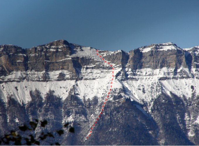
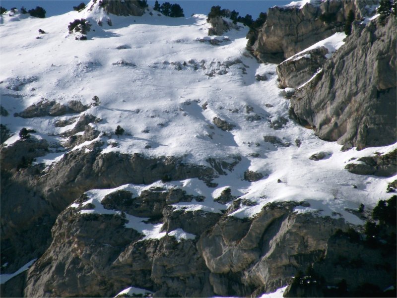
From the Sanglier you climb a shoulder to a rock spire called Le Truc (the Thing) then up to a small gap which accesses the upper suspended slopes. The snow was transformed to the gap which had about 3cm of slabby snow on a hard base. Obviously there had been some transport overnight. The suspended slope was a mix of this slabby snow near the cliff faces and powder on the more exposed central section. The Devil and the Deep Blue Sea.
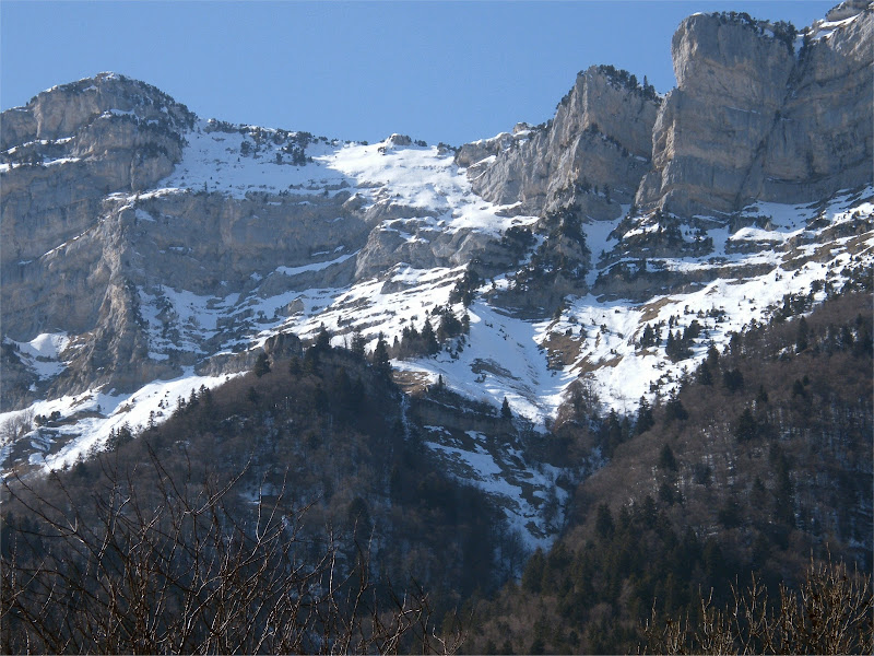
North east bowl and cliffs
I zig-zagged between the rocks and finally had to climb on boots and crampons for the final 50 meters.
Skiing down I entered on the right hand side and immediately a 5cm slab broke away and slithered down the slope. I made a long traverse to what I knew was more stable snow, a few turns through the rocks then a traverse back to the less exposed (but slabby) cliff face.
Below the gap the snow was transformed and pleasant to ski. Then some very narrow section through the woods, about 200 meters of “sanglier” skiing before rejoining the upper section of the chemin de Herse which it was possible to cut across from time to time on some excellent transformed snow. Then the 1km “skating” back to the slopes of St Hilaire.
Of course the slabby snow I found was probably what killed Nicolas Wirshing on a similar, but much steeper slope on the upper section of the Moucherolle. :-(.