Thu, 20 March 2014
Vertical Climbed: 1,580 meters (5,184 feet)
Rating: 2.3
The large Gleyzin valley is clearly visible from the valley as far as Chambery. It keeps snow cover late and is skiable into May with a reasonable amount of portage (a mountain bike can help).
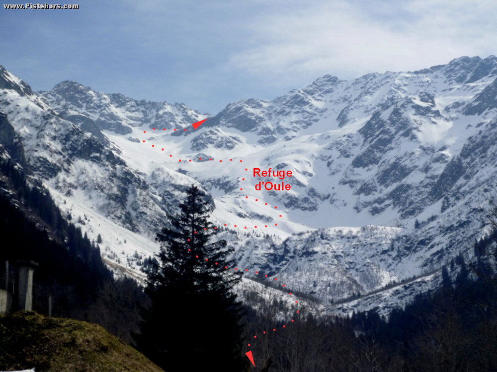
From the village of the Bourgeat Noire follow a track to the south-east. At the exit of the forest climb towards the Pertuis couloir (take care, this can purge, particuarly in the afternoon - keep to the left or right of the obvious avalanche paths). At 1640 meters traverse under the base of cliffs of the Pic de Grandes Lanches towards the south. Exit onto the praire of the Oule, traverse the Gleyzin river to reach the well equipped refuge de l'Oule (unguarded, 10 euros/night per person). The slopes under the Montagne de l'Oule are prone to windslab.
From the refuge continue climbing a steep pitch to the south-east in a series of zig zags to reach a plateau at 2100m. Turn slightly eastwards to climb another pitch to reach the glacier du Gleyzin at 2450 meters. Continue south under the slopes of the Pointe de Comberousse to reach the col (frequently snow free due to wind) at 2669 m.
Comments on route: There is a bar in the village by the car-park. Don't hesitate to stop for a drink.
Access: A41, take the Goncellin or Poncharra exit to Allevard then the Breda valley to the 7 Laux (Pleynet). Drive through the village of Pinsot and take the first left by a small road that climbes to the Bourgeat Noire. At the village take a right turn to a car park at the end of the road. In the winter the route is frequently covered in ice. Do not hesitate to fit snow chains at Pinsot as there is little opportunity to do so on the steep and icy climb.
Equipment: Ski crampons
Country: France Area: Belledonne Trailhead: Gleyzin